So, I’m a little late kicking off my mountain climbing this year.
It’s not that I haven’t wanted to. But with substantial winter snowpack still hanging around on the high peaks and an unusually wet June there have been very few days with a weather window wide enough to accommodate the 7 – 8 hours it takes to climb a 14er. I love getting up into the mountains. I enjoy the effort of climbing, the joy of exploring new terrain and the views from up high but I don’t want to be cold and wet doing it.
The mountain in my sites to start my 2023 climbing season was 14,071’ Missouri Mountain in the central Sawatch Range. Missouri is a strange mountain; more of a high ridge, really. But as I found out, it meets all the criteria of a Colorado 14er and is a fun and engaging climb.
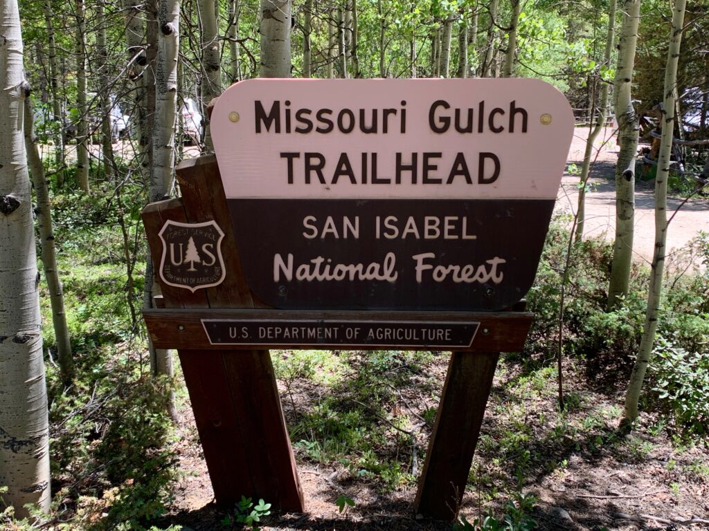
Appropriately, Missouri Mountain is accessed via the Missouri Gulch trailhead. The very same trailhead used to access Mt. Belford and Mt. Oxford, which I climbed last summer.
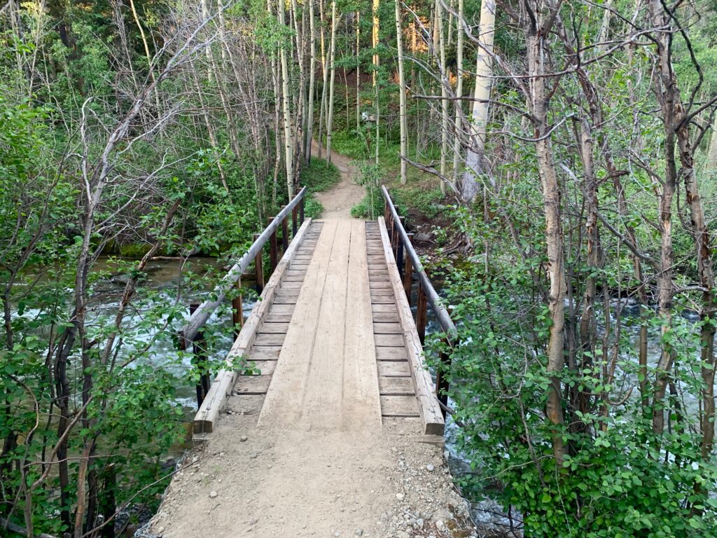
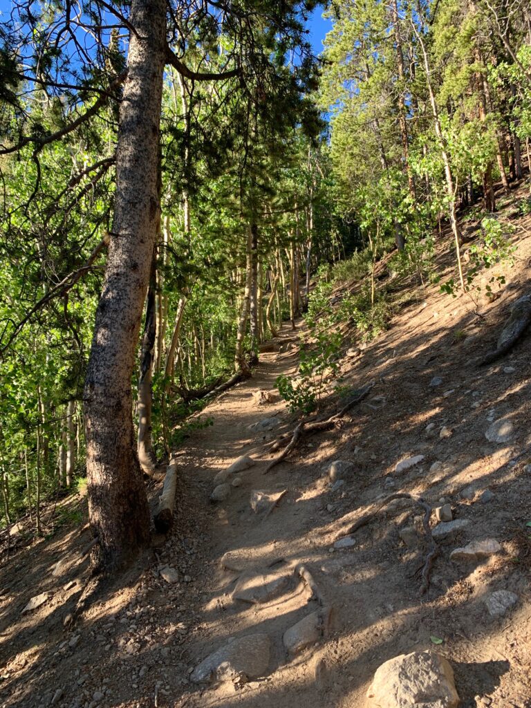
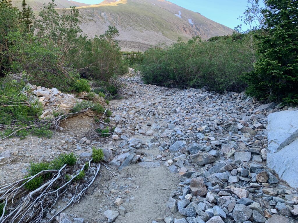
Since the approach to Missouri Mountain is exactly the same as the approach to Belford and Oxford, I didn’t take a lot of photos of the first part of this hike.
Same bridge over Clear Creek which, like all the rivers and streams around here, is running particularly high this year.
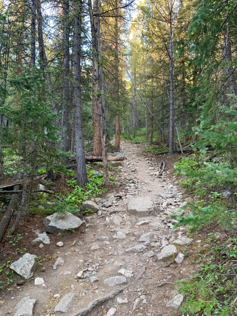
Same steep, rocky trail.

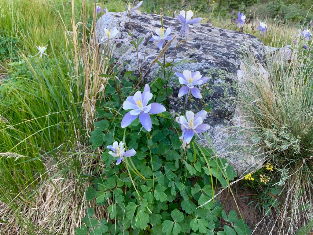
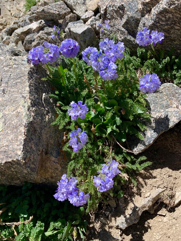
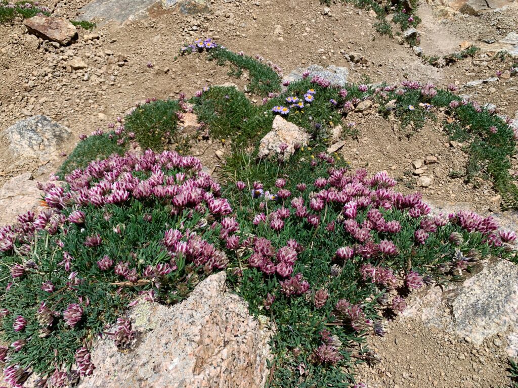
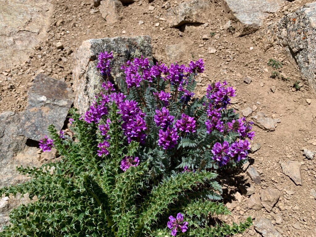
But the wildflowers, like Columbines, are always new.

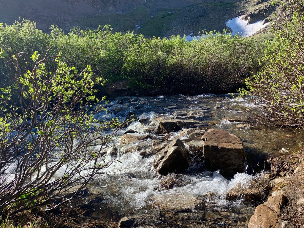
And the Missouri Creek cascade was flowing more impressive than ever.

As I climbed out of the gulch and into the lower basin, the views began to open up. The sun was just hitting the upper slopes of Mt. Belford to the east.
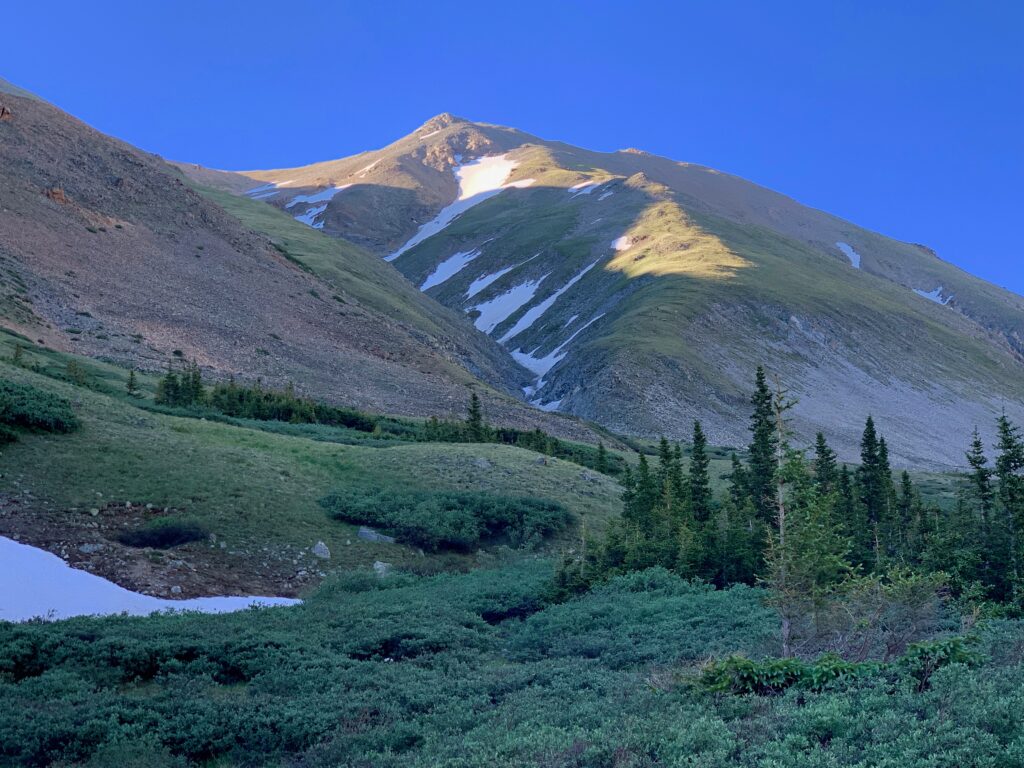
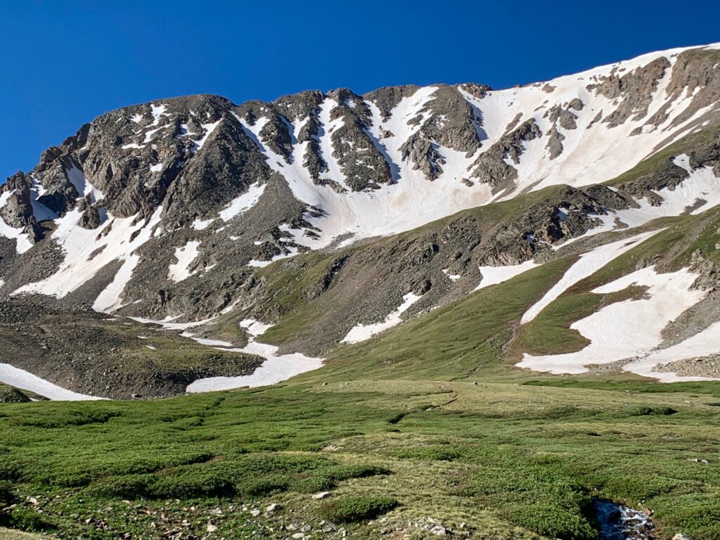
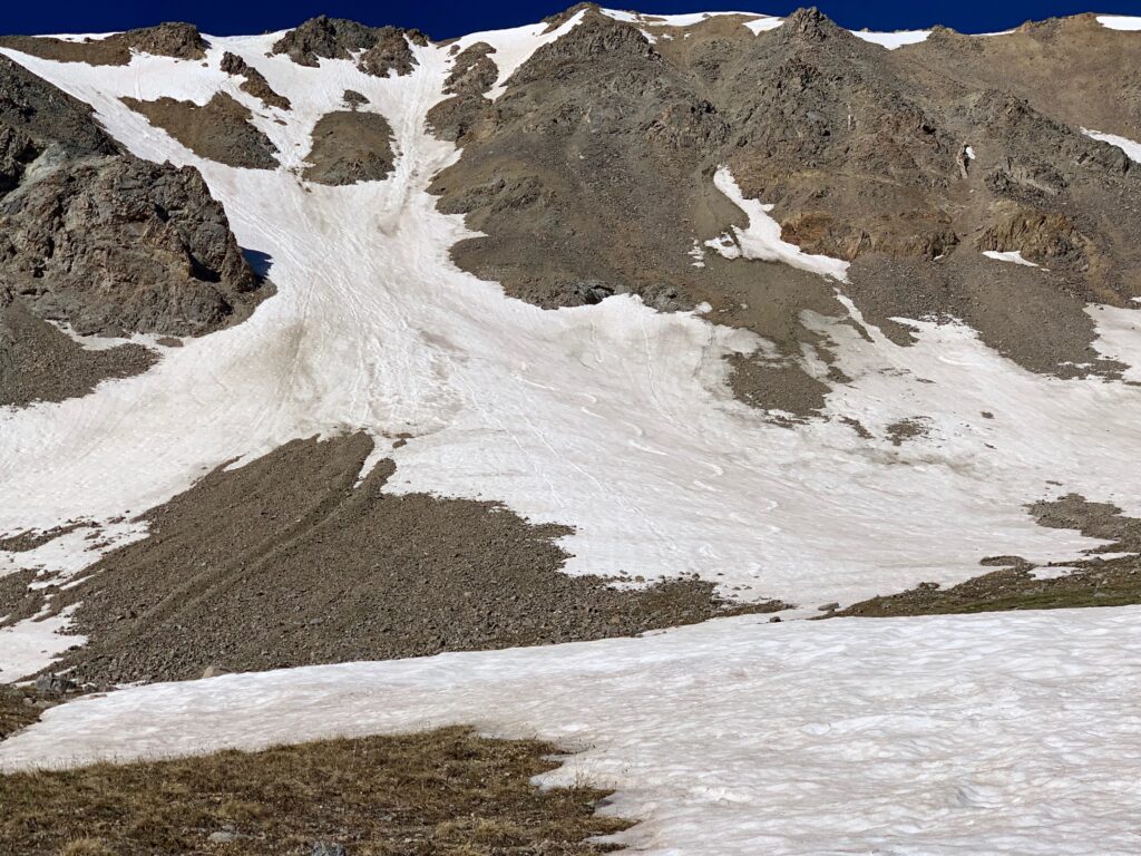
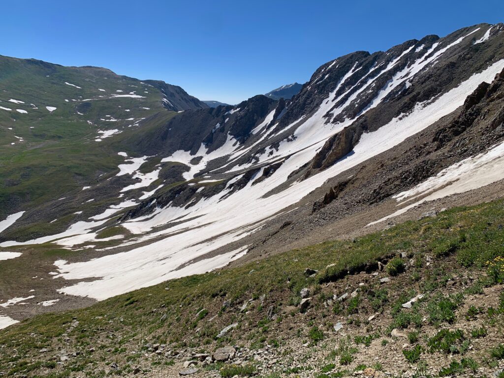
While Missouri Mountain, on the south end of the basin was in full sun. The hike approaches from the north and for most of the way through the basin you’re looking at Missouri’s steep north face, still holding significant amounts of snow mid-July.

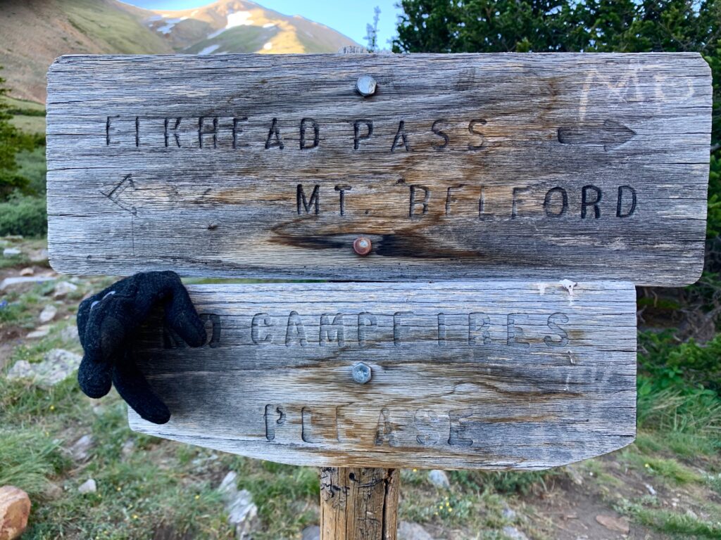
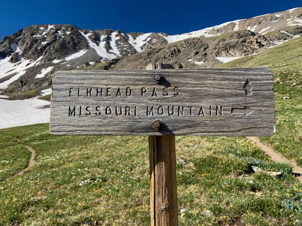
At the first fork in the trail, go right toward Elkhead Pass.
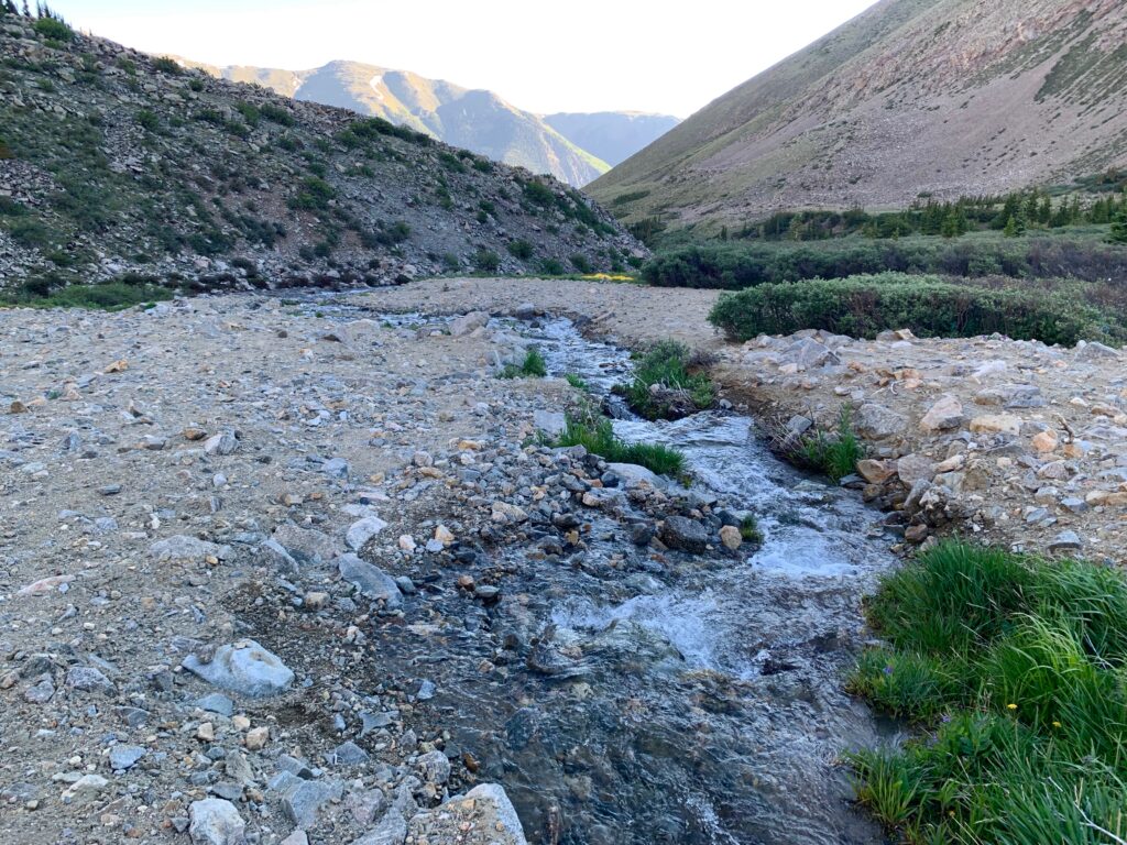
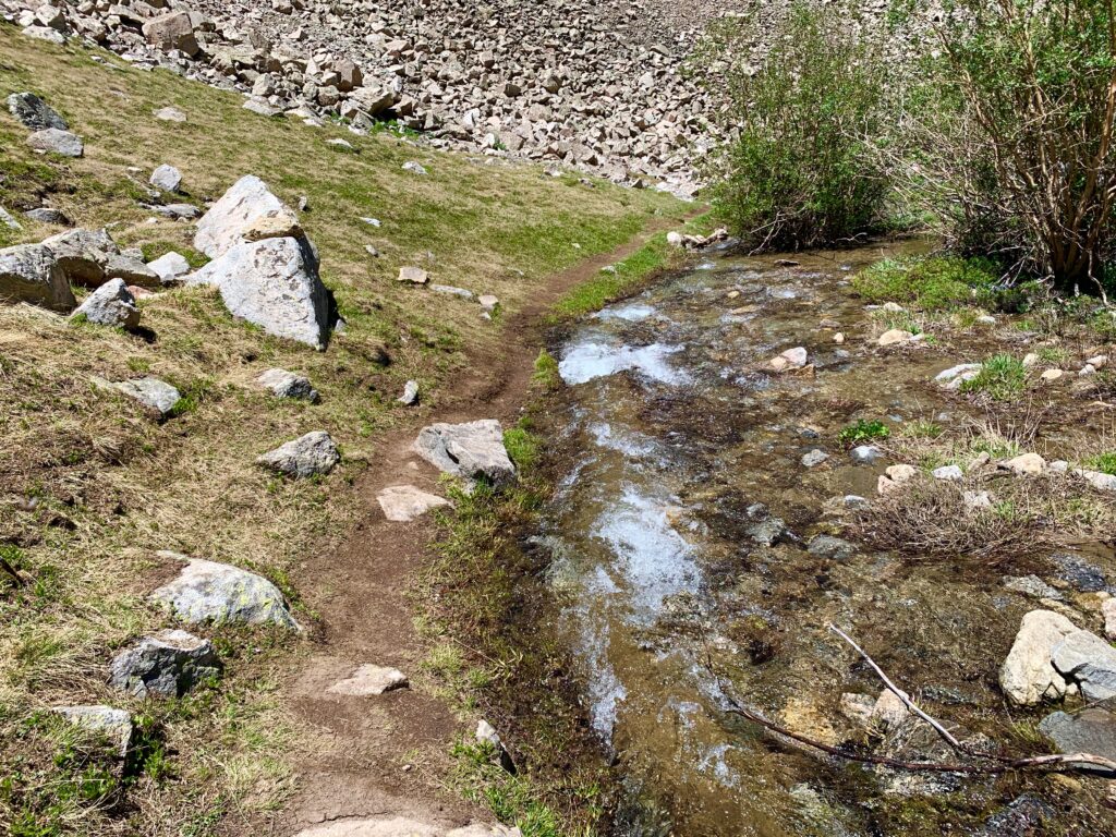
Shortly after the fork in the trail came the first obstacle of the day, the first crossing of Missouri Creek. At the point where the trail crosses the creek there is no bridge. The water was running fast and deep and there was a tangle of deadfall from small trees and the surrounding willows. Any stepping stones that exist were completely submerged. It didn’t look safe.
Pondering my options, I decided to detour upstream, up a dry creek bed next to the creek until I could find a spot suitable for crossing. This took some time and brought me slightly off-route.
Fortunately, within a quarter mile or so I found a spot narrow enough to jump across and after some brief bushwhacking I re-found the trail and was back on course.
Heading into the middle basin.
The second creek crossing wasn’t as deep or wide as the first. I could see stepping stones but several of them were underwater.
Not feeling 100% confident in the water resistance of my hiking boots, I considered my options. Crossing in boots might be possible but one slip and my foot would be submerged and I’d be looking at doing the rest of the climb in wet socks. Which would suck.
So I sat down on a rock, removed my shoes and socks, tied my shoes together and threw them around my neck, took out my hiking poles and proceeded across. The water was cold — you definitely wouldn’t want to stand in it very long — but for the few steps it took to get across it actually felt refreshing.
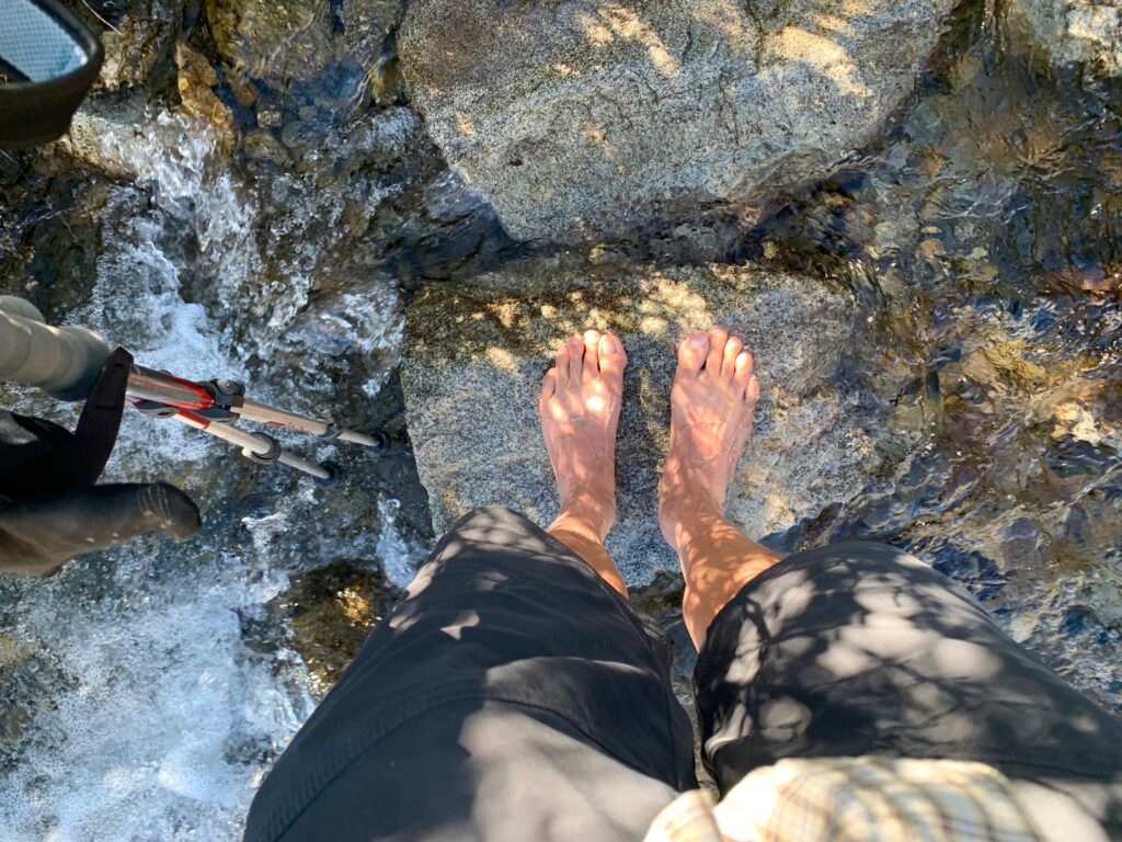
I dried my feet in the grass on the other side, put my socks and shoes back on and proceeded on my way.

And here’s a bonus tidbit of information. Ever wondered how they make water? Well, here you go. They’re cranking it out by the thousands of gallons in Missouri Gulch.
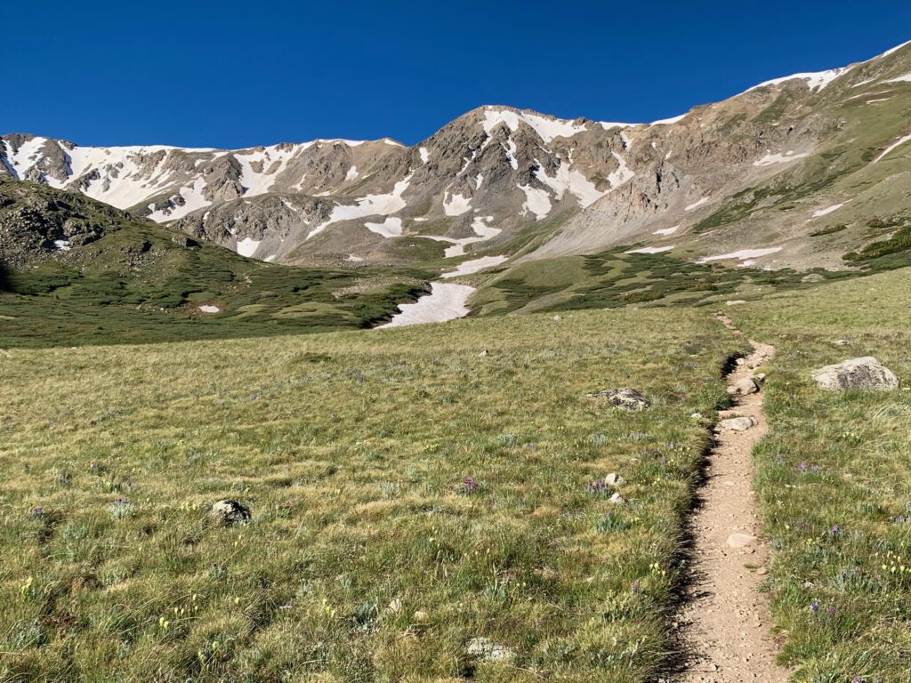
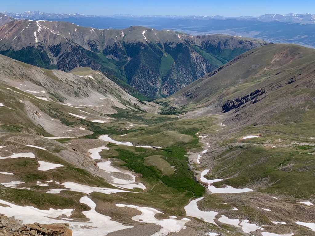
In the upper basin under Missouri’s snowy north face.
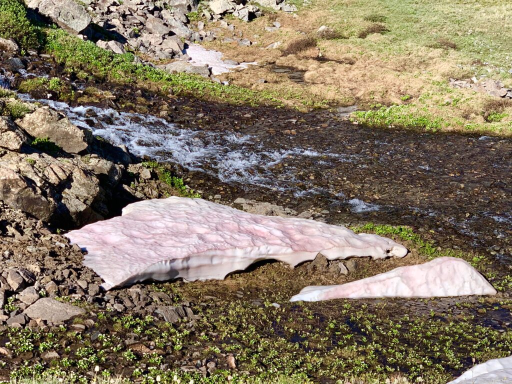
I spotted several patches of this weird pink snow along the creeks in the upper basin. I didn’t know what it was at the time but looking it up later I found it’s called “watermelon snow” and is caused by a type of algae that lives in freezing water.
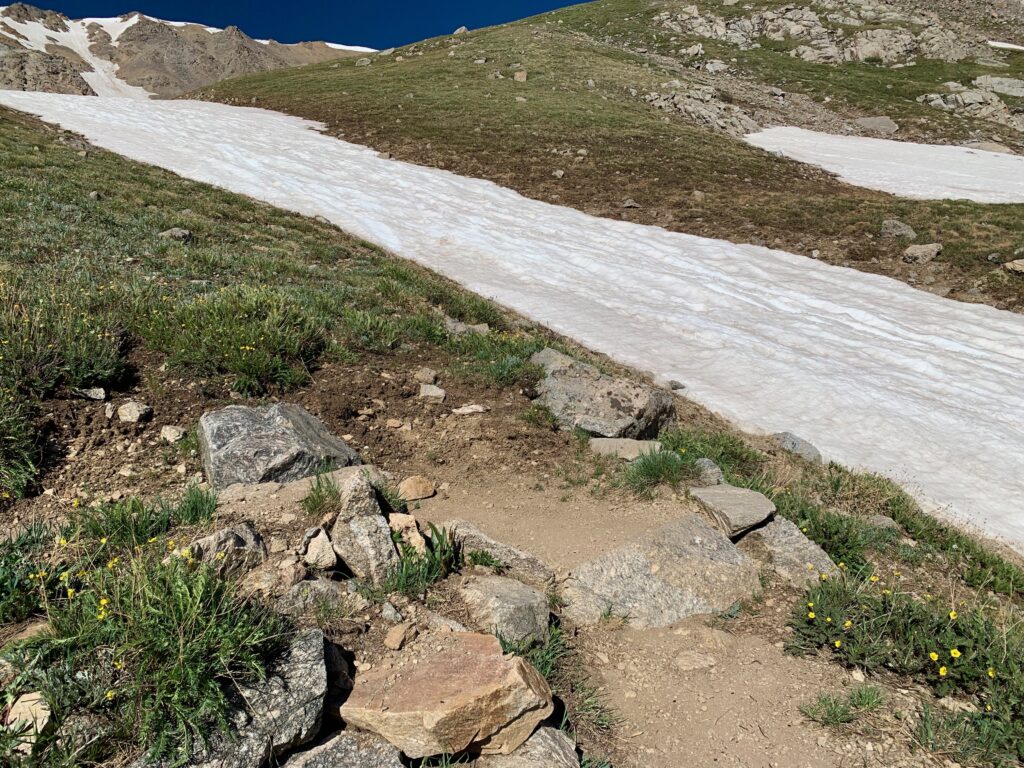
Next trail junction. Right to Missouri Mountain. Approach over, time to actually climb Missouri.
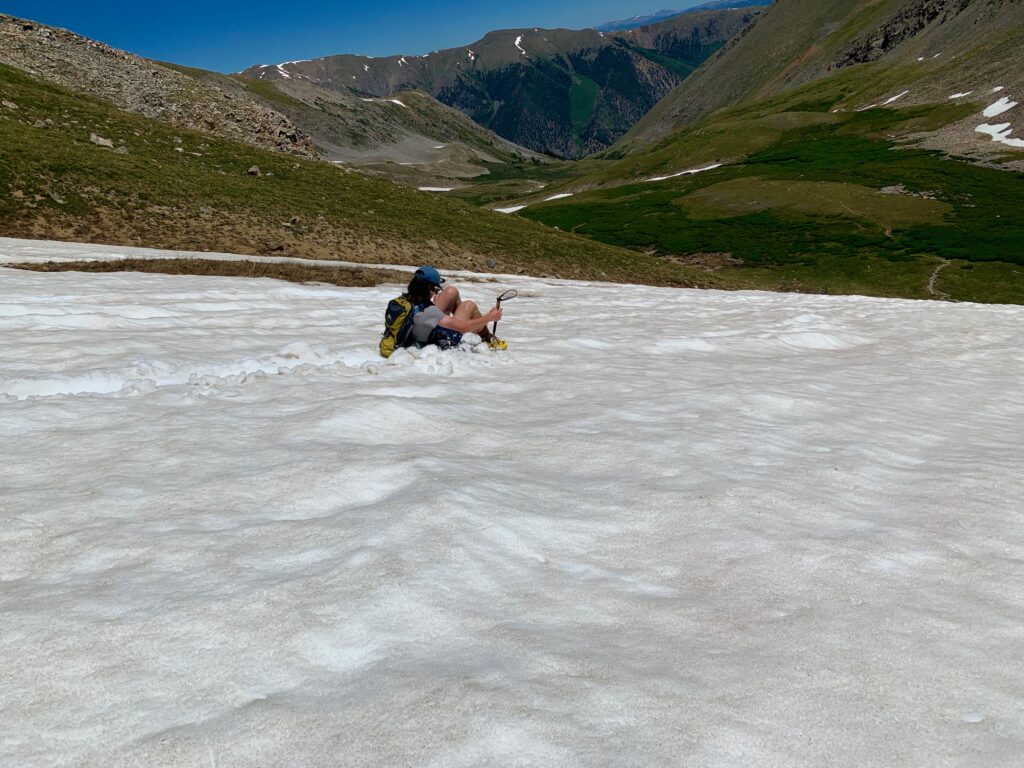
Starting with a series of switchbacks next to a large snowfield. The trail zigzags up for several hundred feet before finally taking a right and crossing the top of the snowfield.


Old ski tracks in one of the couloirs on Missouri’s north face.
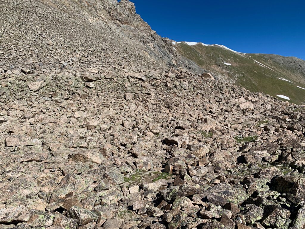
Above the snowfield the trail gets rockier.

It was along here a couple of young guys passed me as I was making my way through the rocks. I’d follow them the rest of the way to the summit, meeting again as they were heading back down.
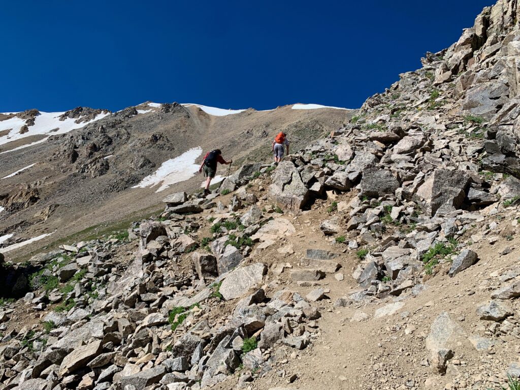

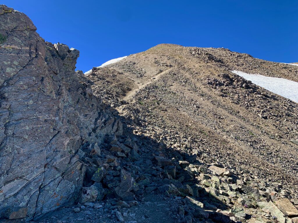
The long, steep traverse up Missouri’s northwest ridge was the most difficult part of the climb. It’s only rated as class 1-2 climbing, but it’s tricky due to the steepness of trail and the number of loose gravel sections you have to cross. Climbing solid rocks on a steep face is no problem; climbing loose gravel on a steep face is unnerving.
On the traverse, looking across Missouri’s north face toward Elkhead Pass.
Last snowfield crossing near the top of the saddle.

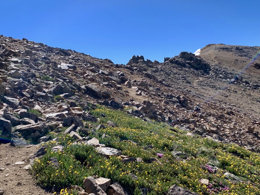
Large cairn marking the top of the saddle at 13,700’ and the start of Missouri’s long NW ridge.

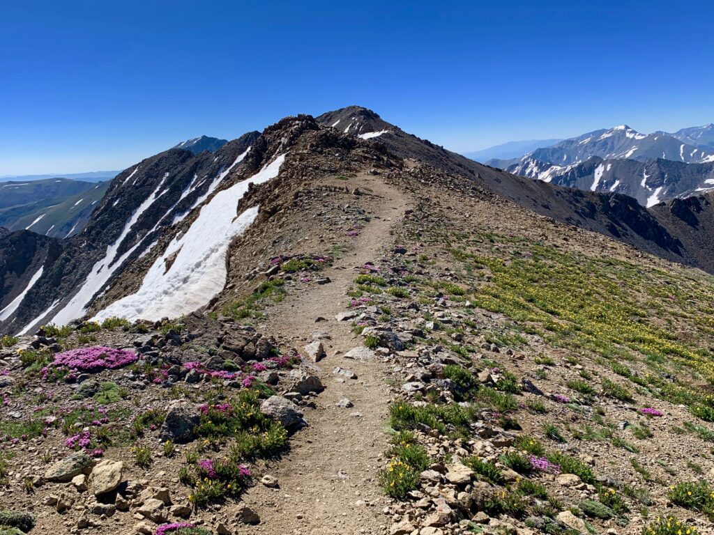
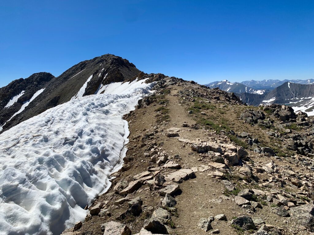
The NW ridge was the most entertaining section of the hike. There was still a fair amount of climbing to go but mixed in with the ups were flat sections and a few downs. The views off both sides of the ridge were breathtaking.

In these two photos you can see the two guys that passed me standing on the summit.

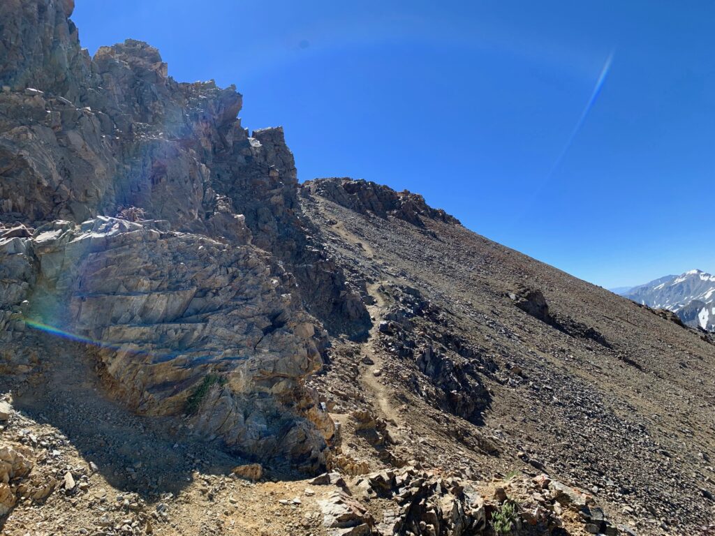
For the most part, the trail stays on top of the ridge until it gets to the summit. The most notable exception is when it gets to a set of rock towers about two-thirds of the way across. To get around the towers, the trail drops about twenty feet down a rock ledge, requiring a downclimb. This is considered the crux of the climb. I had read the description of it and had heard that some people turn around when they get to it. I am happy to report I did not. Although it looks a bit hairy as you approach it from above, the rocks are solid and provide excellent hand and foot holds. It was just a matter of planning your moves and being careful. In about four moves it was over.

Honestly, the sketchiest part of the whole climb was crossing that smooth section of trail at the bottom of the downclimb. You can’t tell from the picture above but that’s loose gravel on an approximately thirty-degree slope. Not fun.
Looking back at the rock towers from above.

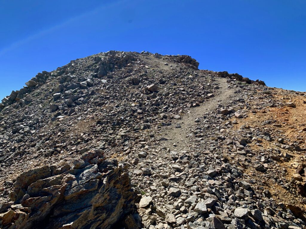
Final pitch to the summit.
Almost there.
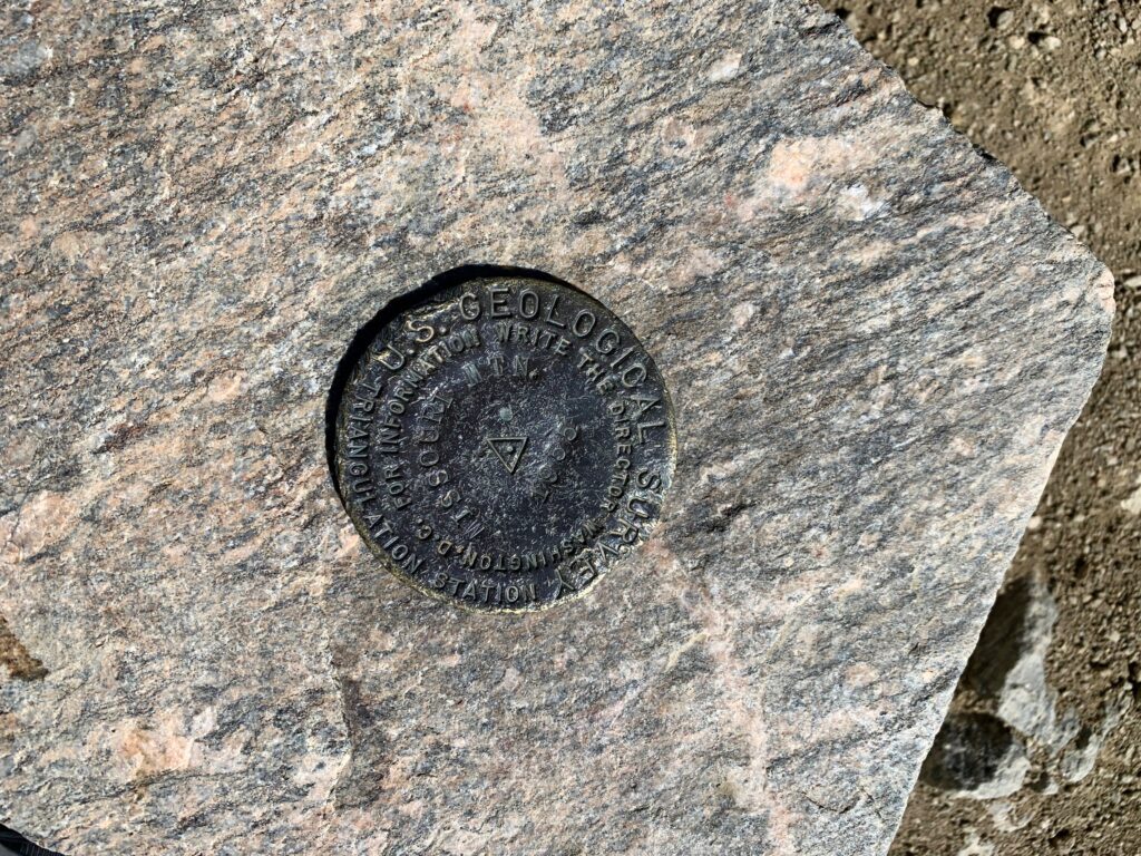
And look! A summit marker, dated 1955. Always a cool find.
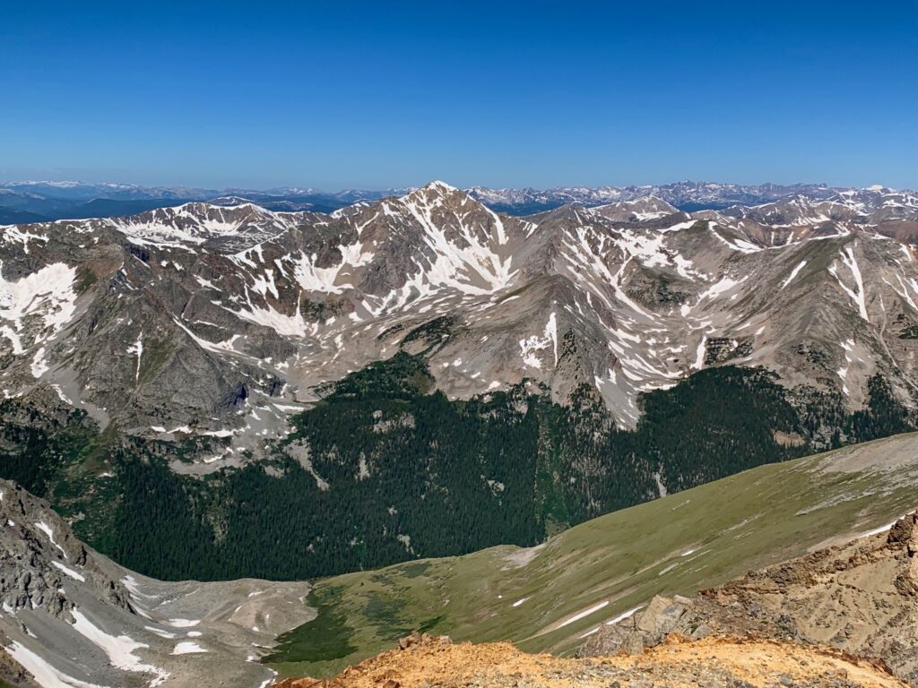
Looking back down Missouri’s NW ridge from the summit. That’s La Platta peak on the horizon, just right of center.

Huron Peak across the valley to the west.
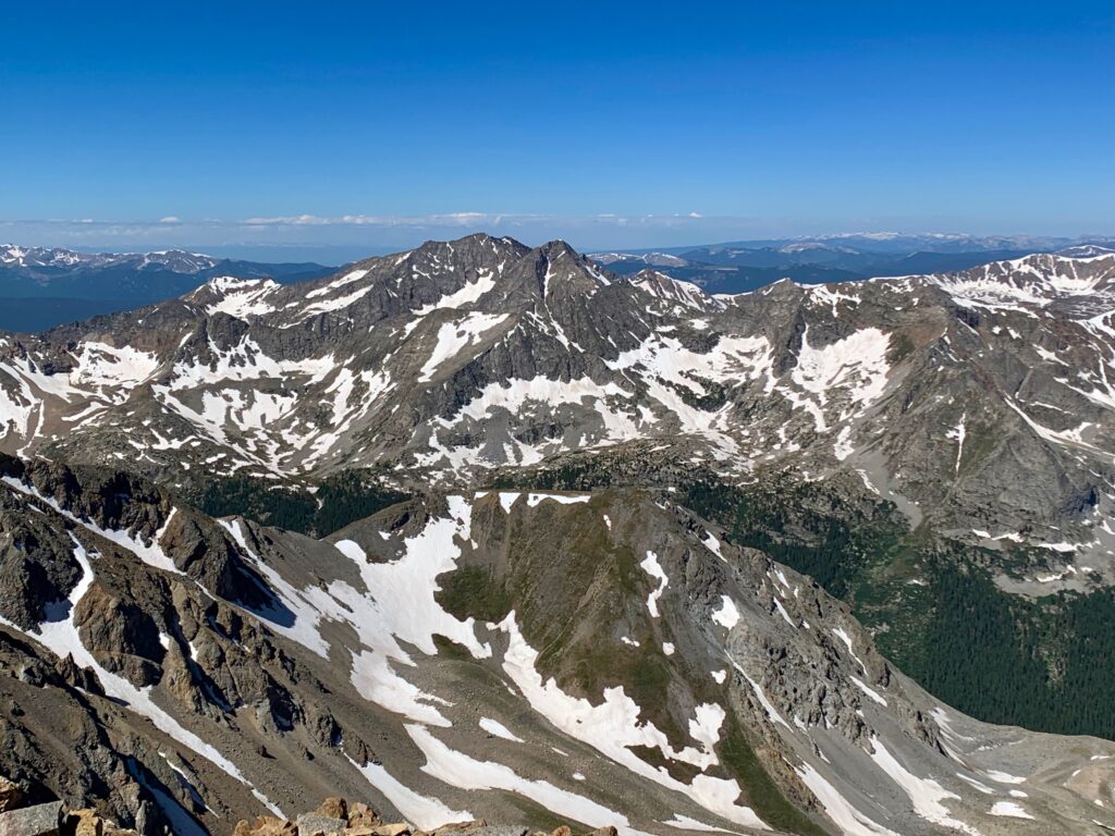
The Apostles to the southwest.
The twin summit of Silver King Peak and Silver King lake to the south.
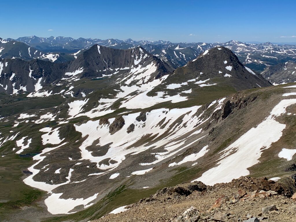
Big boys Mt. Harvard and Mt. Columbia to the southeast.

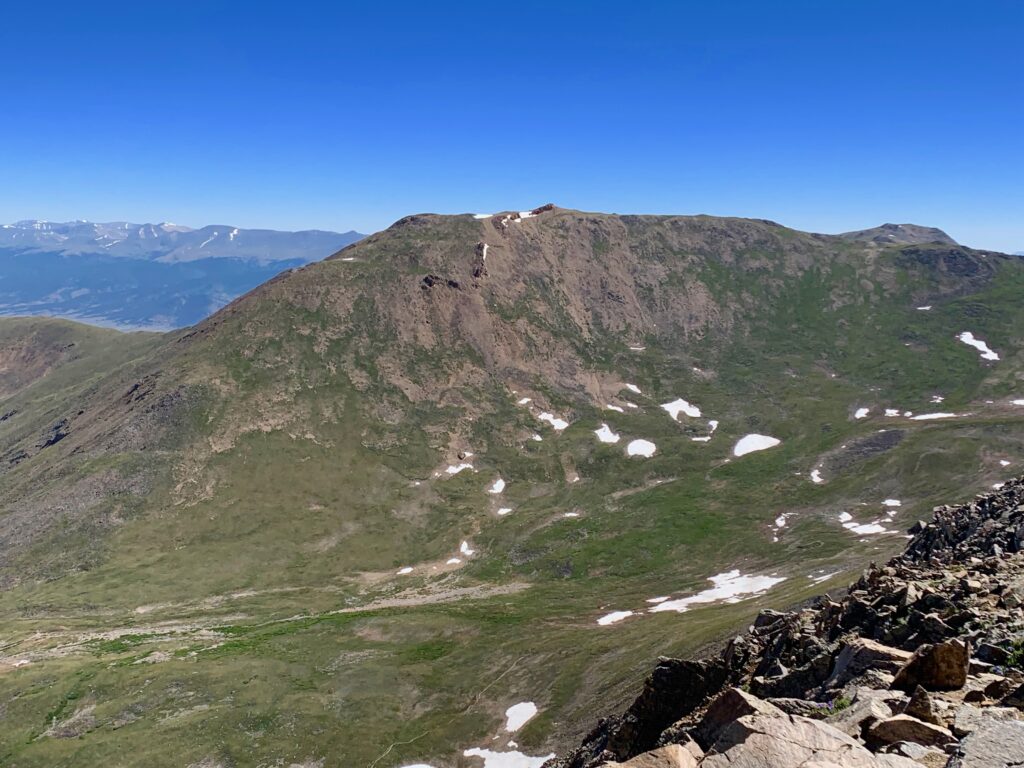
Mt. Belford across the basin looking remarkably boring and featureless from this angle.
And due north is Missouri Gulch. You can see a fair amount of the trail I just hiked to get here.
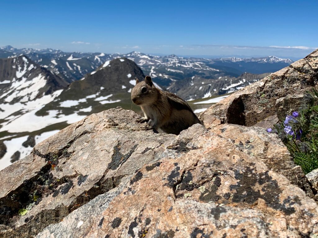
I ducked behind some rocks to get out of the wind which had come up hard just before I reached the summit. I sat down to text home and eat some lunch and was immediately joined by this bold little fellow.
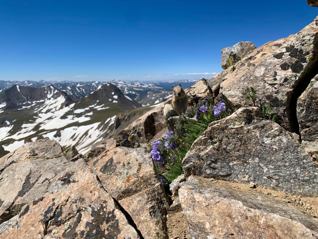

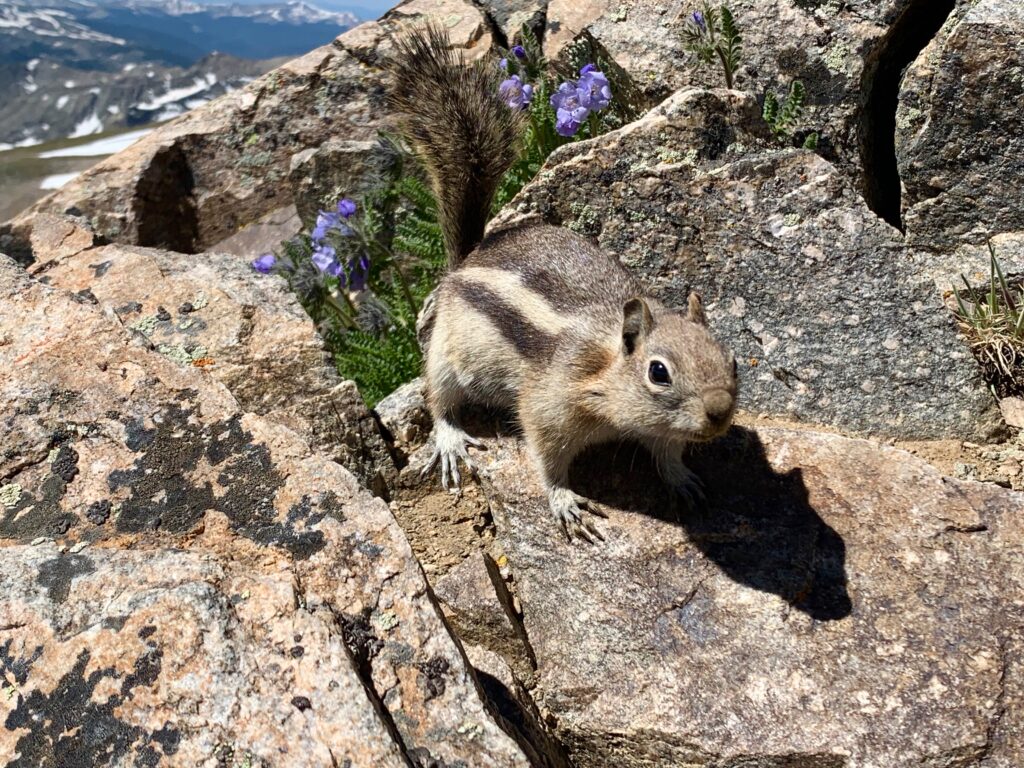
How you doin’?
Because of the wind I didn’t stay long on the summit. It was probably mid-60 degrees and sunny but it felt much colder. I pulled on a wind shell and gloves for the descent back down the ridge. I’m not a good judge of wind speed but it was blowing out of the west with gusts strong enough that several times I had to stop and kneel down to keep from getting blown off the trail.
The interesting thing was, as soon as I dropped back off the east side of the ridge it was dead calm. I could hear the wind over my head but the ridge protected me for the remainder of the descent. Wind shell, gloves and a couple base layers came off for the remainder of the hike.
It’s funny, on climbs I’m usually looking around at the scenery but on descents, probably because I’m always looking down, my eyes tend to fall on things nearby, namely the wildflowers. Here’s a sample of some of my favorites.


As I was about to cross the large snowfield before the switchbacks I was caught by another young guy who had summited just as I was leaving the top. He said he was going to try a shortcut, namely a glissade directly down the snowfield. It looked like he had a good time, but due to the mushiness of the snow he didn’t save that much time.
Back down in the lower basin, I went ahead and left my shoes on for the first two creek crossings. I was ready to be back to the car and I figured if my socks got wet at this point it wouldn’t make much of a difference. I’m happy to report my hiking boots are surprisingly waterproof. I managed to stay completely dry. But I still needed to find a way across the third and widest crossing. I found a spot just past this grassy section, bushwhacked my way back through the willows and re-found the trail on the other side.
I was back at the car 7.5 hours after I started, pleasantly tired and ready for a beer. It had been a great day. The first 14er climb of the season is always a bit of a shock to the system but I love being up high in the mountains. Missouri Mountain reminded me how much.