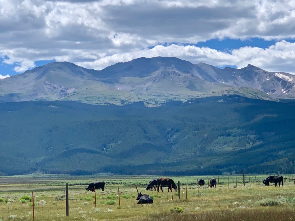
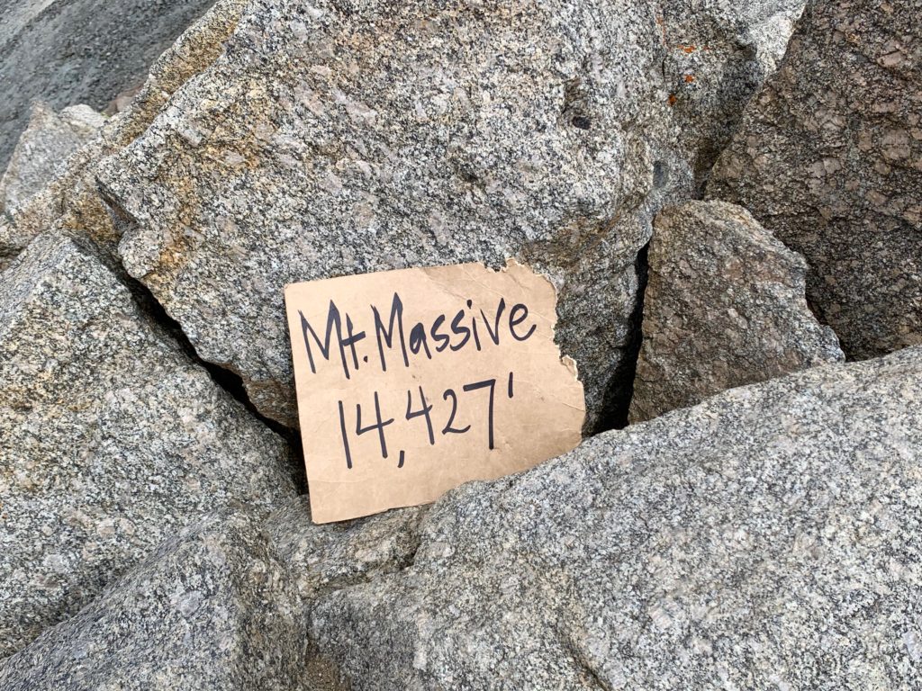
Mt. Massive is the second highest mountain in Colorado, only 11 feet shorter than its neighbor across the valley, Mt. Elbert. It makes up for those 11 feet by being the mountain with the most area over 14,000 feet in the contiguous 48 states. With a summit and four sub-summits over 14,000 feet and a three-mile-long summit ridge Mt. Massive is truly massive. If you’ve been to Leadville, you’ve seen Mt. Massive and you may have mistaken it for a whole mountain range. Massive doesn’t so much dominate Leadville’s western skyline as it IS Leadville’s western skyline.
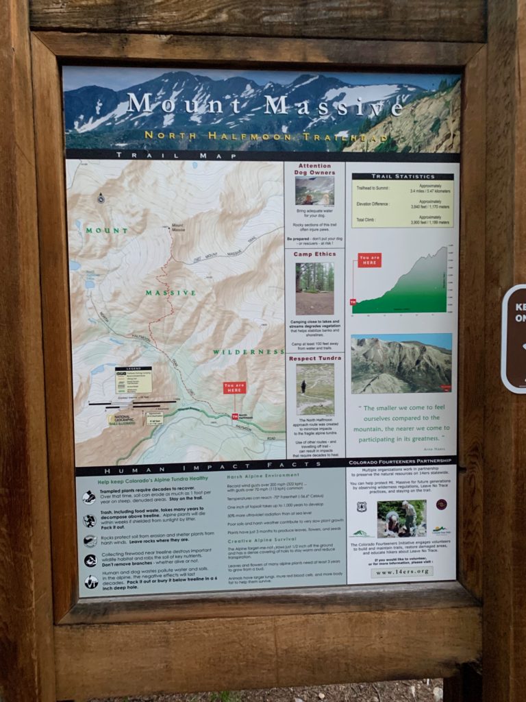
Big mountains like Massive have multiple routes to their summits. The standard route up Massive from the east is a long, but relatively gentle 14.5 miles. The shortest route, up the southwest slopes, is only 7.5 miles from the upper trailhead but is brutally steep and probably takes about the same amount of time to climb as the standard route. Not particularly interested in either of those, I decided to try a third, less-traveled route called the west slopes. This route is appealing because a) at approximately 9.0 miles it’s much shorter than the standard route, b) except for one section it’s less steep than the SW slopes route and c) it allows you to do a loop rather than a typical out-and-back hike.
What I learned, though, is although the stats for the west slopes route sound appealing, the reality in the mountains doesn’t always play out the way you expect. There are no shortcuts when it comes to climbing. Gravity and terrain rule and what you save in mileage will need to be made up somewhere else in the form of effort. More on that later.
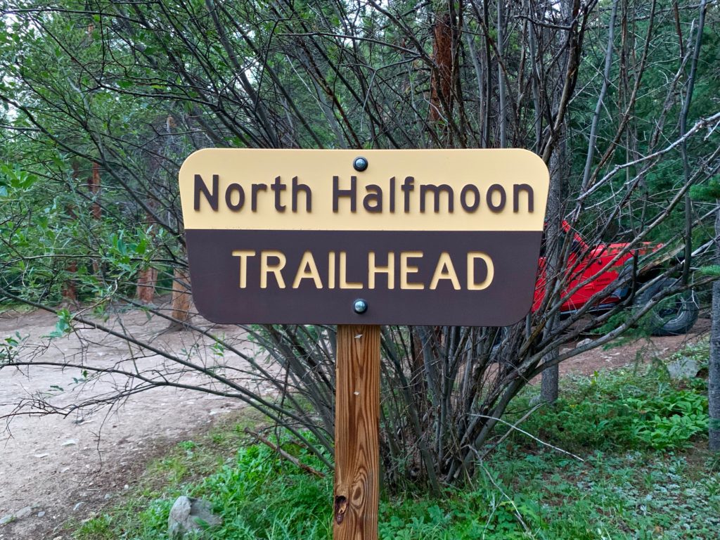
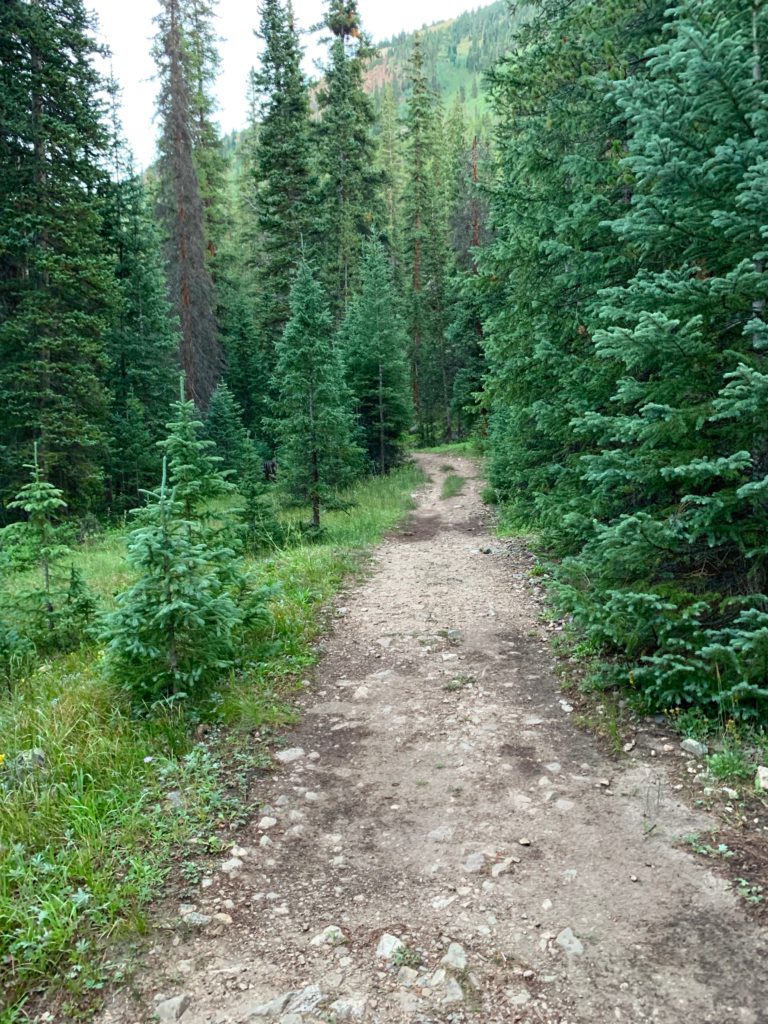
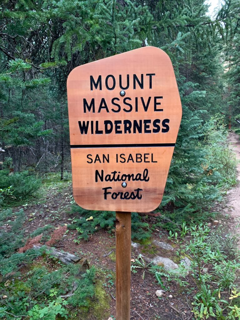
The trail starts at the North Halfmoon trailhead in the drainage between Mt. Elbert and Mt. Massive. There’s parking for about 8-10 cars at the end of a rugged, but I’ve seen worse, 4WD road.
Just past the parking area there’s a memorial for four army soldiers who died in a Blackhawk helicopter crash on Mt. Massive in 2009.

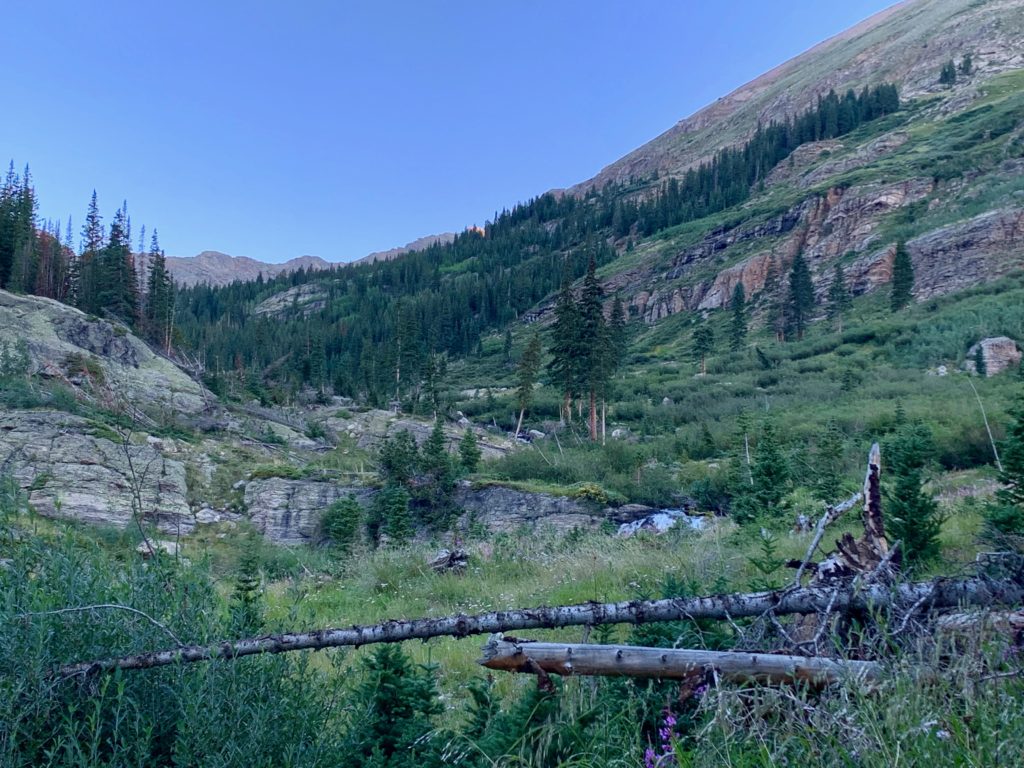
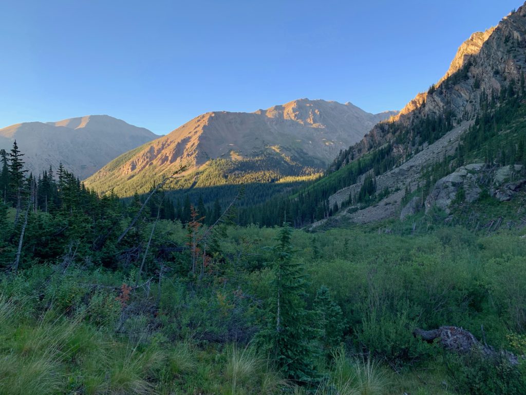
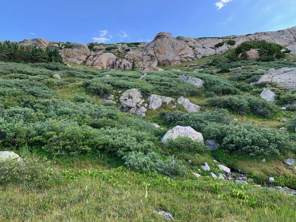
Entering lower North Halfmoon basin.
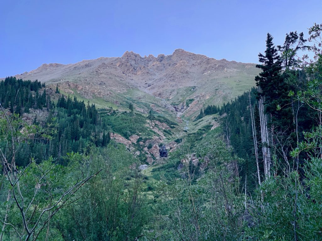
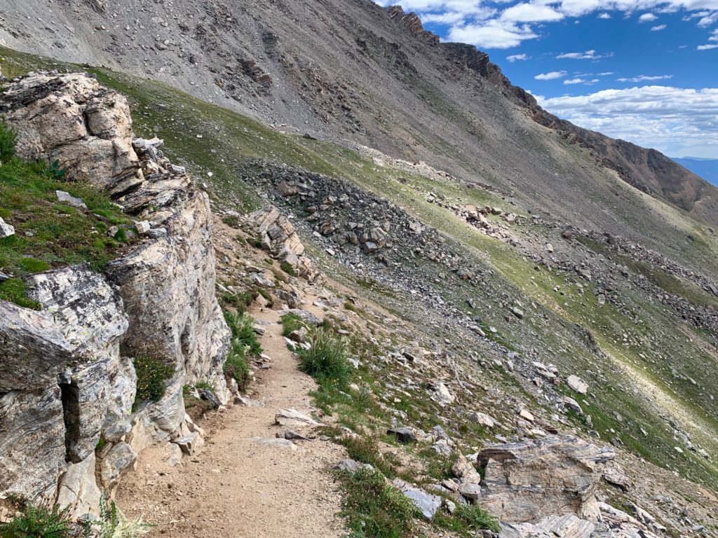
Much of the hike is spent in North Halfmoon basin with Mt. Massive always towering over your right shoulder, putting you in shade until you enter the upper basin.
Looking back down the basin with the morning sun just starting to hit the mountains behind me.
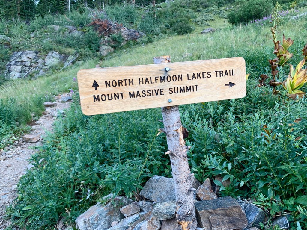
New sign? The SW slopes trail is to the right. Instead, I went straight on the North Halfmoon Lakes trail. I didn’t see a single other person from this sign until I summited Mt. Massive.
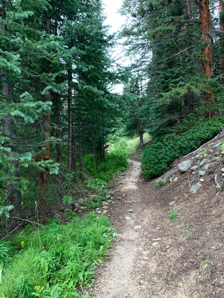
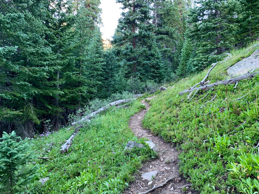
The North Halfmoon Lakes trail is beautiful and clearly less traveled than the trail I’d been on up to the intersection.
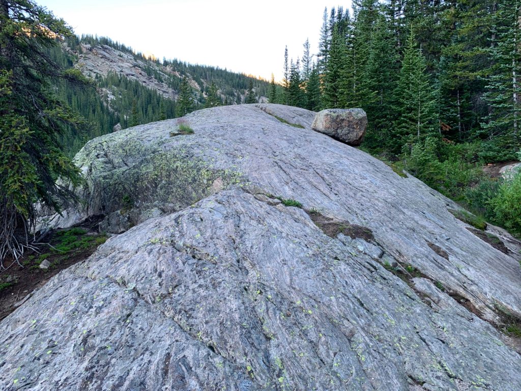
There are cool granite outcroppings to walk over.
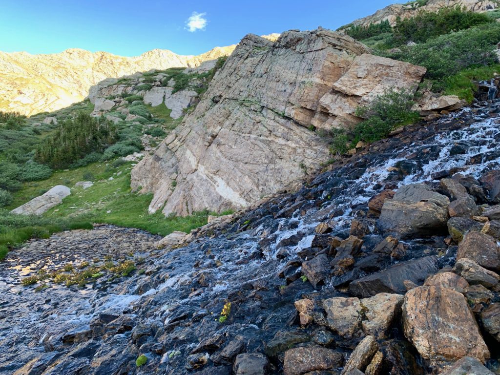
Beautiful cascades.

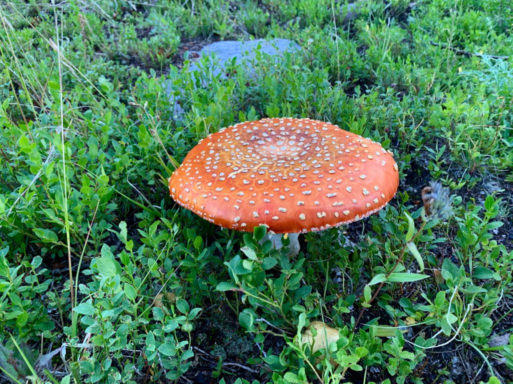
Large orange mushrooms.
And lots of peace and quiet.
Mt. Oklahoma in the morning sun on the west side of the basin.

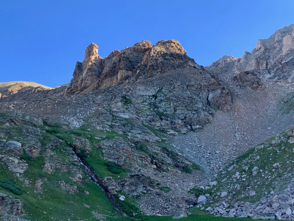
As you climb higher into the basin an impressive rock column at the south end of North Massive’s south ridge comes into view.

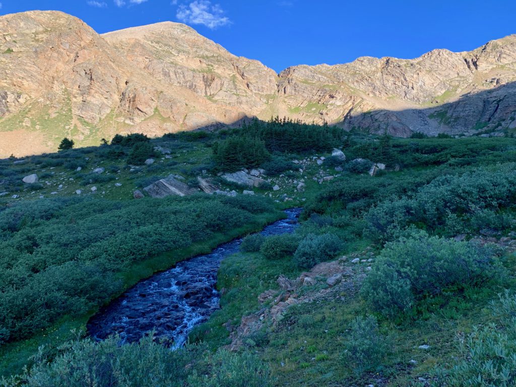
And North Halfmoon creek is always nearby.
Just east of Lower North Halfmoon Lake the trail abruptly ends in the willows. From this point on you’re on your own for navigation. To get out of the thick willows I followed one of the many small springs flowing through the basin.

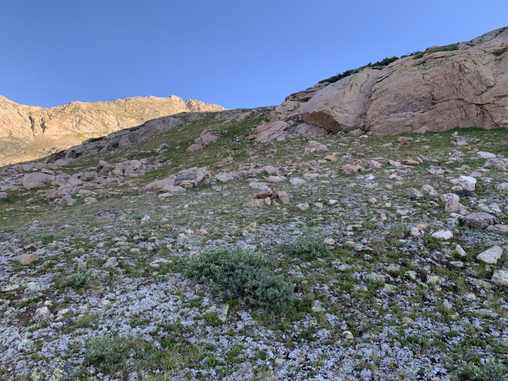
Once out of the willows it became an interesting exercise in route finding, locating the path of least resistance in undulating terrain. The east side of the basin contains a series of large ledges of increasing altitude each guarded by a band of boulders. It looks like these rocks could offer some fun climbing but I was looking for an easier way and so worked my way around the gentler west side of the ledges. There were occasional cairns indicating that others had been up here but the cairns were widely dispersed and hard to follow. I mostly just used my judgement on which way to go, knowing where I needed to end up.
Looking back down at the lower lake.
The morning sun hitting North Massive’s rock column.
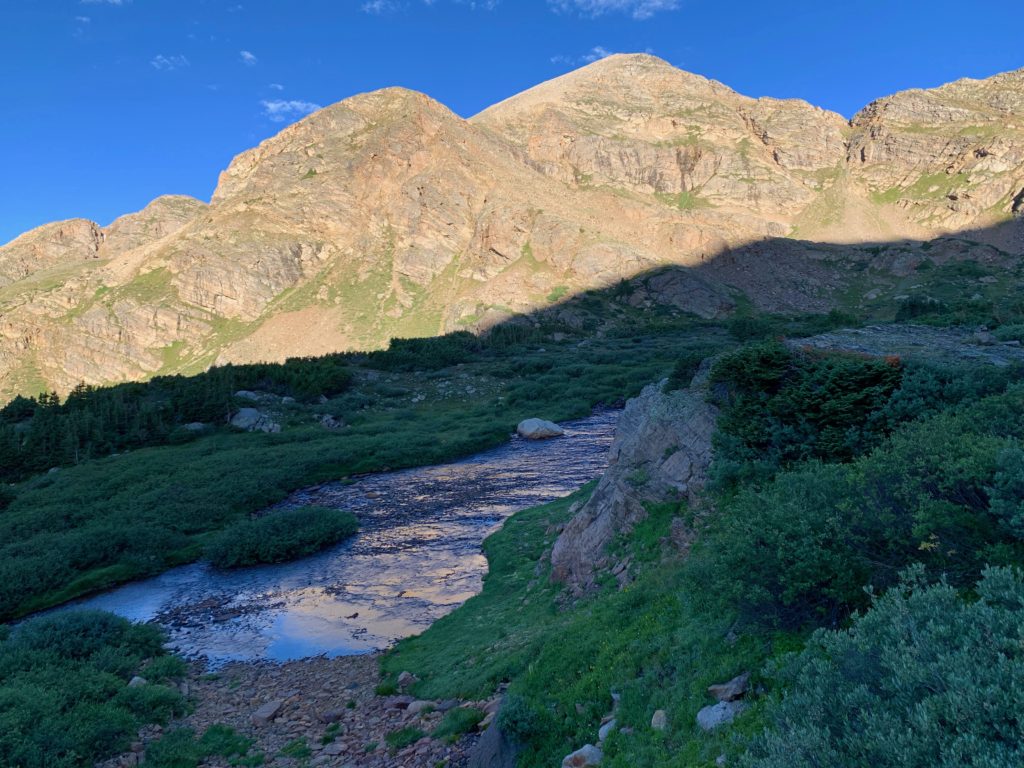
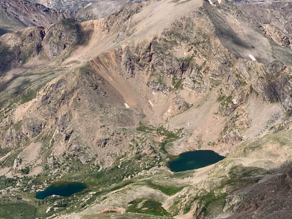
The upper lake from higher up.

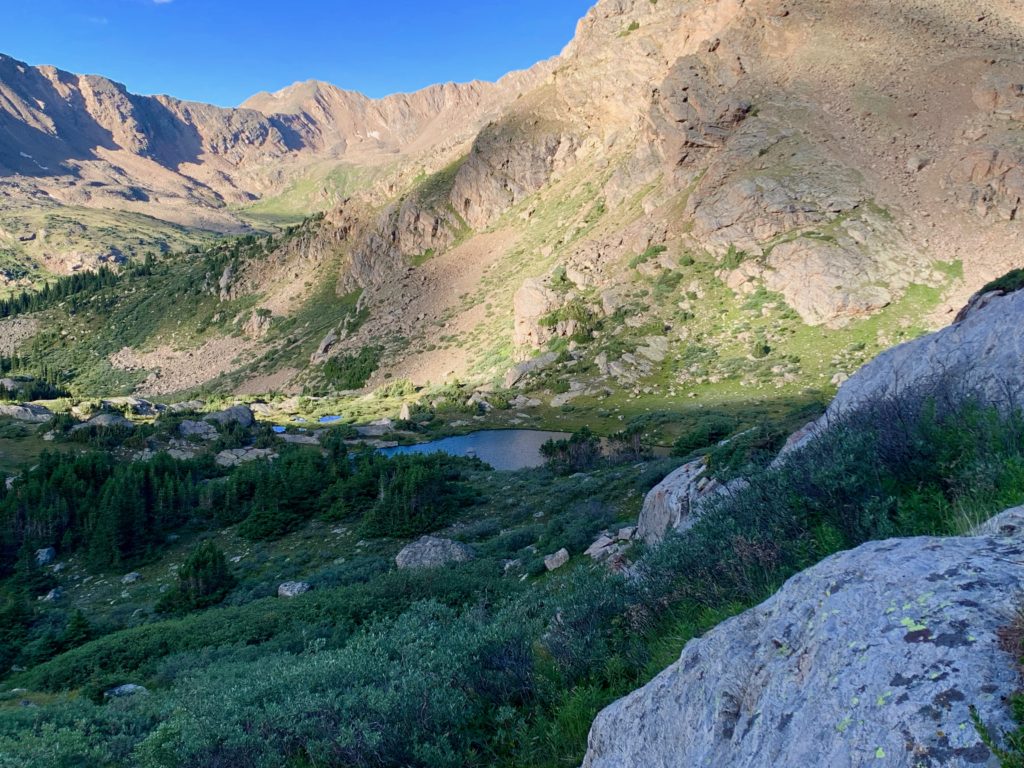
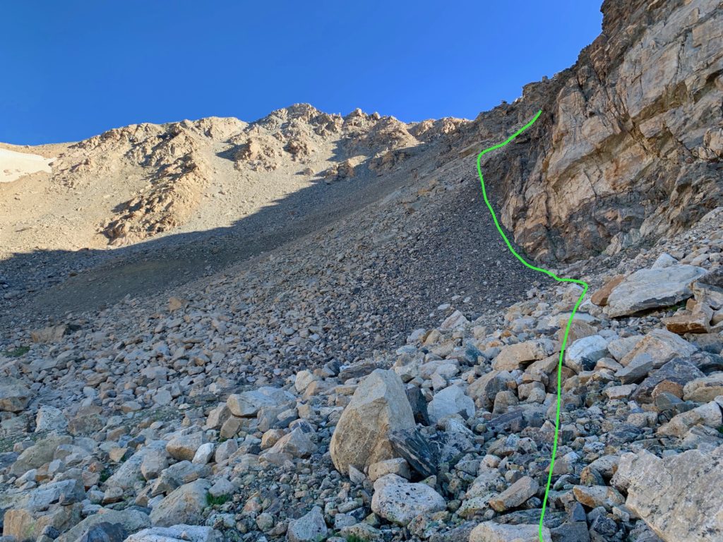
Entering the upper basin, the remainder of the route comes into view. That’s North Massive in the sunlight straight ahead and the cliffy west face of Massive Green to the right. My objective was the rocky gully rising to the right between them.

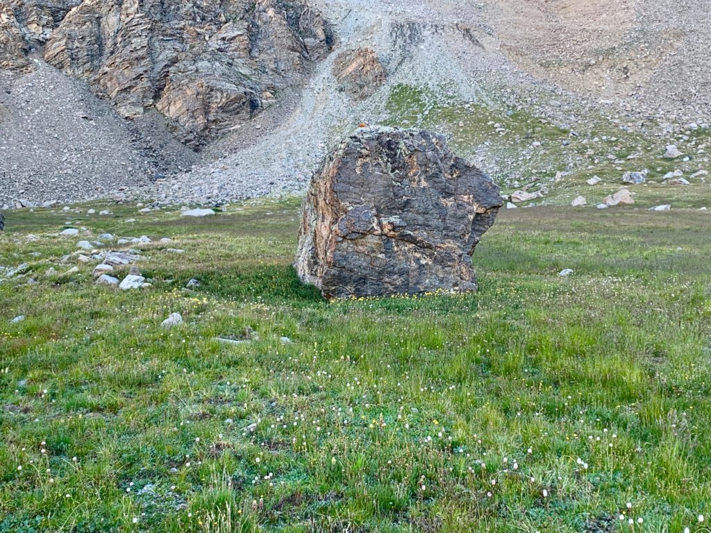
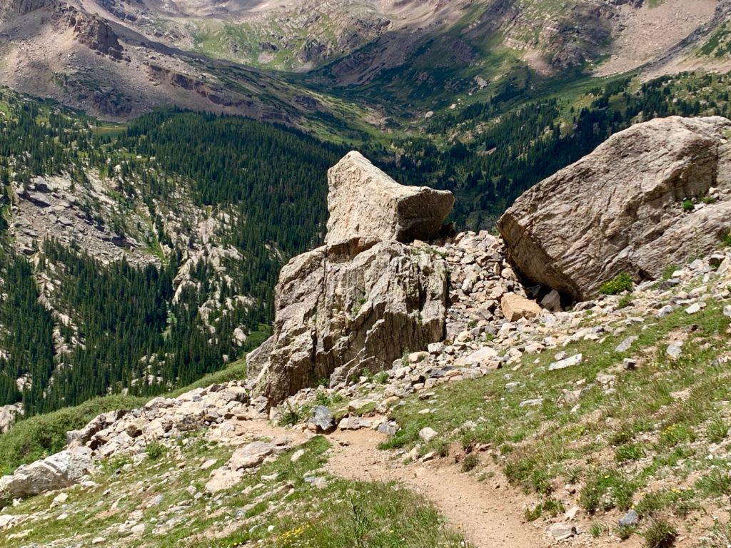
I came across this large cube-shaped boulder sitting by itself in a meadow and wished I had something to indicate scale. That thing is approximately 8’x 8’x 8’. Like a giant’s dice sitting on a game board.
Approaching the crux of the route, the gully. I stood here for a while trying to decide the best approach. Traversing to the white rocks in center would be longer but initially less steep. The gray rocks on the right offer a more direct route but are steeper. Then I noticed the cliff wall on the right. I knew that regardless of which way I went the rocks would be loose. It might be useful to be able to hang on to a solid rock wall. I opted for the gray rocks.
This worked great initially. The rocks weren’t as loose here and the rock wall offered nice hand holds to stabilize and pull myself along. I even noticed some foot prints and small pieces of litter indicating that others had been here before me.
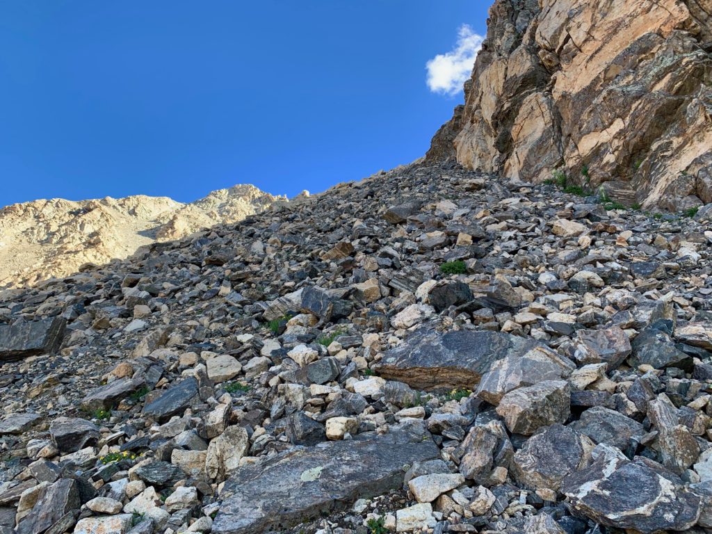
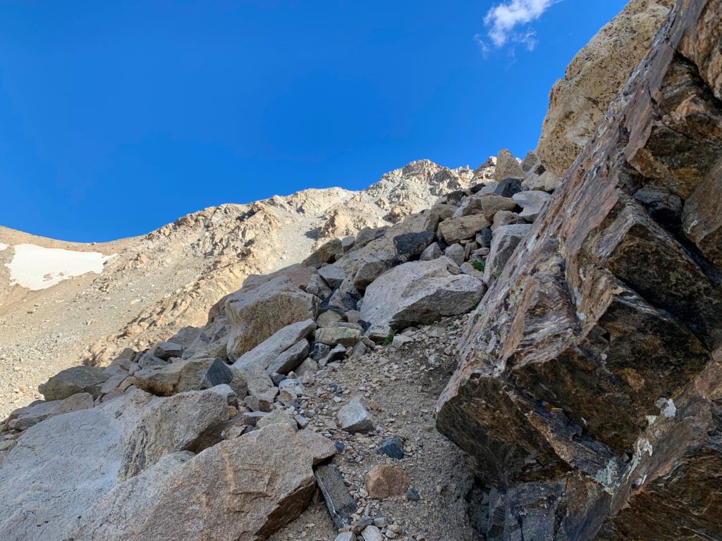
Unfortunately, after a while the handholds faded, the rock wall became smooth and I was forced to traverse left onto the larger, more stable white rocks in the center of the gully.

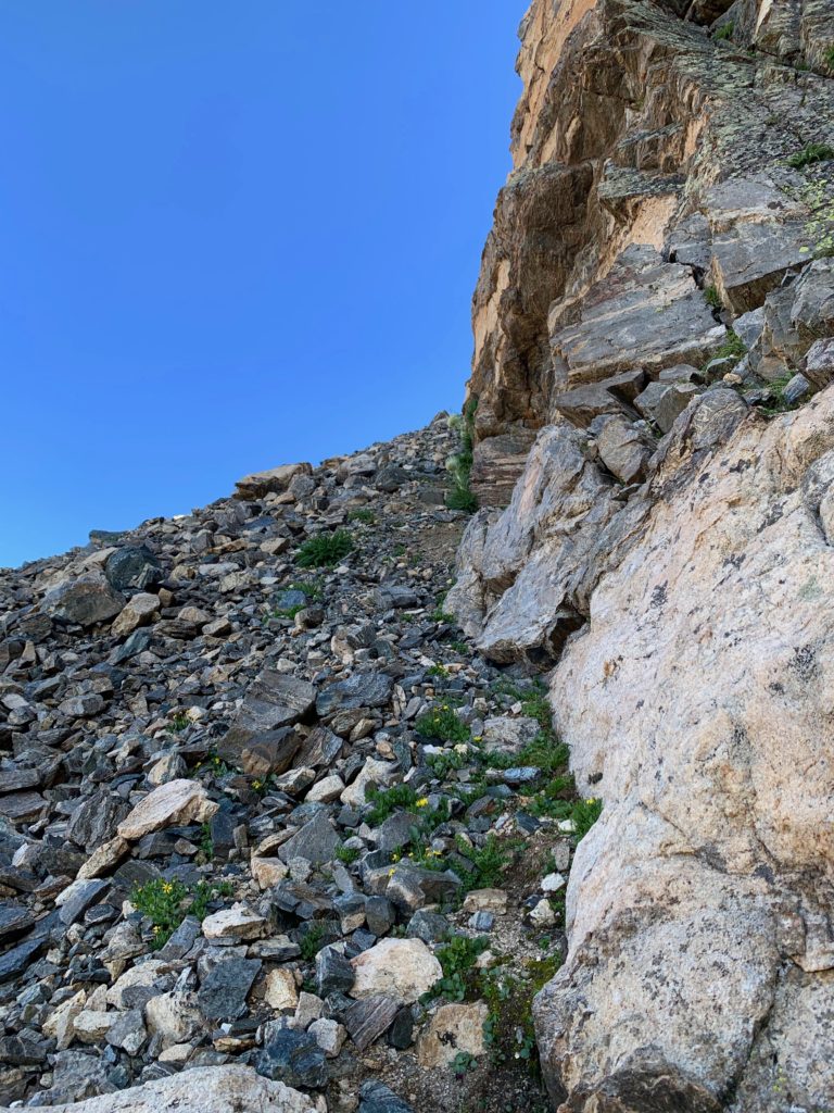
This also worked for a while but eventually the band of larger rocks disappeared and I was left standing/sliding on loose golf-ball sized rocks on a 35-40 degree slope unable to make upward progress. So I traversed to another band of large rocks and climbed it until it ran out. Climb. Slide. Traverse. Climb. Slide. Traverse. It was tedious and at times a bit scary.
I lost track of how long I was on that face but I was beginning to wonder if I had put myself in a bad position. If worse came to worse I figured I could butt-scoot back down and re-trace my path back to the car but by now I was over halfway up the gully and the desire to complete it kept pushing me higher.
Then looking up I noticed there was a separate branch of the gully to the right. It was slightly steeper than the slope I was on but it was mostly solid rock. Class 3 climbing, meaning climbing with hands and feet. I have very little experience climbing class 3 but compared to the rock slip and slide I was standing on, solid rock was a welcome sight. Time to learn me some class 3.

This turned out to be the solution to the gully. There were still some loose ledges on this route and I was forced to climb slightly higher on Massive Green’s north shoulder rather than topping out on the actual North Massive / Massive Green saddle. But after considerable time spent route finding through the sometimes-crumbly rock, I made it. Topping out on the ridge I was never so glad to see an actual trail.
On Massive Green looking back at North Massive. The saddle I was originally aiming for is in the lower right of this photo.

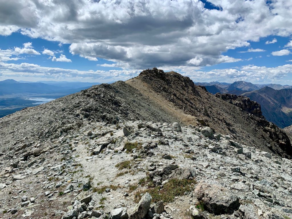
From here it was just a matter of walking up the remaining 150 feet or so to the summit of Massive Green and following the rest of the ridgeline over to Mt. Massive’s summit.
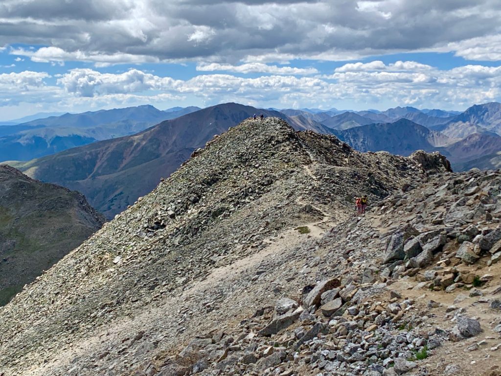
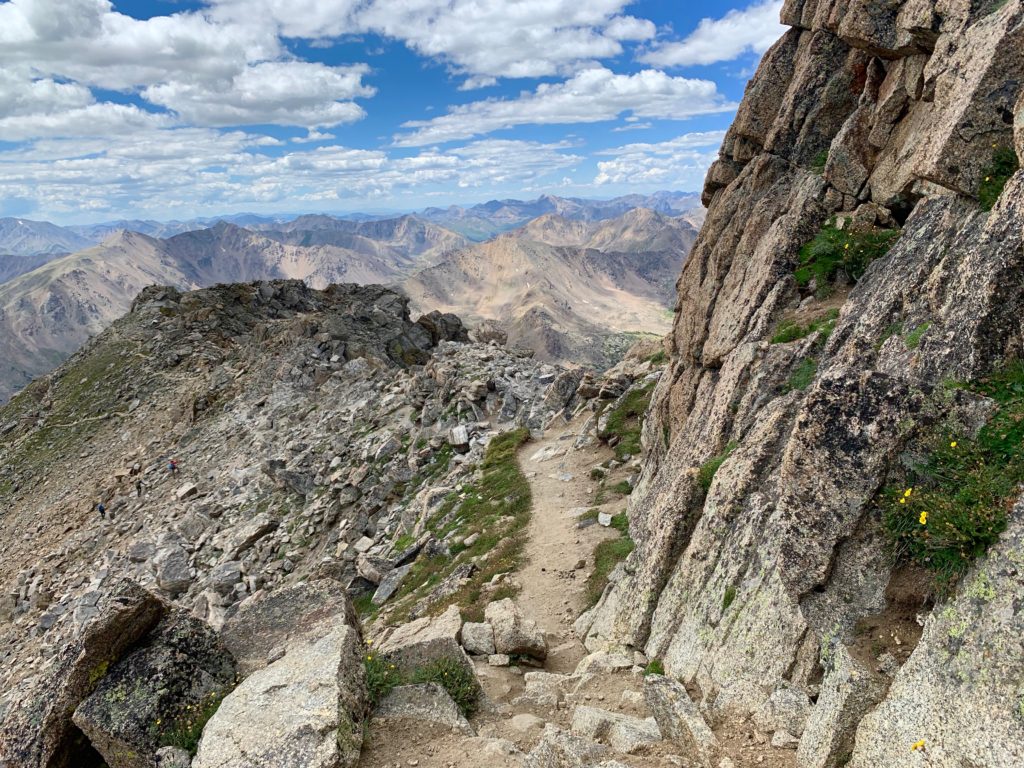
On the summit of Massive Green looking south along Massive’s ridgeline.

Almost there.
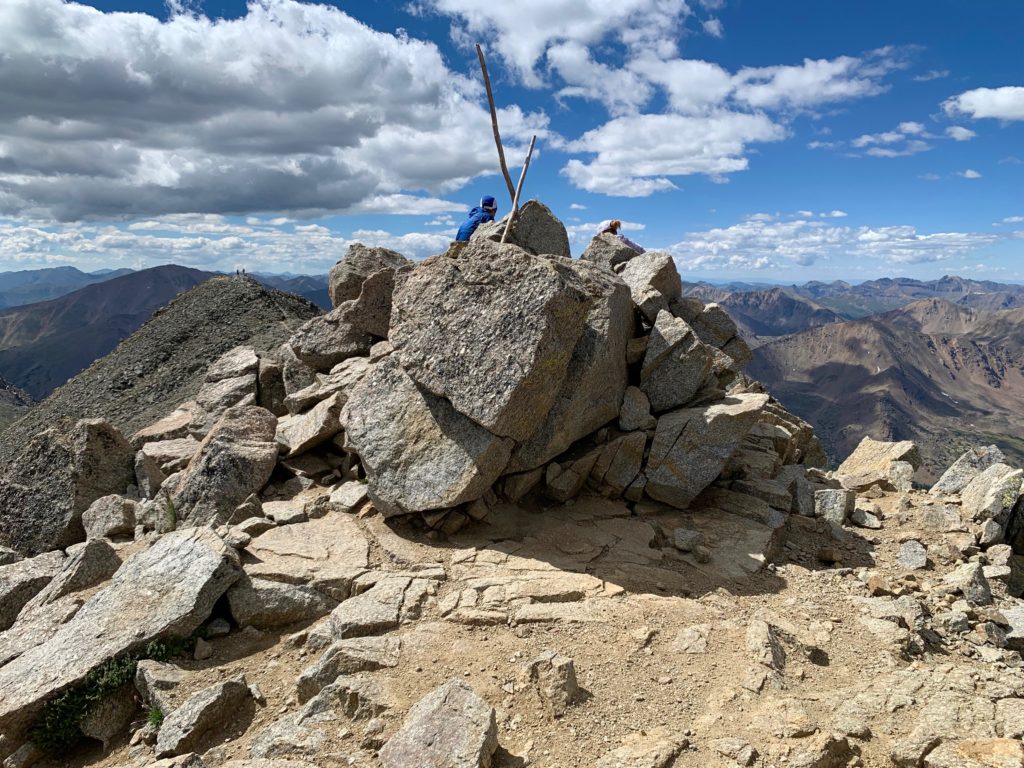
Summit of Massive.
Both Massive’s standard and SW slopes routes approach the summit from the south. I definitely got some funny looks from the folks on the summit as I walked up from the north side. Where’d you come from?! Well, let me tell you, see those lakes down there…
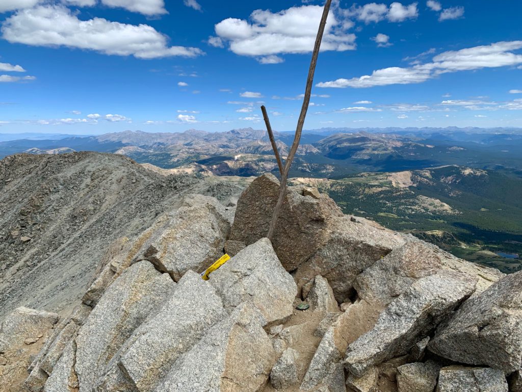
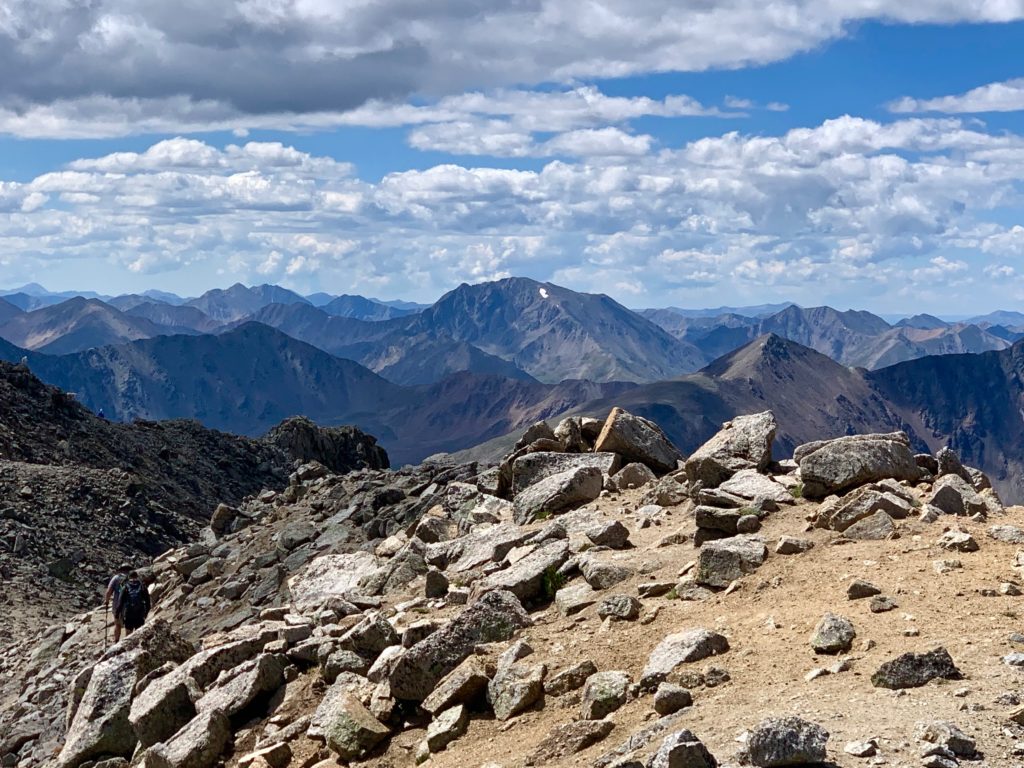
A few summit shots…
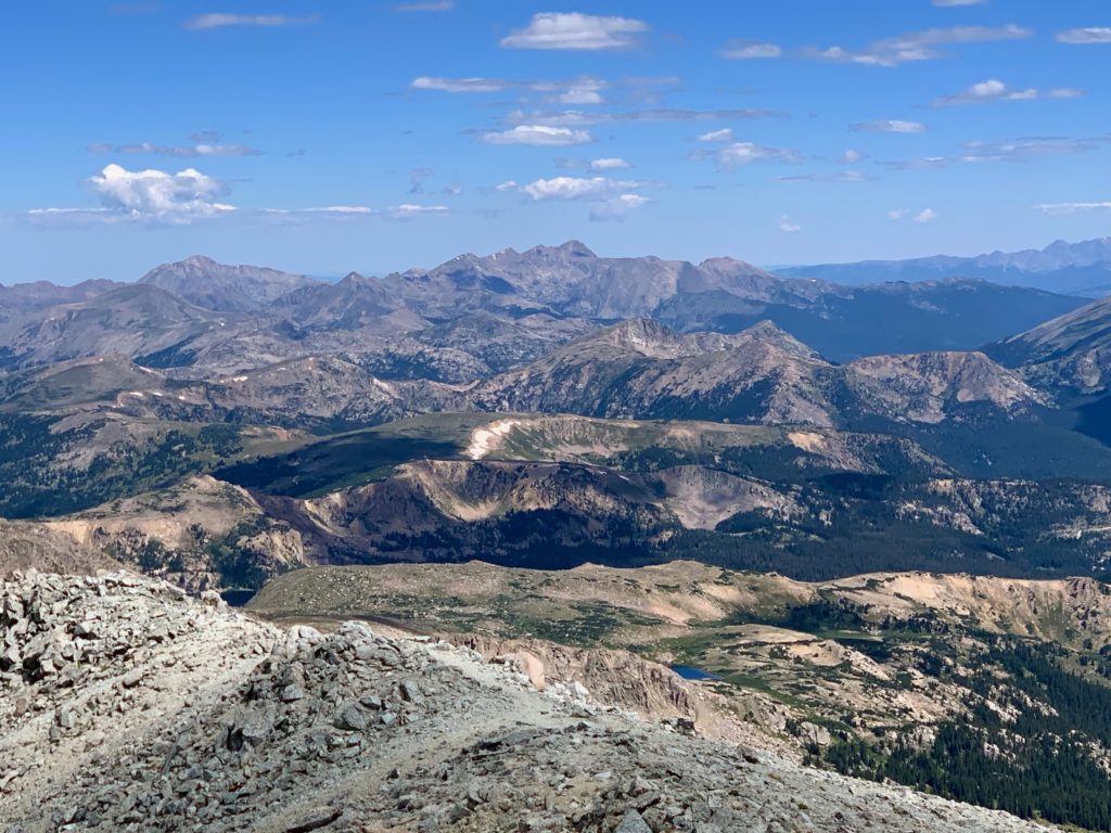
Mt. of the Holy Cross to the north.
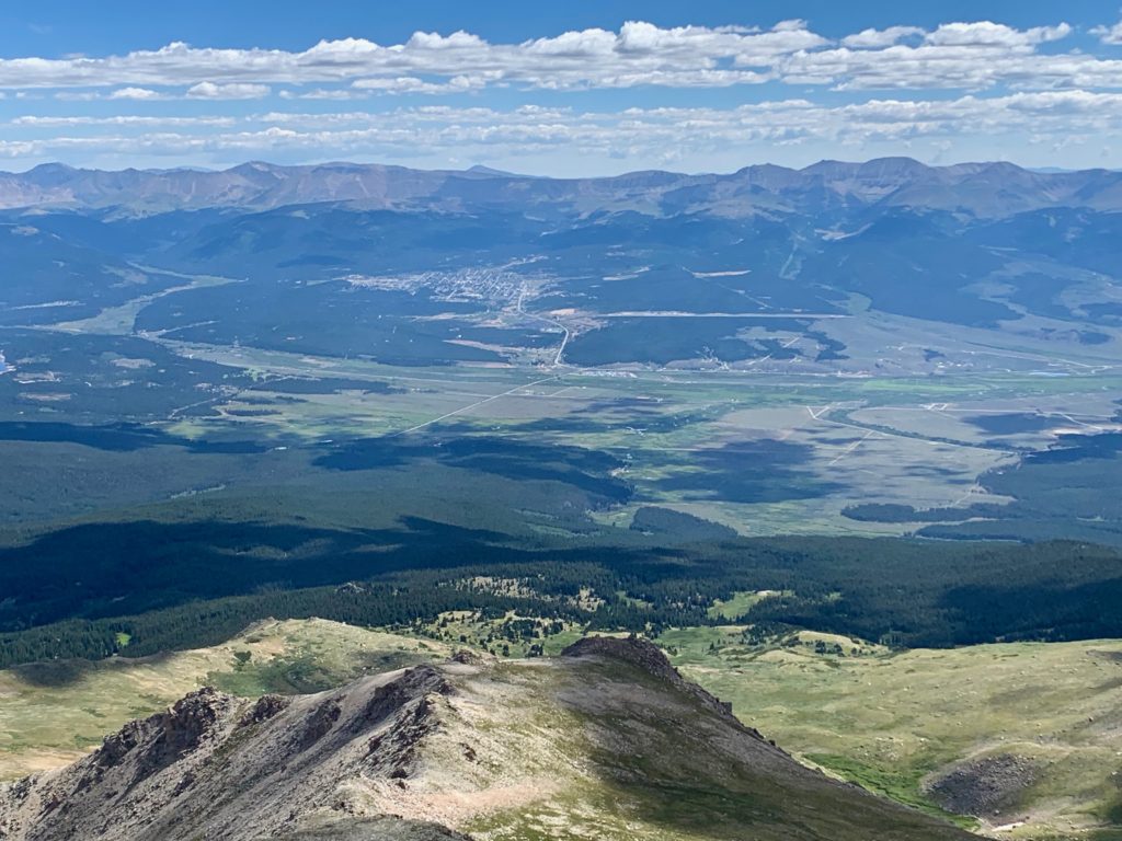
Leadville to the east.
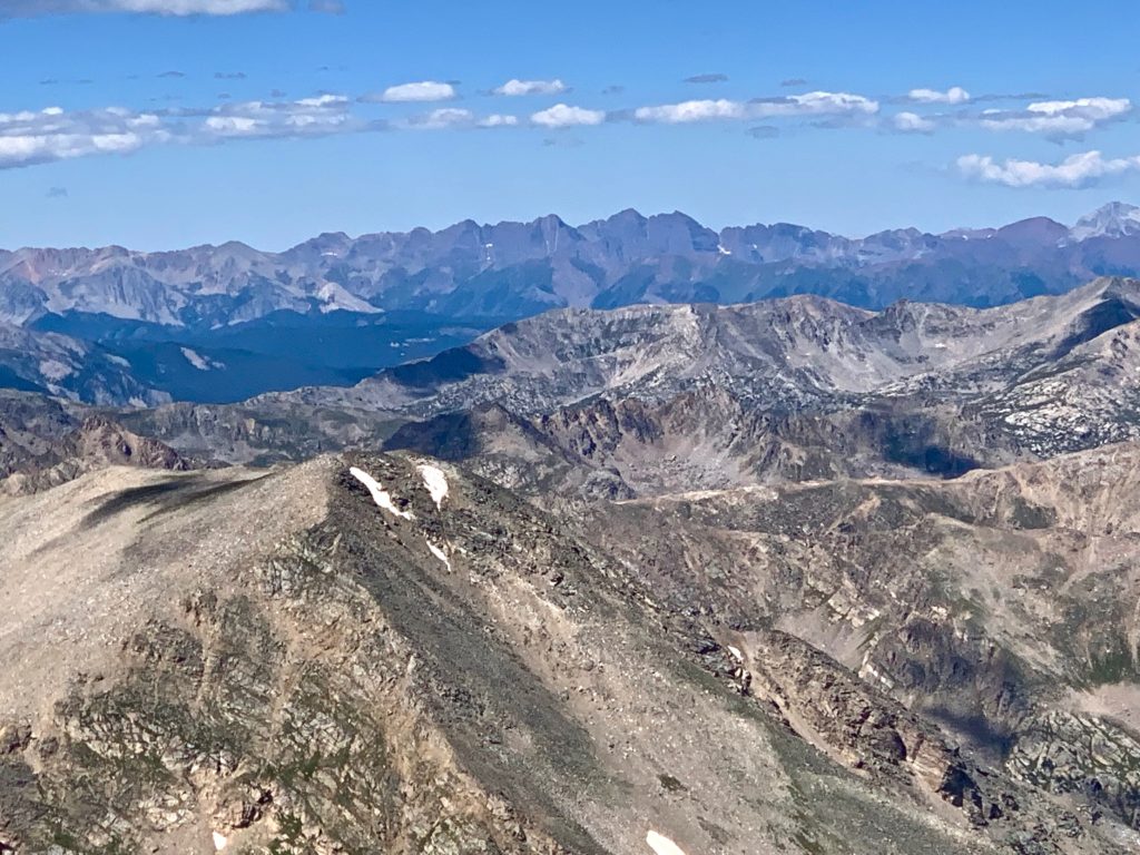
Climbers coming up the standard route with Mt. Elbert behind.
La Plata Peak.
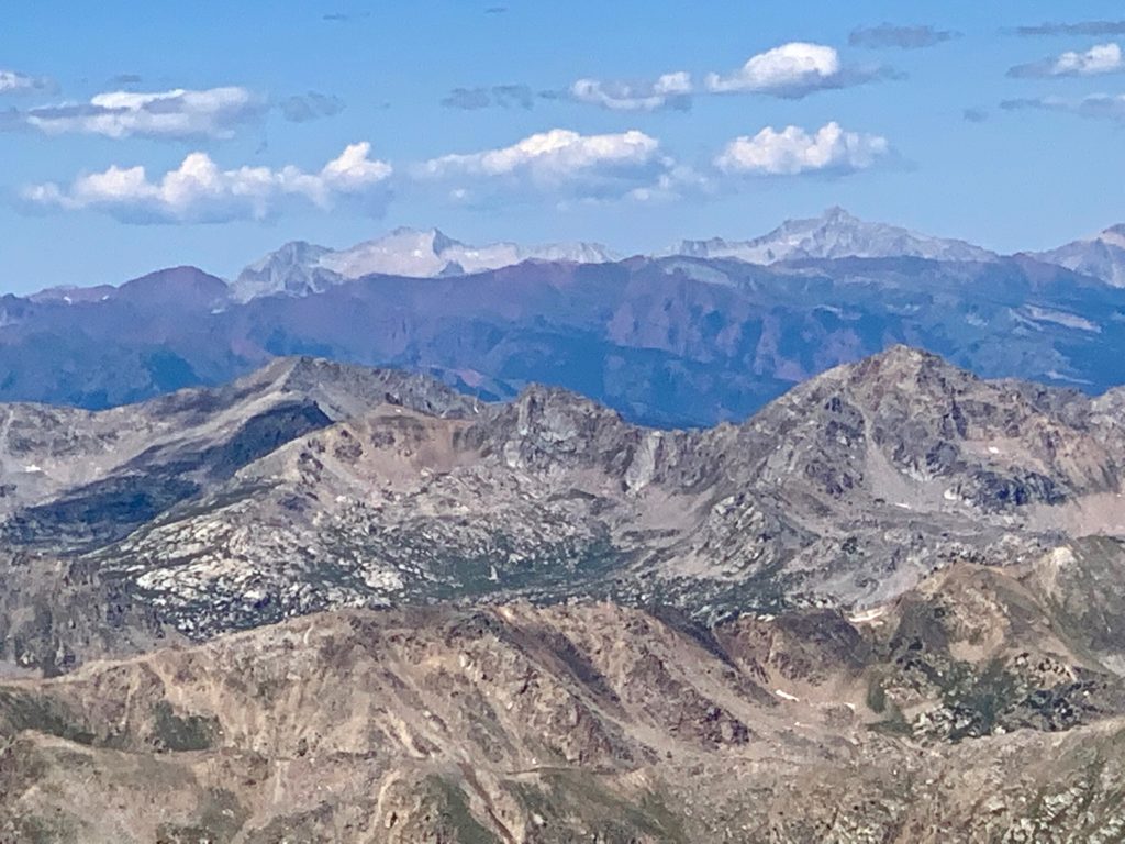
Mt. Massive offers some of the best views I’ve seen of the Elk Mountains from the Sawatch. The iPhone zoom function doesn’t do them justice but here are the Maroon Bells.
And Snowmass and Capital.
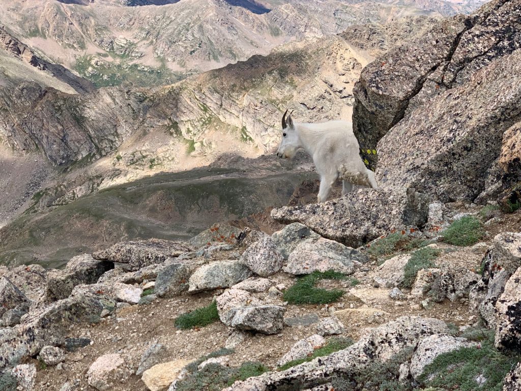
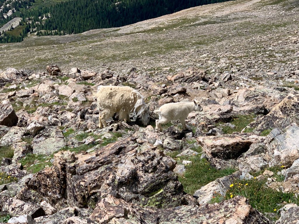
It was a perfect sunny, windless day on Massive’s summit. While I was sitting there eating my lunch chatting with my fellow climbers, people arriving via the standard route were talking about the mountain goats they had seen on the way up. Goats?! Mountain goats are one of the few large animals in Colorado I’ve not had the opportunity to see in the wild. I inhaled the remainder of my lunch, packed up and headed down.
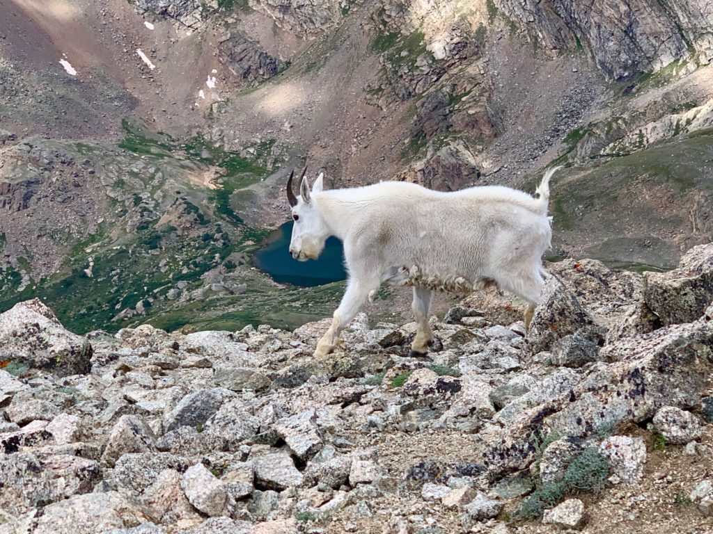
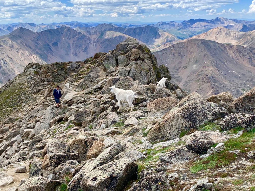
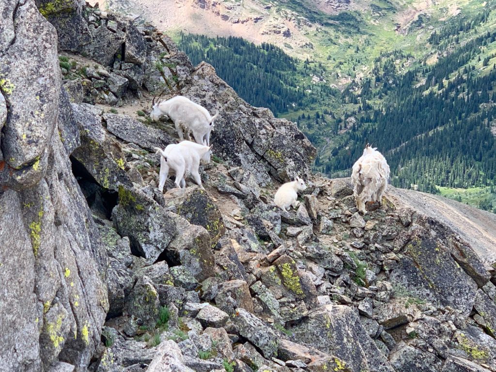
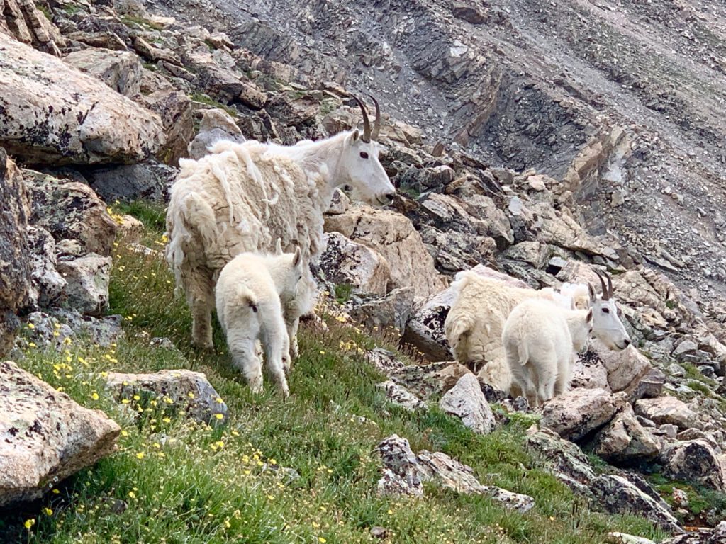
The descent route for my loop was the normal SW slopes route. It was the highlight of the day. On Massive’s ridge, shortly before the trail junction for the east slopes standard route, I walked past a rock wall and watched in amazement as a family of mountain goats walked out from the other side, maybe 20 feet from me. They were mothers with babies. At first I was concerned whether the moms would be protective of their younglings but after a while of walking fairly close to them it became obvious they were watchful but unafraid of humans in their mountain home.

As I was standing there watching them another hiker was coming up the trail and spotted them from below.
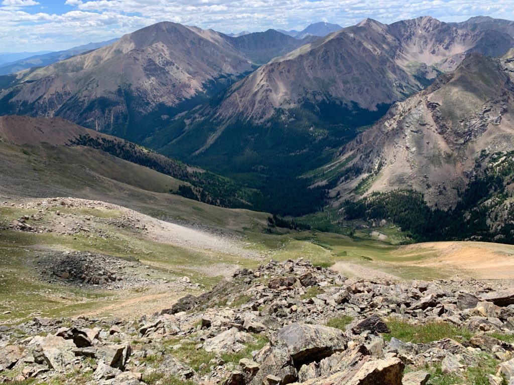
Heading down the SW slopes route with Mt. Elbert always in view.


And it wasn’t the end of my goat sightings. I got to see them multiple times as they were taking a direct line down the SW slopes and across the switchbacking SW slopes trail. Seeing the young ones, already surefooted on the steep rocks, made me especially happy.


Heading back down to North Halfmoon basin.

Deer Mountain looking particularly picturesque.

Back to North Halfmoon creek at the trailhead.

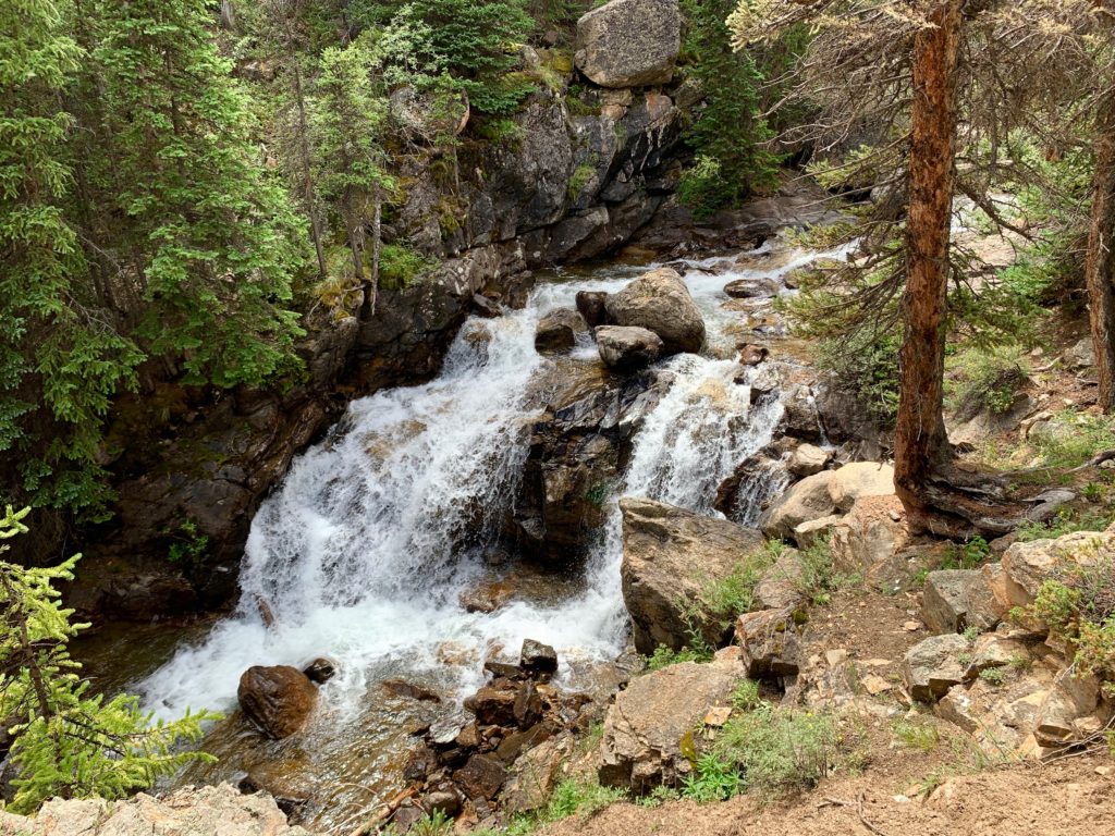
Cool waterfall on the drive out.
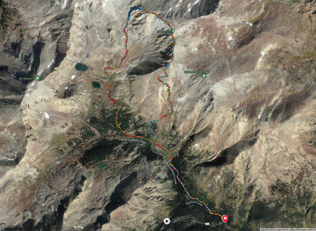
And here’s my complete route from Garmin in case anyone’s interested. Although, while this route has a lot to offer, I honestly can’t recommend it. It’s a shame too because North Halfmoon basin is uniquely beautiful and the summit ridge walk is amazing but that gully climb out of the basin to the ridge is nasty, scary, godawful and probably dangerous. Best to stick to the standard routes, you know, the ones with actual trails. And hey, that’s where the goats are anyway and they’re the best part!
Gorgeous country you’re exploring there Rossi. Really jealous.
It’s a tough job but someone has to do it!