
Under the category of “it’s on the Internet so it must be true” People for Bikes just released their 2023 city ratings.

While I’m sure there are those who follow such things, I was personally unaware of these ratings until a few days ago when my random electronic wanderings popped them on my radar.
And of course, since it’s a rating/ranking list on the Internet, it must be carefully parsed and considered. Six foods to avoid if you have bladder problems! Seven things to stop doing to be more productive!
So the first thing I did was look up my town. Hmm… Salida has a rating of 64. Is that good or bad? It looks sort of above average.
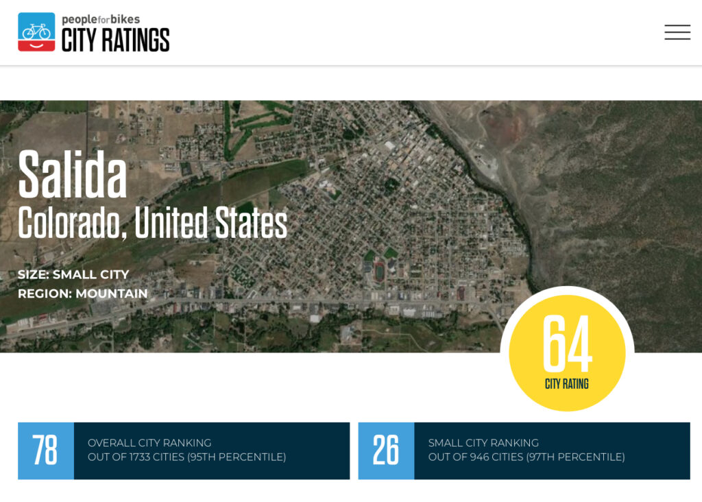
Then I noticed this. Yea, us! I guess.
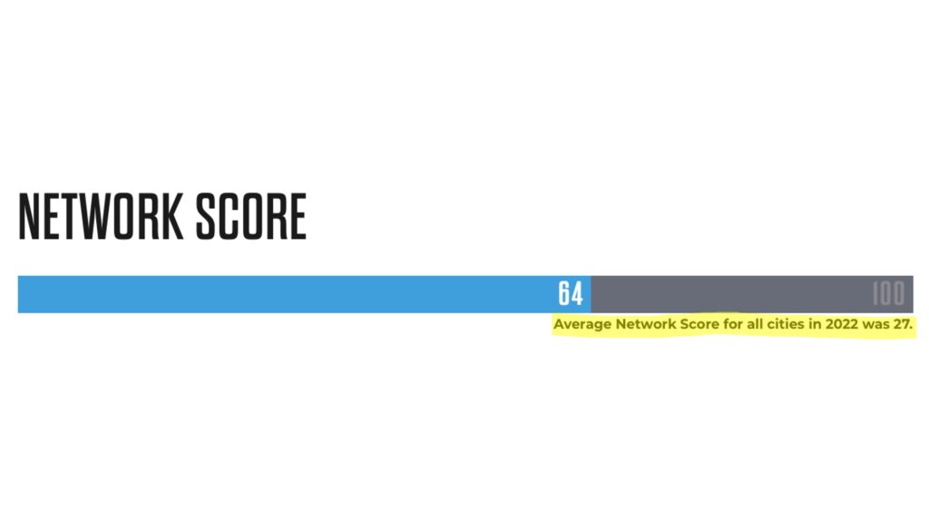
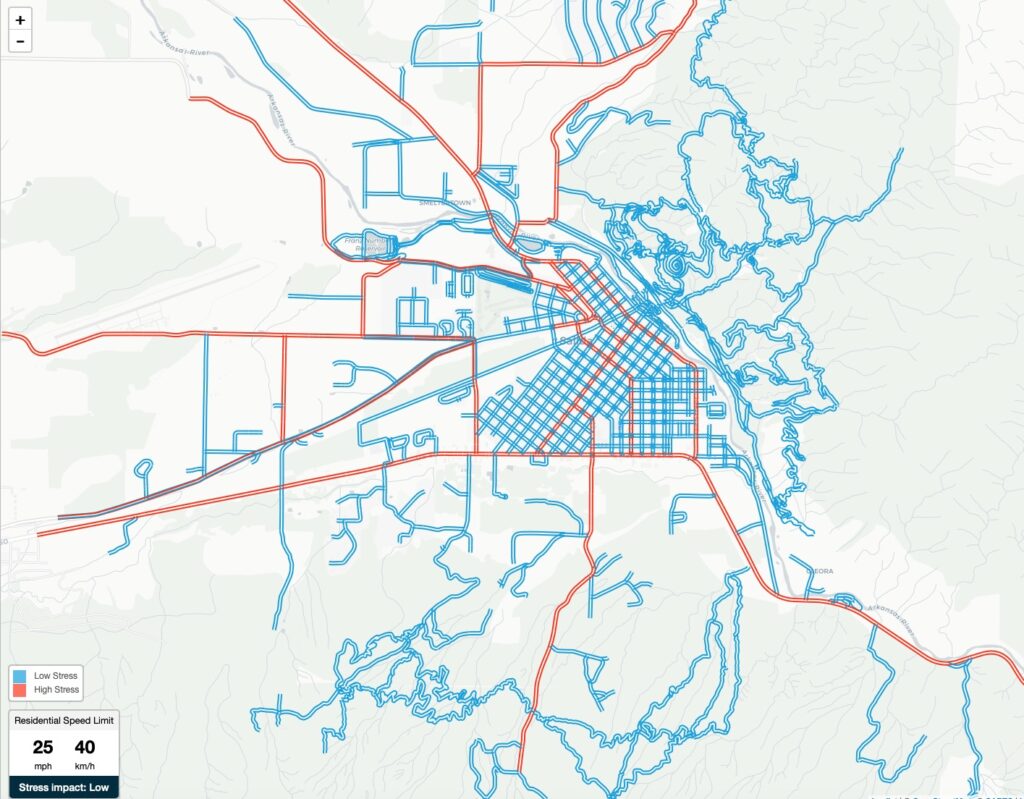
But how’d they come up with 64? Drilling into their network analysis left me confused.

Is a low score good or bad? A low score is red; so I’m thinking it’s bad. So blue is good? And what is BNA? A little more digging turned up this definition of their methodology.
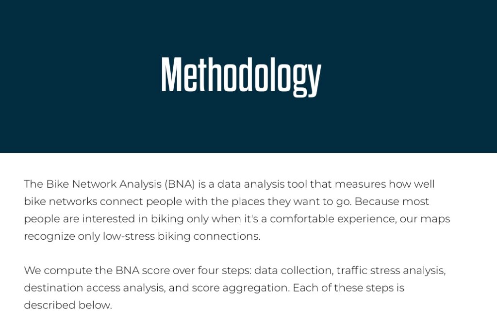
Having ridden in my share of traffic, I understand the concept of low-stress biking and think it’s a reasonable measure of how good a bike network is. But the definition left me even more confused in regards to the map of Salida.
For one, the area in the upper right in red is all wilderness.

Aside from a handful of 4wd roads, the only thing up there are mountain bike trails so I’m not sure what’s adding to the stress unless you’re worried about riding off a cliff (of which there are a few) or getting head butted by big horn sheep.

Same thing with the dark red area to the south.
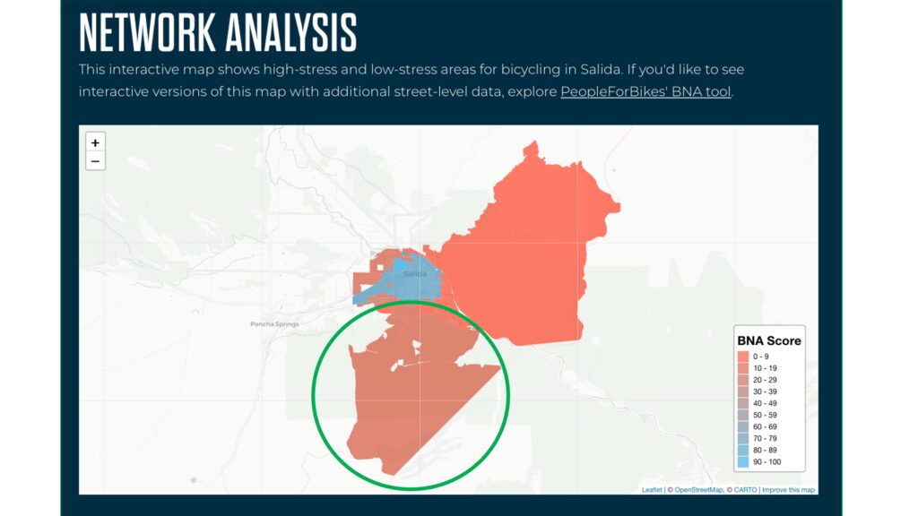
That’s the Methodist Mountain side of town. Nothing but a handful of dispersed neighborhoods, mountain bike trails and dirt roads. Maybe the folks at People for Bikes are stressed at the thought of being run over by hipster gravel riders?
Not to mention, the only part of the map actually within the city limits of Salida is the area in blue and that’s the part of town where you’re going to see the most cars.
Even more perplexing, when you drill into their street-level detail, all the areas in red on the map above contain mostly blue roads and trails.
This map makes sense to me. But how does blue detail get reported as red in the analysis? I don’t get it. And apparently, I’m not the only one. The guru of all that’s urban cycling, Eben Weiss, Bike Snob NYC, has the very same questions about his home town.
So maybe we’re lost in the weeds. Let’s zoom out to 60,000 feet and take a look at the supposed best of the best, the top three large, medium and small cities.
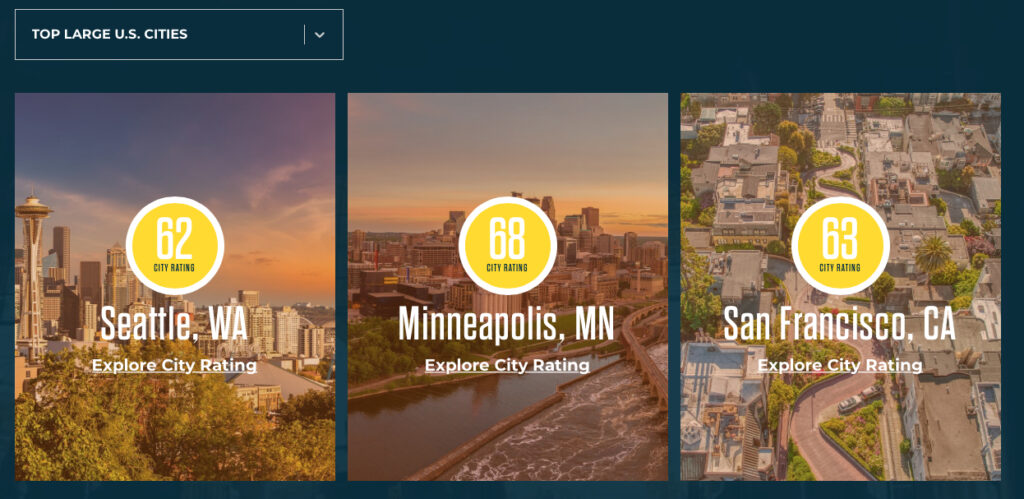
First of all, I agree with Mr. Weiss on this one. I can’t take any of these seriously as “large cities”. Maybe San Francisco. None of them have a population of even a million. They’re medium/large at best. But even taking their categorization at face value, the top three medium-sized cities look like this:

And the best of the best, the top three small cities:
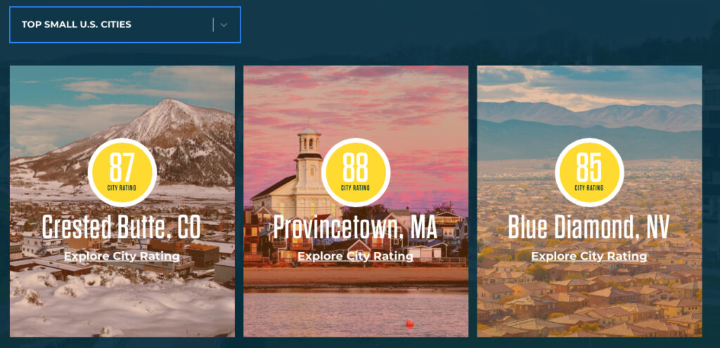
Who’d a thunk it?! Riding bikes in small towns is better than riding bikes in large cities. Duh.
Telling me that it’s better to ride a bike in Crested Butte than in San Francisco is like telling me it’s more comfortable to ride around in a Mercedes S class than on a city bus. Sure, ok, but what if I’ve only got a bus ticket? And what about winter? It’s unclear whether People for Bikes adjusts for weather. I guarantee you, riding a bike in Crested Butte in January is anything but low-stress.
I guess if we all want to feel less stressed on our bikes, we should pack up the family truckster and move to a small town. Wait… that may not work. Don’t do that.
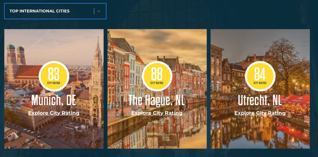
Or we could all move to the Netherlands.
Just for comparison’s sake, I looked up my former hometown of Houston, TX. BNA rating of 10.
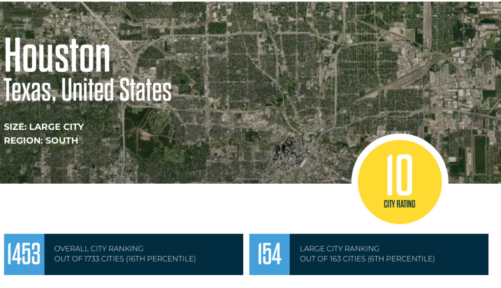
Yeah, ok. That sounds about right.
I guess at the very least, I should feel comfortable in knowing that in moving from Houston to Salida I’ve made some kind of quality of life progress. At least according to some bike advocates on the Internet.