As I mentioned in a previous post, as a kid growing up in Colorado my knowledge of the mountains was pretty limited. The mountains were always there in the background, they just weren’t something my family chose to actively seek out.
I grew up on the Front Range and the sum total of my knowledge of those mountains boiled down to two: Pikes Peak and Mt. Evans. They are the two 14ers with roads to the top. Pikes Peak is the Colorado Springs mountain; Mt. Evans is the Denver mountain. Beyond the Front Range, my understanding of Colorado’s mountains went something along these lines:
- Sawatch: The big, friendly mountains near Salida. I probably saw the Sawatch, at least the southern part, more than any other mountains on frequent family trips to Buena Vista. I also spent a fair amount of time in the Sawatch hunting and fishing with my dad and his friends. The only mountain in the range I could actually name was Mt. Shavano because of the famous Angel of Shavano, visible in the winter.
- Sangre de Cristos: Home of the Crestones, which I most commonly viewed from the east on trips into the valley around Westcliffe. They were menacing, castle-like and as far as I knew, totally unclimbable. Oh, and the Sand Dunes, the Sangres were the home of the Great Sand Dunes National Park.
- Elks: Aspen, movie stars, multi-million-dollar mountain lodges. The Elks are hard to get to from southern Colorado. They close Independence Pass in the winter and I always assumed it was to keep away the Arkansas Valley riff-raff like my family. I didn’t see the Maroon Bells in person until I was in college and standing at Maroon Lake gazing at that real-life post-card view only contributed to my otherworldly impression of the Elks.
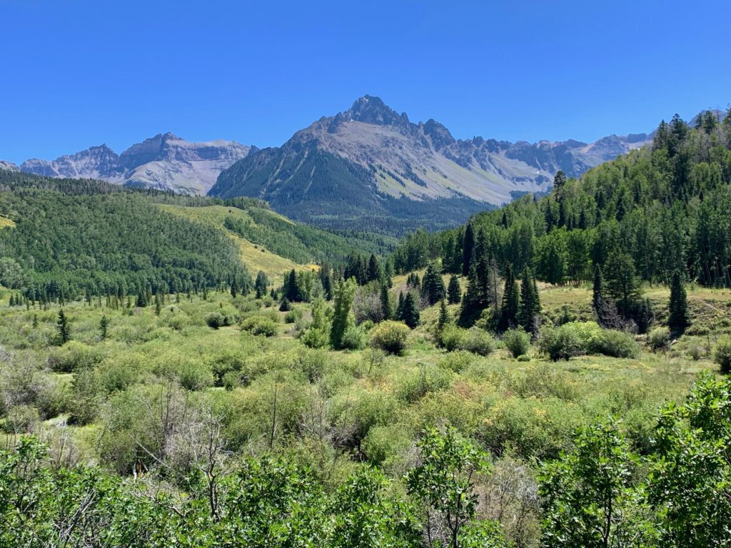
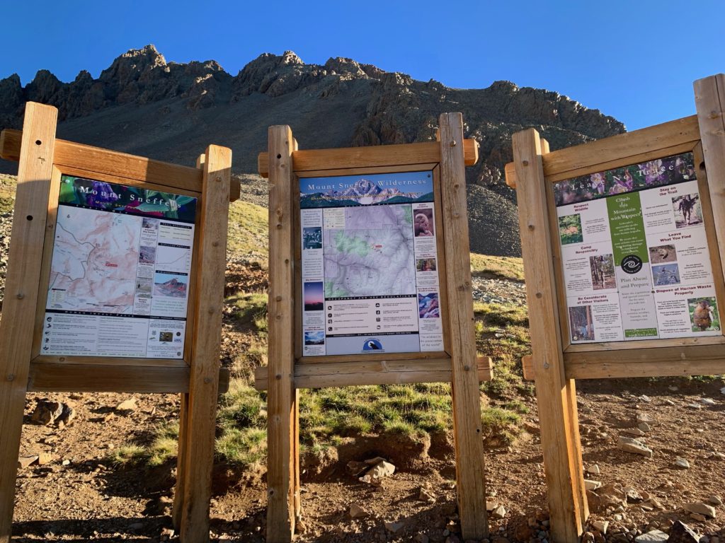
- San Juans: Wild and remote, in the Southwest corner of the state. Growing up, I got to spend some time there on outings with my dad. The mountains there have funny names like Sneffels and Uncompahgre. I can remember going through Creed and Ouray with my family and in college I did some skiing in Telluride. But most of this huge area was unknown to me.
- Mosquito/Ten Mile: Never heard of them despite the fact that in high school I drove through them hundreds of times to go skiing in Breckenridge. They were familiar but unnamed mountains to me.
It’s funny what you take for granted in the place where you grow up.
Having successfully climbed several of the nearby Sawatch peaks, I wanted to do some exploring farther afield. I targeted the San Juans and one of those funny-named peaks, Mt. Sneffels, as our next objective. According to my 14er guide, the standard route on Mt. Sneffels is “a good route for someone who has climbed many easy Fourteeners and wants a taste of what the harder ones are like”. Which is exactly what I was looking for. This was my plan. Unfortunately, when Ms. Seeking heard that when climbing Sneffels it is recommended that you wear one of these…

…the love of my life decided it wasn’t HER plan. For the uninitiated, that’s a climbing helmet. It’s for keeping you from getting donked on the head by falling rocks while climbing slopes steep enough for such things to happen. Ok, so it was also going to be my first solo climb.
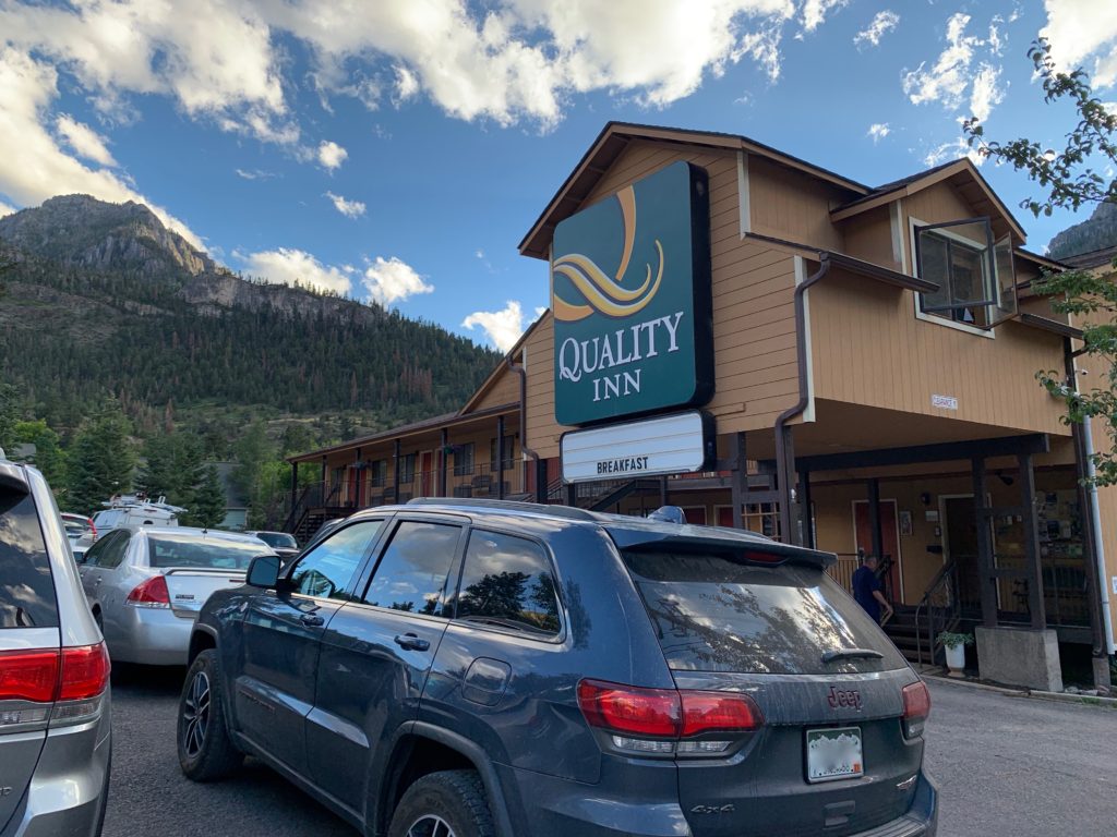
Because Mt. Sneffels is 3.5 hours from Salida, my plan was to drive to Ouray Monday afternoon and spend the night for an early Tuesday morning start. Being left to my own devices for overnight accommodations, I decided to try my hand at car camping in one of the camp areas near Ouray. I purchased a lightweight camp stove for the occasion and packed the Jeep with a sleeping pad and bedding. Unfortunately, when I arrived in Ouray tourist season was still in full swing and there were literally no campsites to be had anywhere in the area. I considered just parking somewhere in the woods but there were signs everywhere saying ‘No overnight camping’ and besides I really wanted access to some kind of bathroom. So, after an hour of driving around looking for a spot without success I ended up camping here. Bathroom AND a free breakfast!
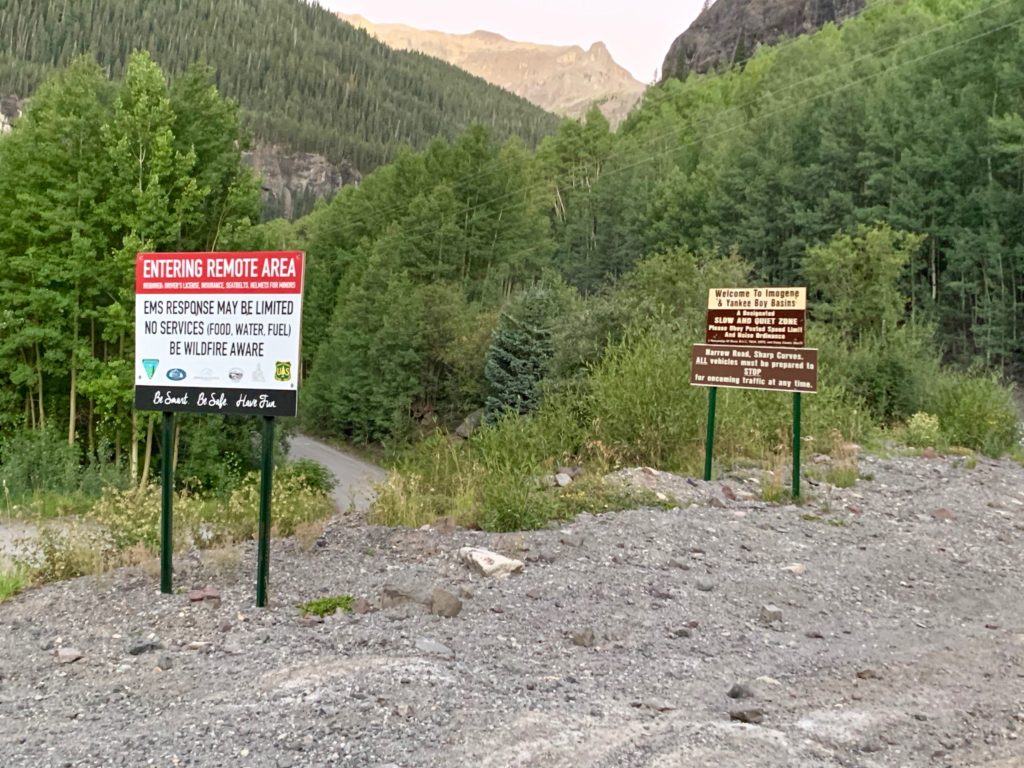
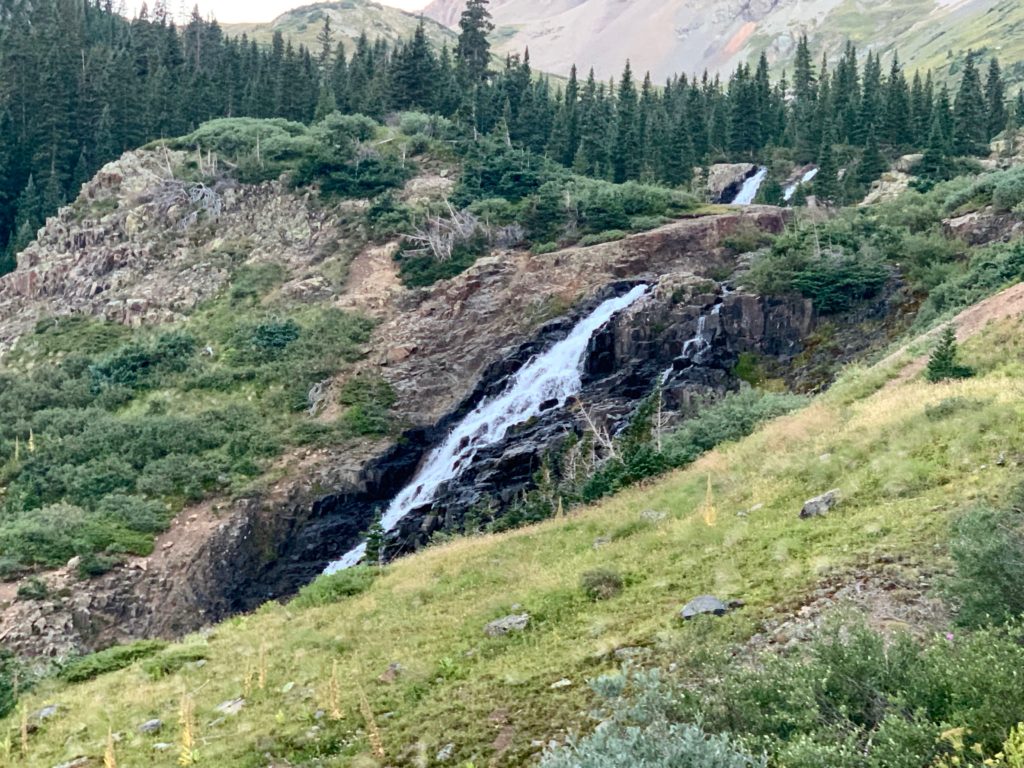
Tuesday morning I headed up County Road 361 at 6:00 a.m. just as the sky was beginning to turn light. My destination was Yankee Boy basin 7.5 miles west of Ouray, on the south side of Mt. Sneffels. The drive itself is pretty spectacular. It’s a steep narrow road, one-lane in many places with great views and some interesting features.
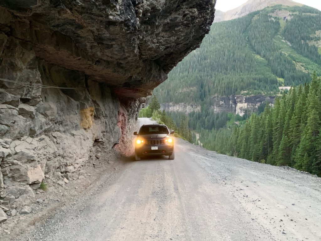
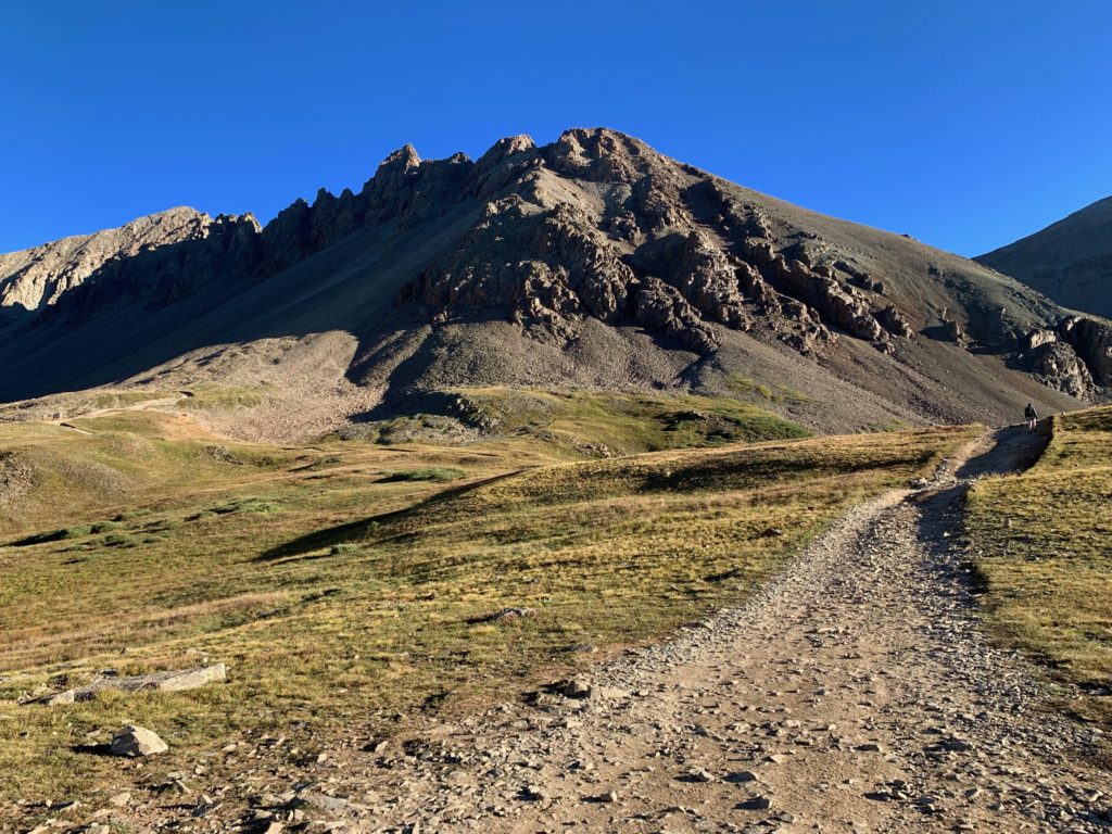
The road starts out as 2WD and gets increasingly rough as you go up. Discretion being the greater part of valor, I opted to park at a small parking area 1.2 miles up the 4WD section of the road and hike the rest of the way in. Beyond this point the road gets seriously gnarly and I figured it would be better to hike than to risk a broken Jeep this far from home.
Besides, the scenery in Yankee Boy basin is of the jaw-dropping variety so hiking a couple miles up the remaining 4WD road was actually a nice warm up for the climb proper.
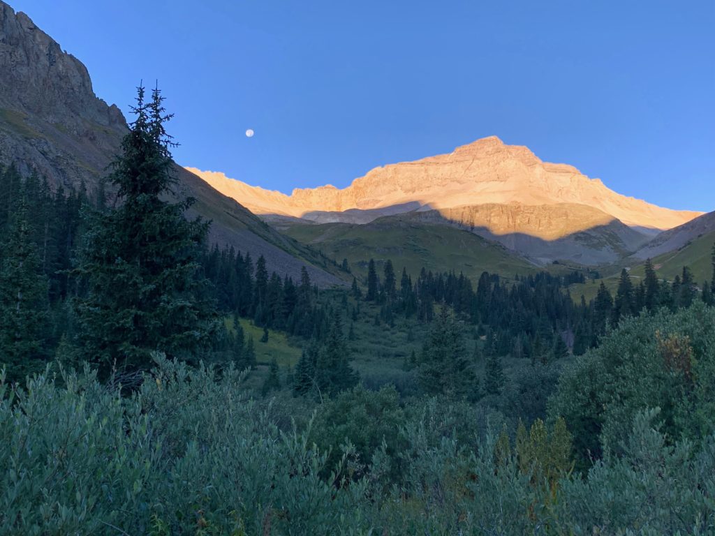
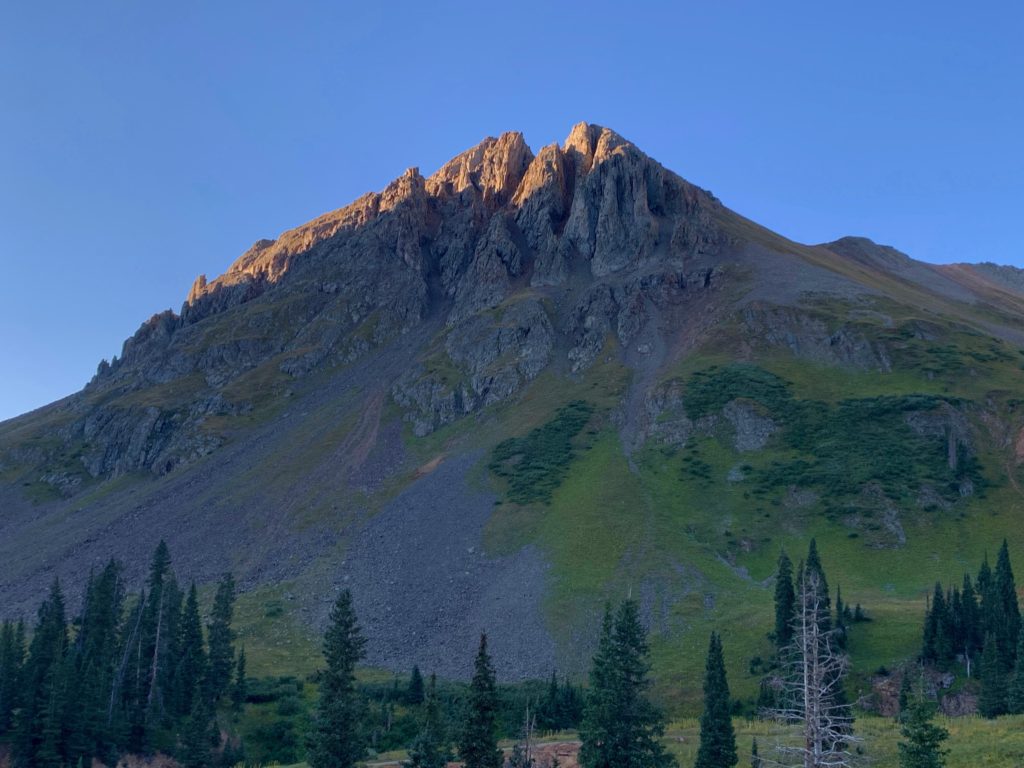
The moon was just setting over Gilpin peak as I started hiking.
The west face of Potosi Peak still in the early morning shadows.
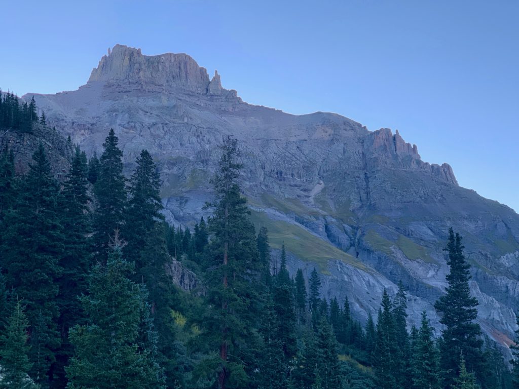
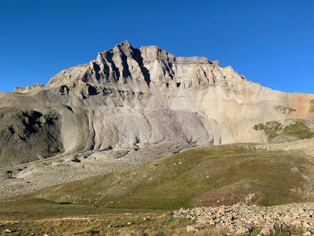
The sun just starting to hit the top of Stony Mountain.
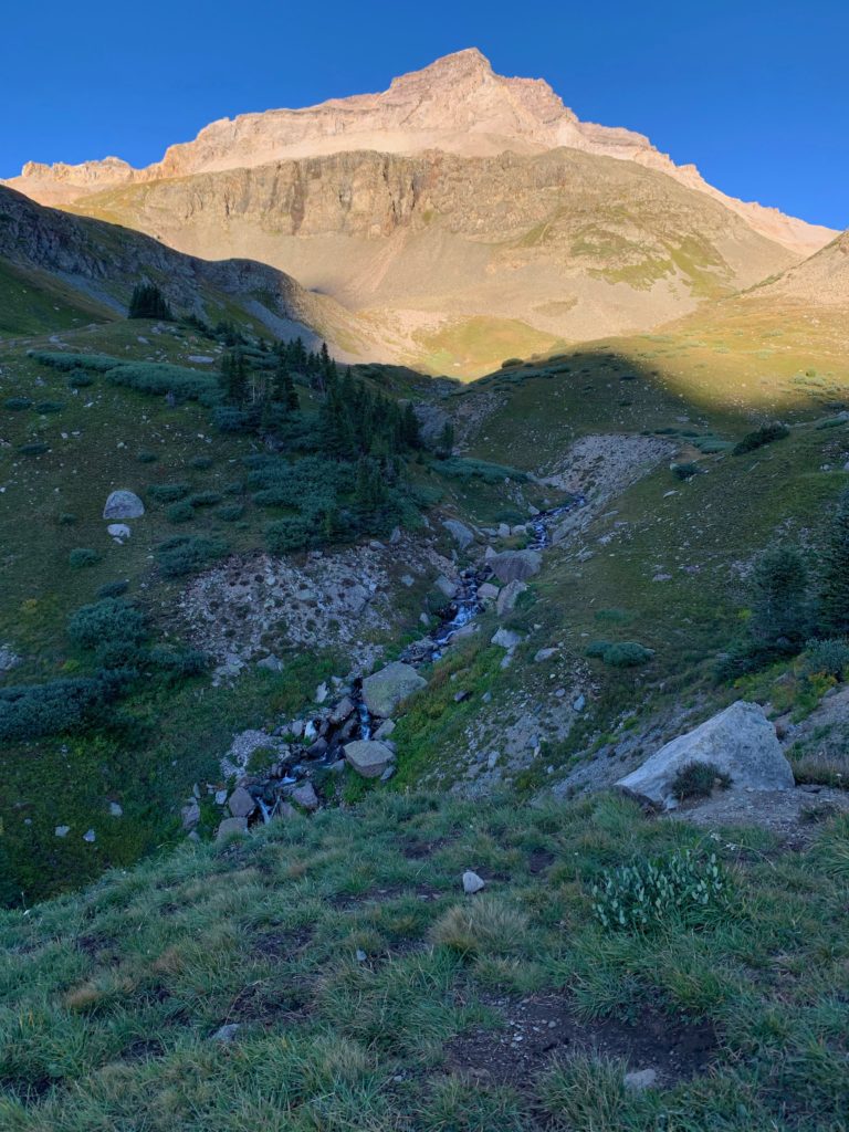
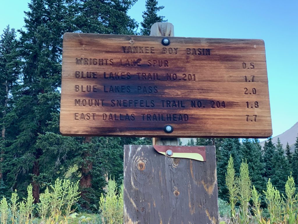
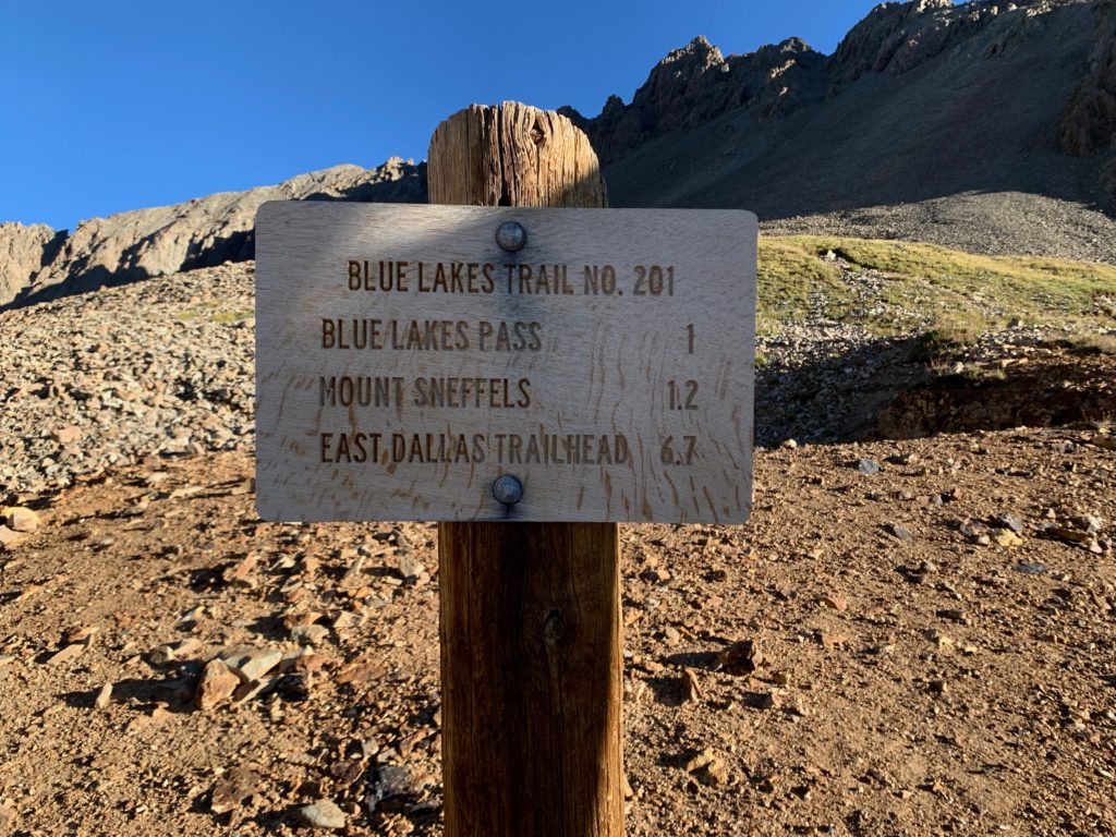
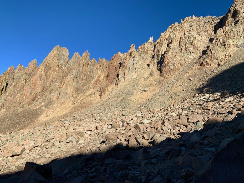
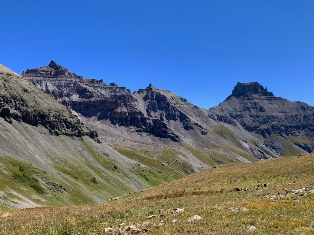
The actual Sneffels trail starts at 12,440 feet at the end of the road in the upper Yankee Boy basin. From there it’s 1.2 miles to the summit, a steep, rocky 1.2 miles.
Gilpin Peak, now in full sunlight.
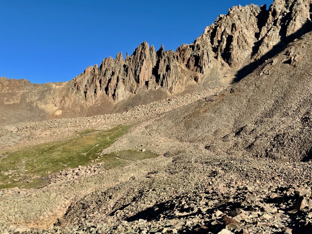
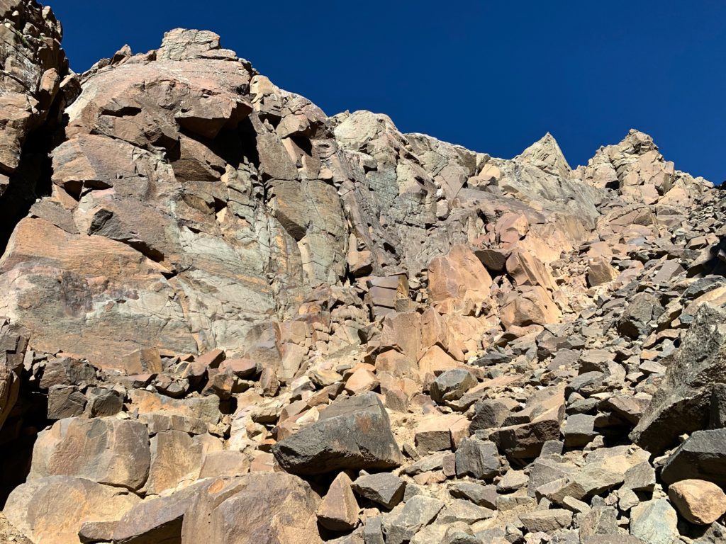
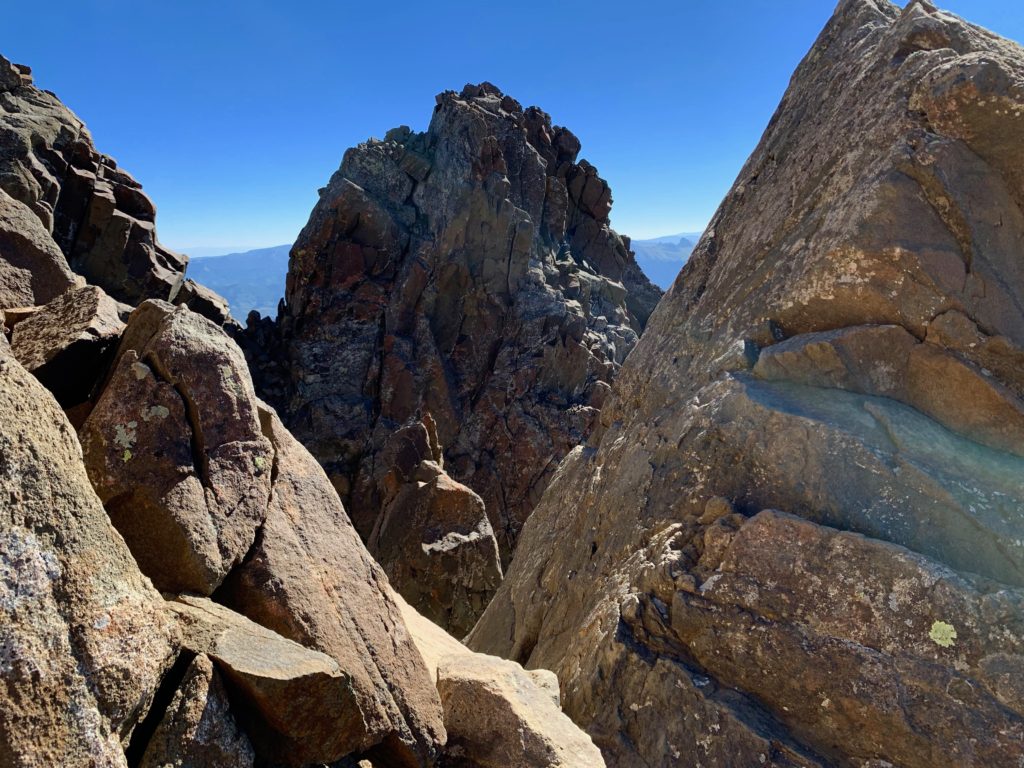
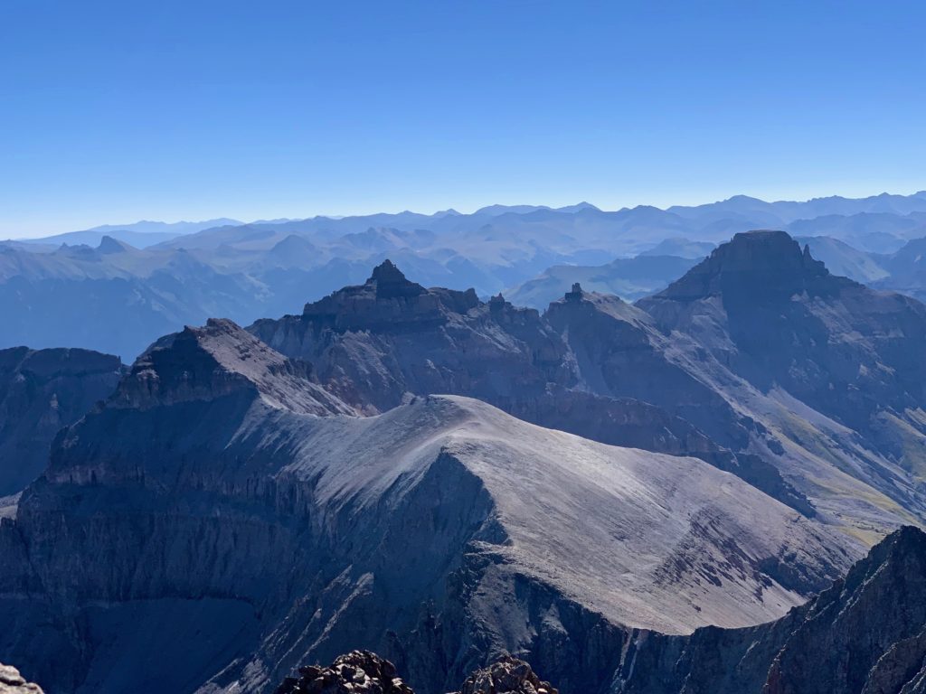
The spires straight ahead are Sneffels’ jagged southwest ridge. To the left of the spires is Blue Lakes Pass. I was not climbing the ridge, which is way over my pay grade. I was taking the standard route which turns right, past the scree field just before the ridge. One of the interesting things about this route is that due to the steepness of the terrain all around you, you never actually see the summit of Sneffels until you are practically standing on it.
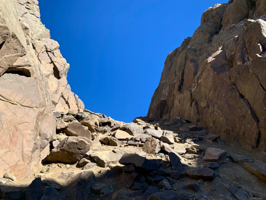
There it is, the Lavender Col, first section of the actual climb.
A closer look at Sneffels SW ridge from the Lavender Col.
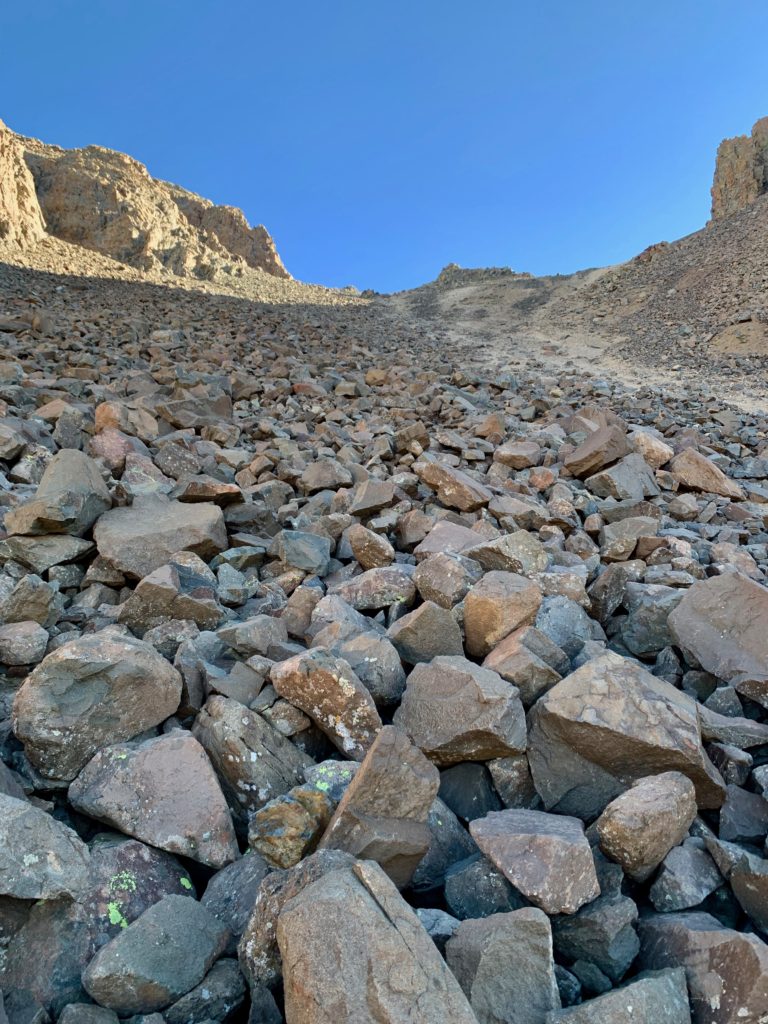
Halfway up the Lavender Col. For best traction, I stayed on the rocks to the left. From our experience climbing La Plata I learned that rocks are grippy while steep gravel, like the lighter dirt to the right in this photo, tends to be two steps forward, one step back.
Looking back down the Lavender Col with Gilpin Peak in the background.
At the top of the Lavender Col looking back at the saddle with Sneffels’ neighbor, Kismet Peak.
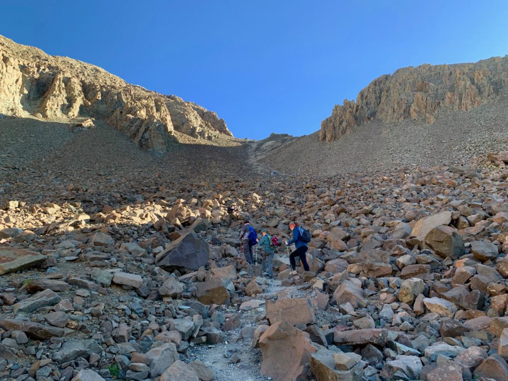
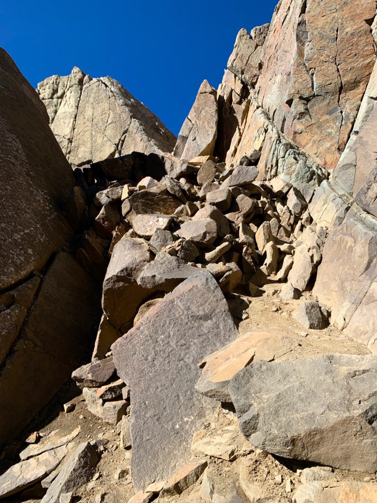
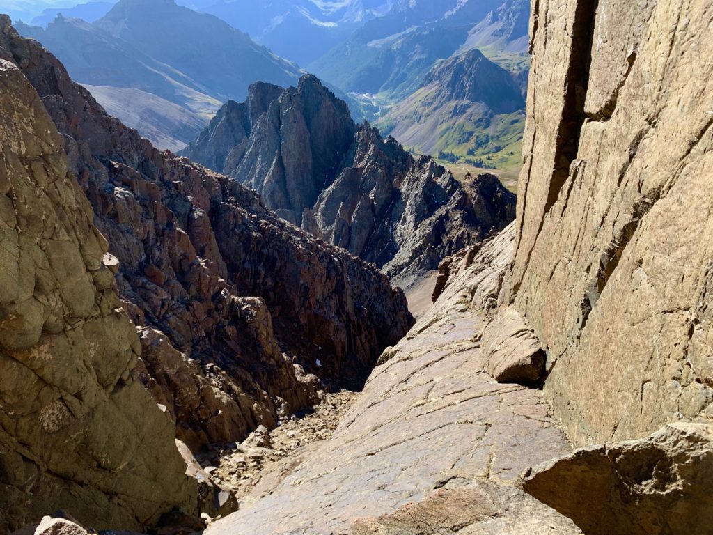
Second part of the climb, the gully.
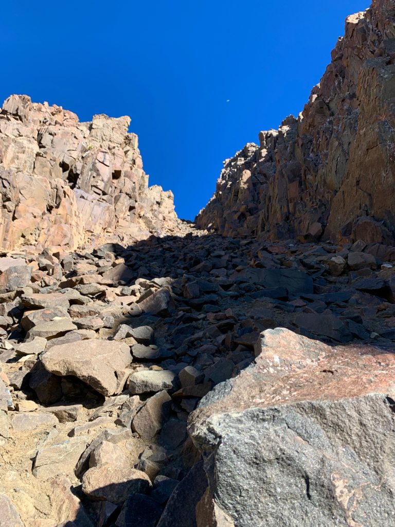
Looking back down the gully to the Kismet / Sneffels saddle and Yankee Boy Basin.
Almost to the top of the gully.
Top of the gully looking down the Snake couloir on Sneffels’ steep northwest face. People (not me) ski this thing in the winter.
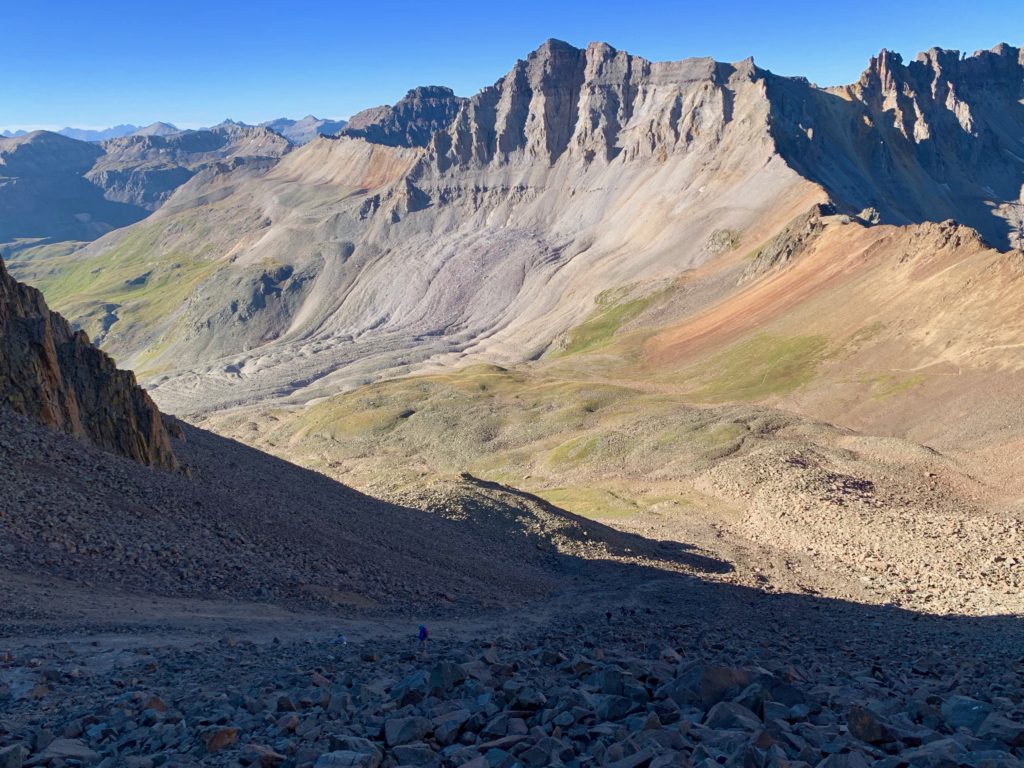
Yankee Boy from the top of the gully.
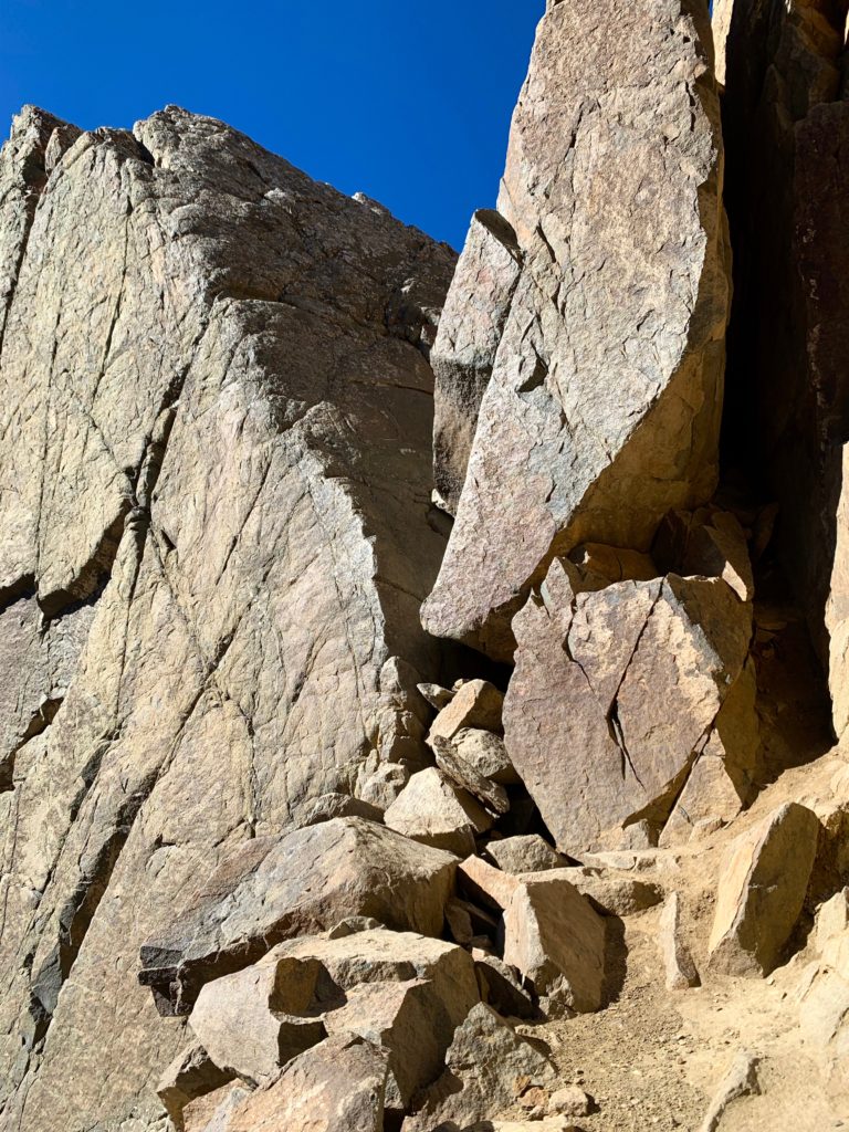
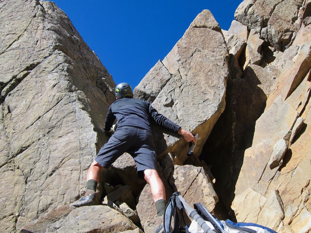
The next problem to solve, the famous V-notch.
A closer look.
Now I’m not normally afraid of heights but I’m not ashamed to say, the V-notch freaked me out. There are good solid handholds but the whole thing just feels awkward and off-balance. For one, the notch slopes down toward the exposure to your immediate left, which they never show you in pictures. Well, here you go. You fall, and it’s a 20-foot drop to sloping rock and then probably another 100 foot skid/bounce down the rocky gully you just climbed. That’s going to leave a mark, a lot of marks.
I arrived at the notch alone and spent several minutes trying to figure out the best combination of right foot, left foot, right hand, left hand moves to get me through the thing. My prior rock-climbing experience gained from indoor climbing gyms with a rope and plastic ducky and starfish handholds did not prepare me for this. Everything I tried left me feeling off-balance and extremely aware of the air below my feet. After about five attempts on my own I began to face the reality that I might not be able to summit Sneffels. I sat down dejected, contemplating my next move.
Me, surveying the notch.
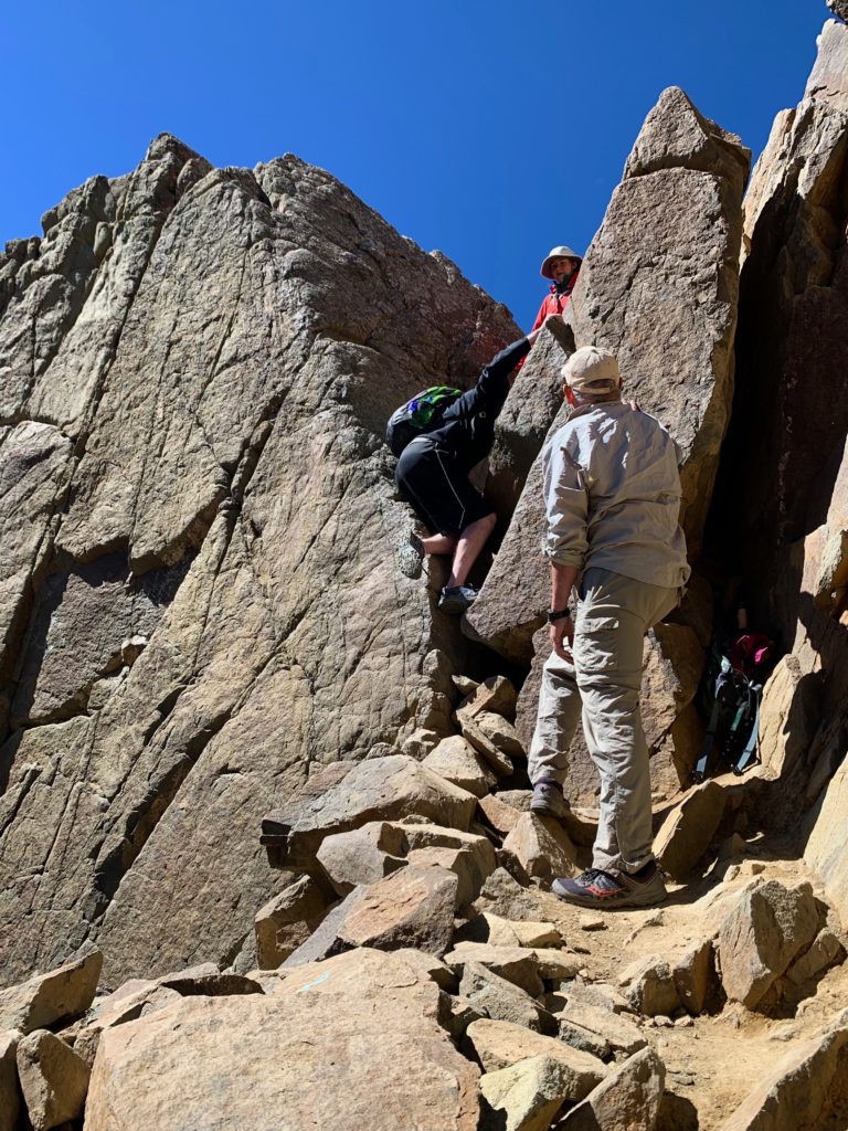
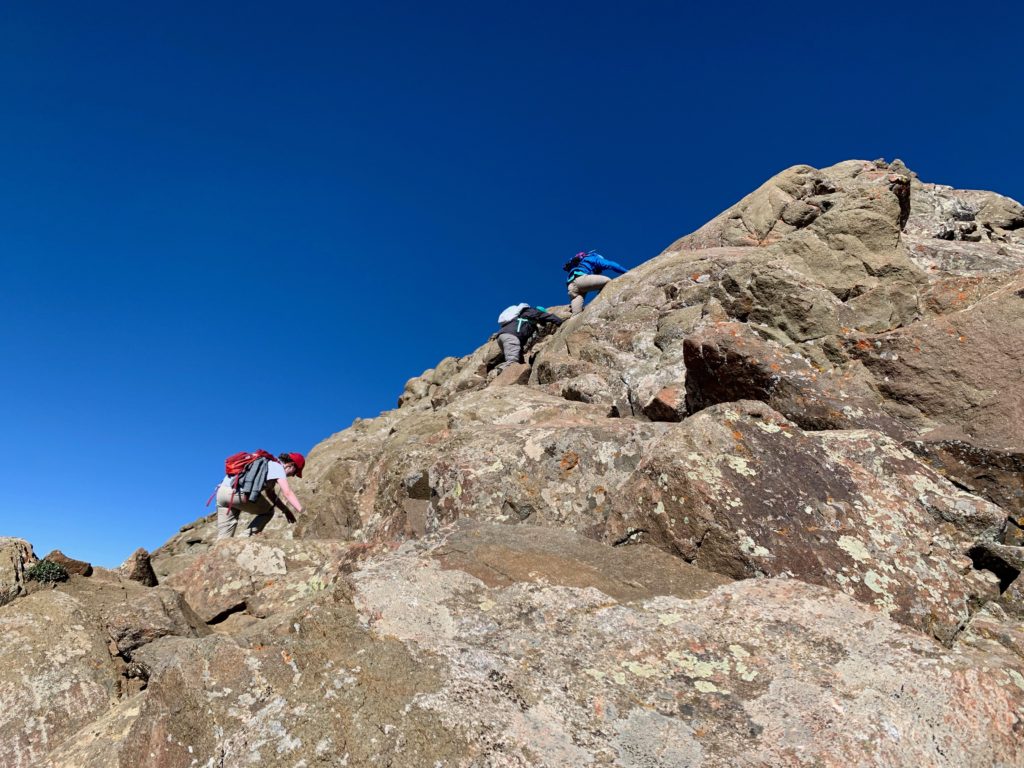
After several minutes, some of the people I had passed coming up started to arrive at the notch. First was a young guy I had met at the upper trailhead. I told him I was stuck. Would he mind going first to show me how it’s done? He said sure, and proceeded to wedge himself in the notch and then using his two arms, basically did a pull up until he was standing in the notch. Ok, cool. Let me try that.
Unfortunately, my massively ripped cyclist upper body is only good for holding on to handle bars. There was no way I could do that move. He offered to give me a hand up from above but I declined because I knew if I couldn’t get up it myself there was no way I would be able to get back down. I thanked him and wished him luck to the summit.
A few minutes later, others started to arrive and I watched in humiliation as every single one, young and old, short and tall stepped, pulled, lifted and wedged themselves through the V-notch.
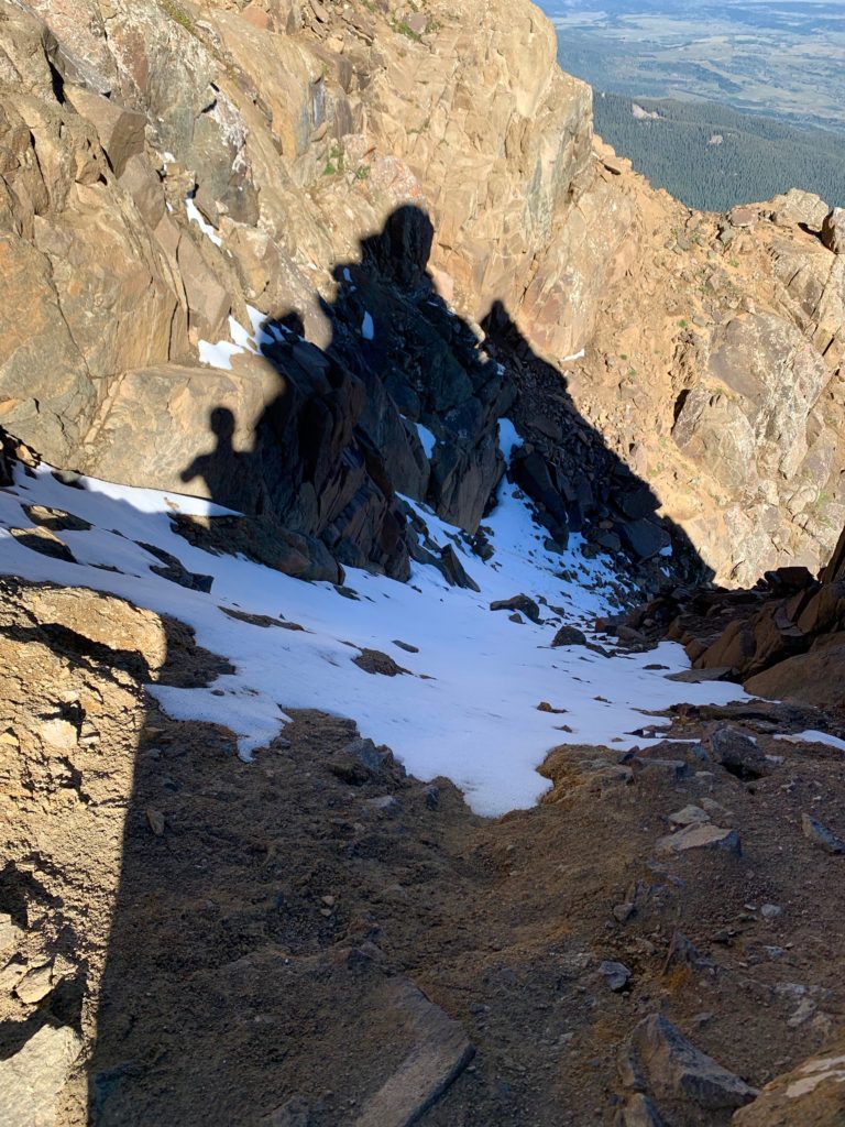
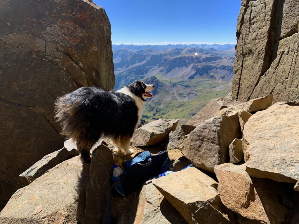
Tex, part dog part mountain goat, watching his owners climb the notch. Thank dog Tex did not climb it. That would have been too much for me to handle.
Finally, one couple came along and I told them my problem. They were sympathetic. The guy said he was kind of afraid of heights but had been in similar situations so said he’d give it a go. He showed me the move that worked for me. Basically, step into the notch and push your left butt cheek against the left rock to stabilize yourself, grab the upper hold with your right hand, pull up, and step up with your other foot. It worked! With my butt pressed against the rock, the feeling of falling went away and I was able work myself the rest of the way up. The famous butt cheek stem and pull, invented by Sir Edmond Hillary, if I’m not mistaken.
So, dude with the beard wearing a blue wind shell, if you happen to be reading this, thank you for the pointers and helping me get to the summit of Sneffels!
View of the notch from above.
My rock-climbing coach leading the way up the last pitch to the summit.
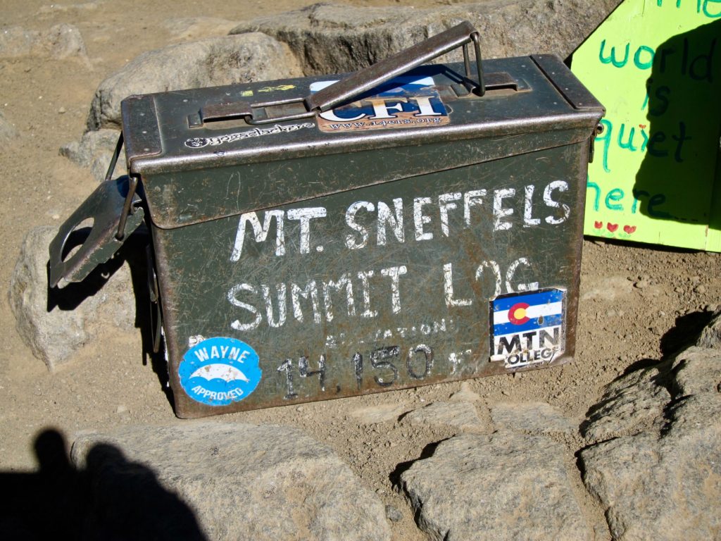
Some 14ers have summit logs, most of the ones we’ve done so far have not. Sneffels has a collection of logs kept in an old ammo case. I don’t know who toted this thing up there or how long it’s been there but it’s very cool. I spent a few minutes reading the names and entering my own in the log.
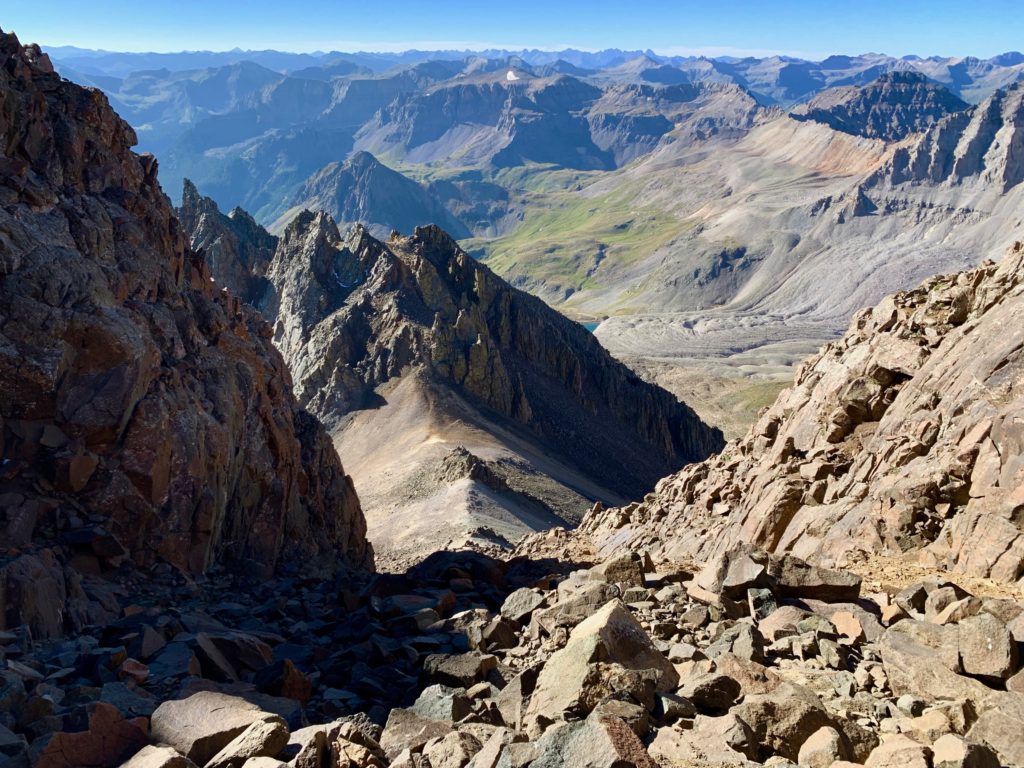
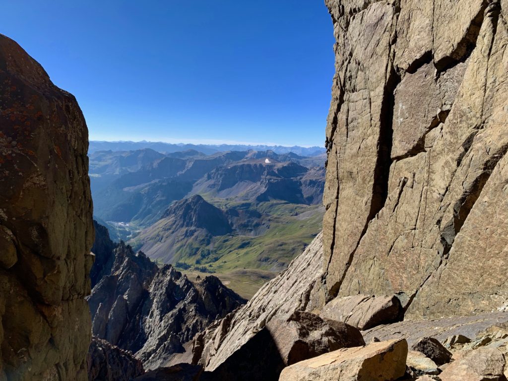
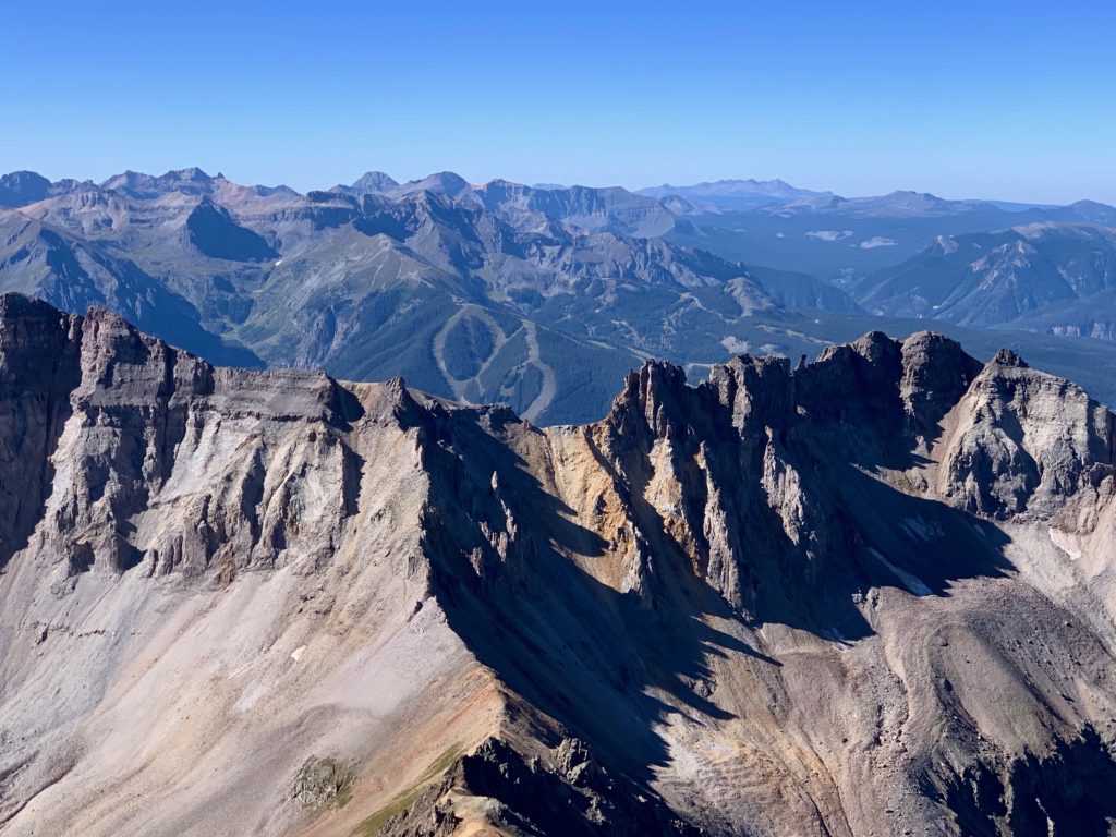
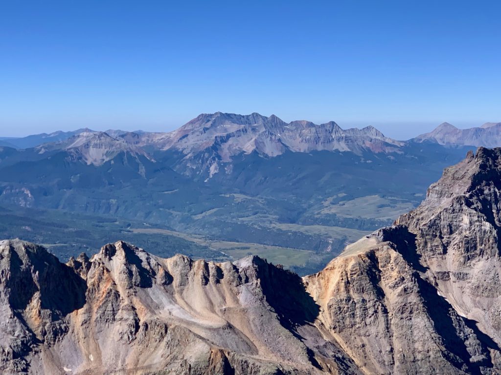
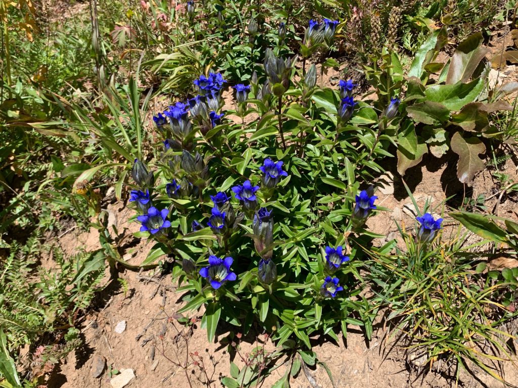
I love summit views and Sneffels has some of the best in Colorado. The San Juans are an amazing place.
Telluride ski area over the ridge to the south.
Coors mountain, the Wilson group.
Dallas Peak
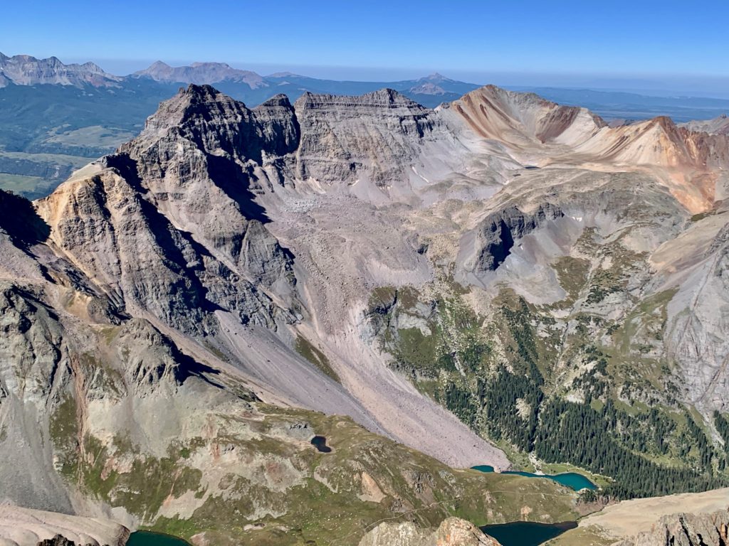
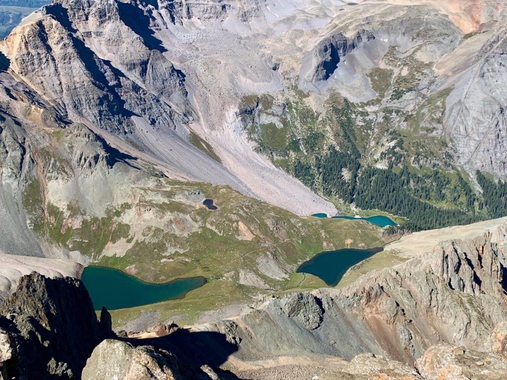
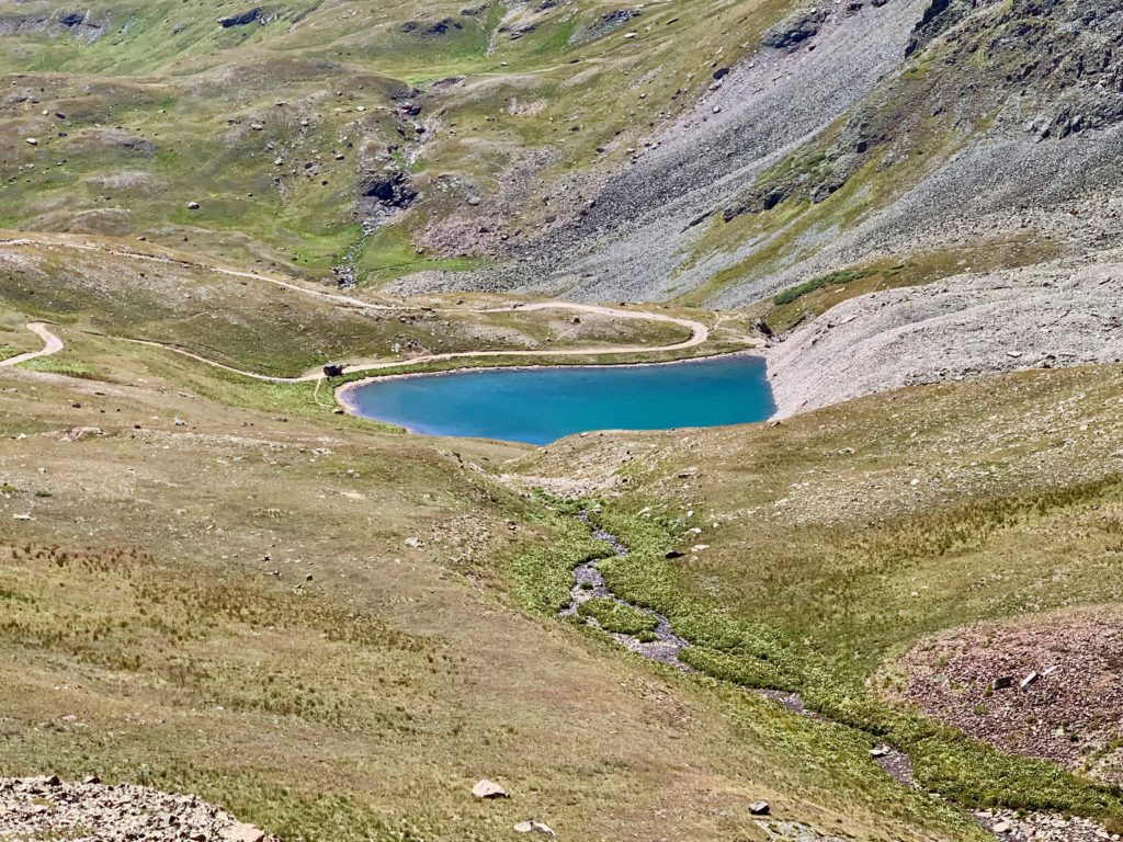
The Blue Lakes
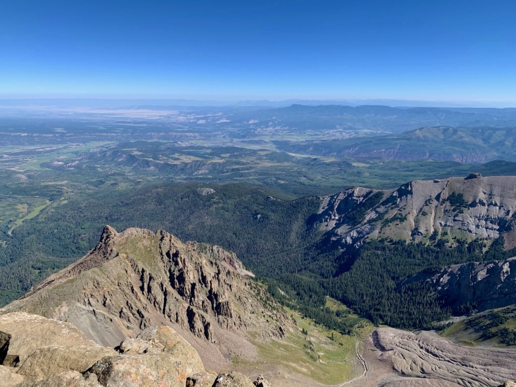
Huge valley and the town of Ridgeway to the north.
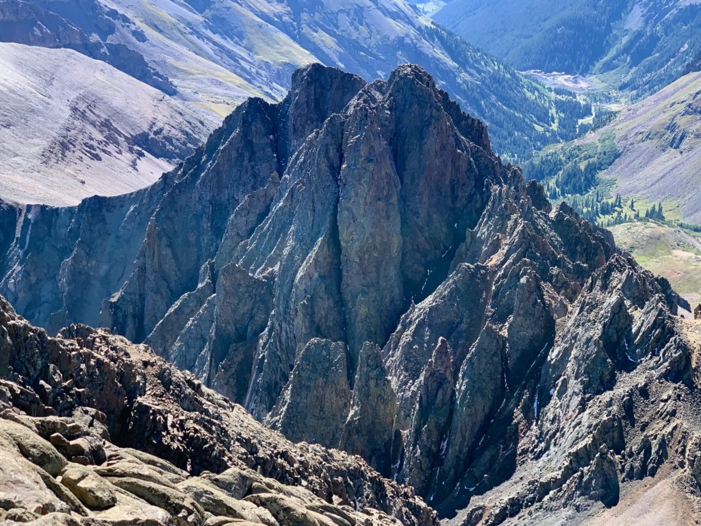
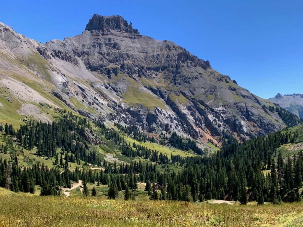
Teakettle Mountain (center) and Potosi Peak (right).
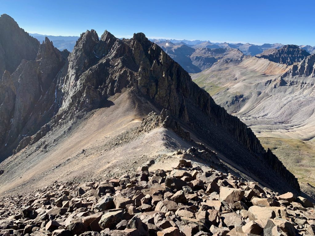
Kismet Peak
It was a sunny, windless day on the summit. There was a fun group of people up there including one young girl who, with the climb of Sneffels, had just completed all 58 Colorado 14ers. We all gave her a round of applause. Lunches were eaten and then it was time to head back down. Several of us (especially me, I think) were concerned about the downclimb through the V-notch. But it turns out once you know the move to get up, going down isn’t that bad.
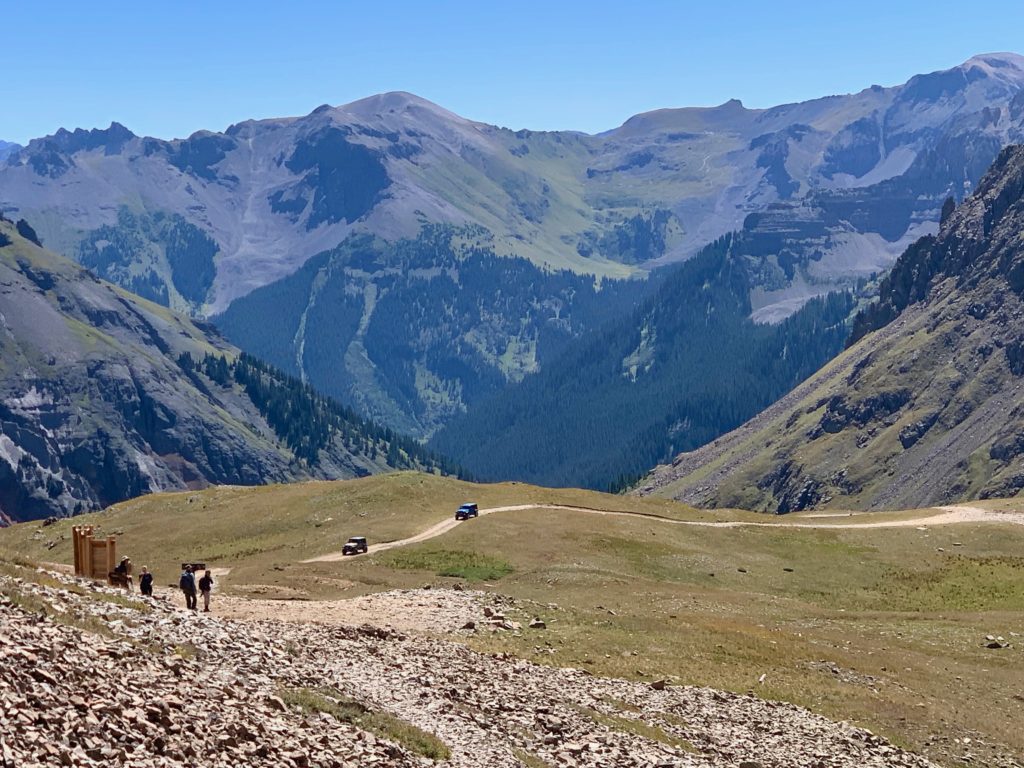
Yankee Boy basin was even more eye popping in the midday sun. As I arrived back at the upper trailhead the Jeep guys were just working their way up the road. You could hear them grinding up the basin in low gear.
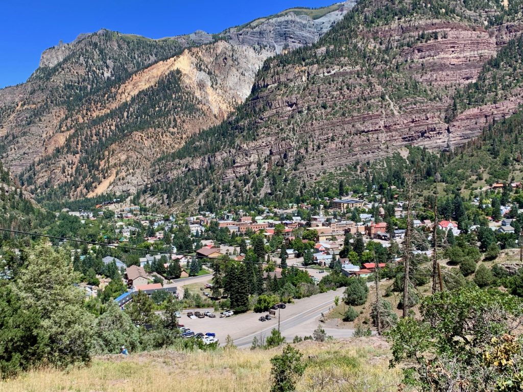
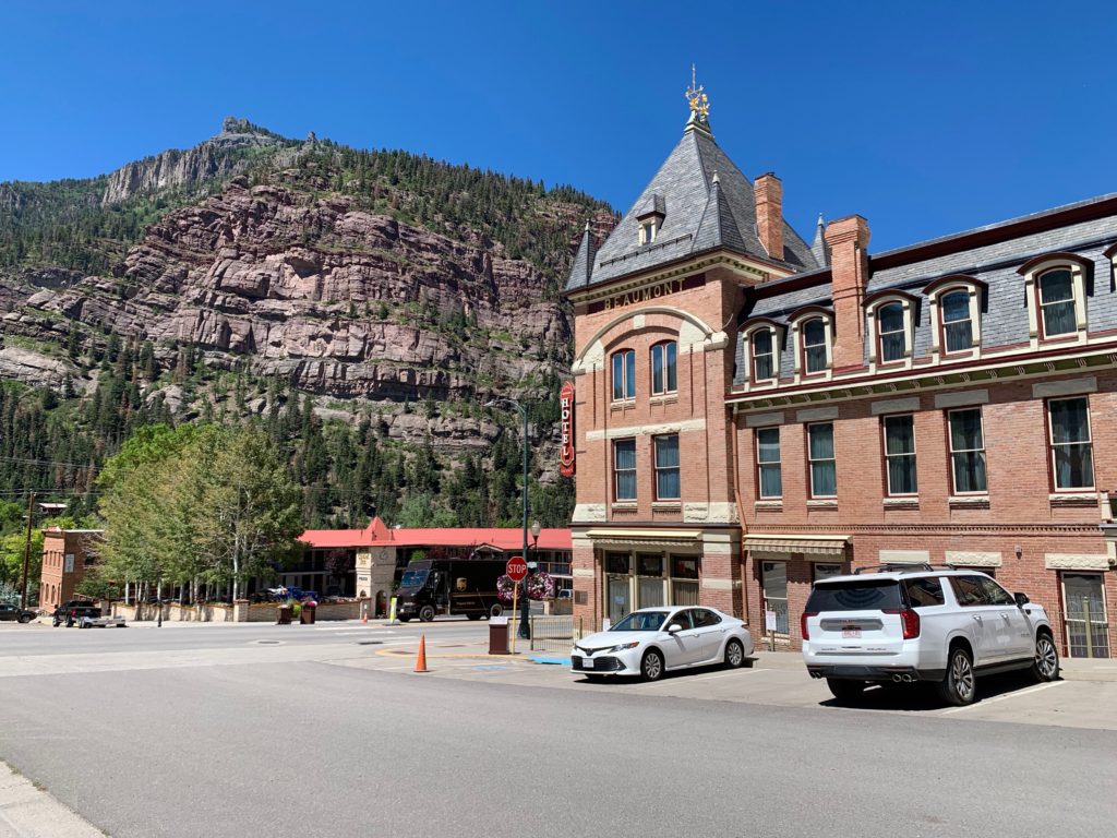
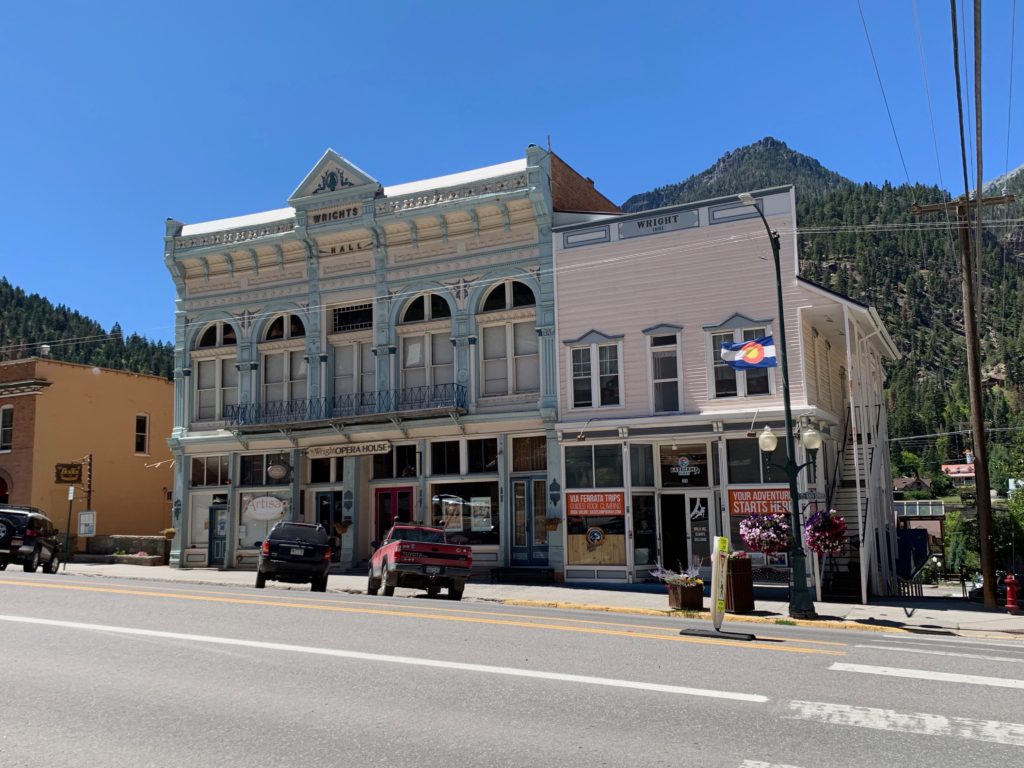
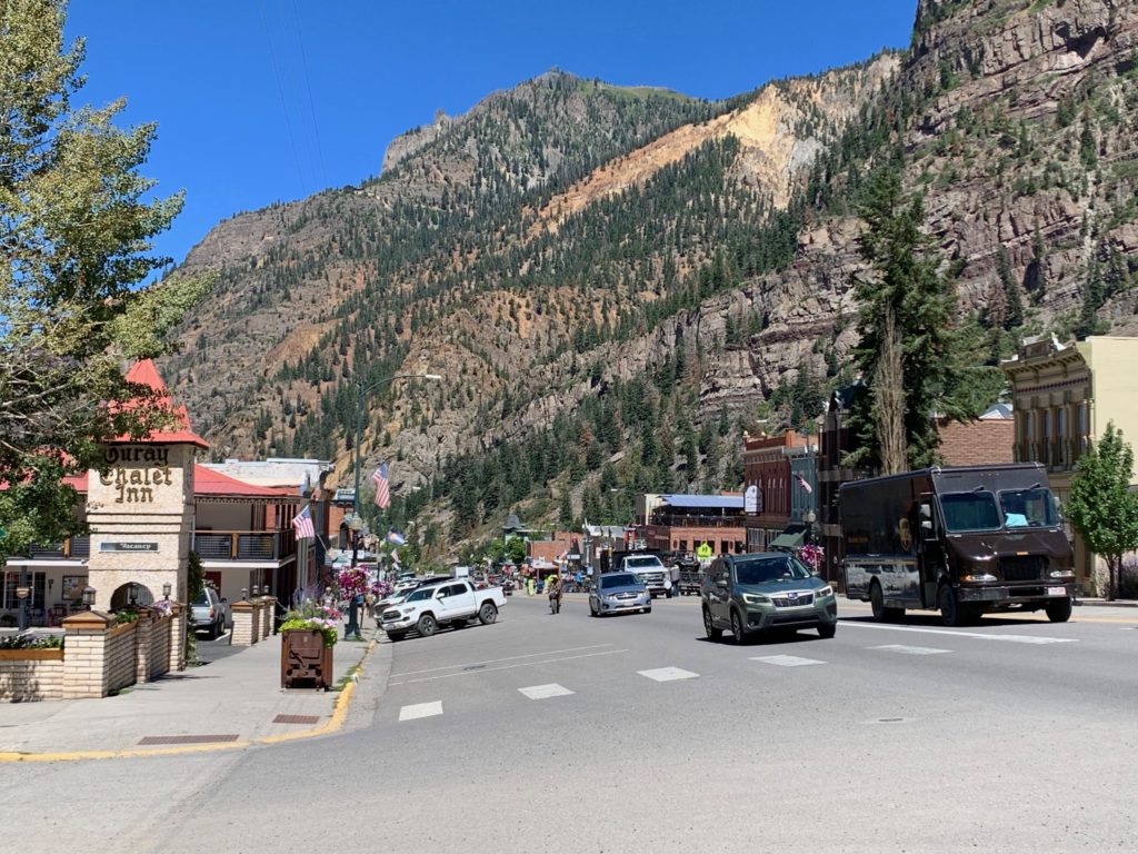
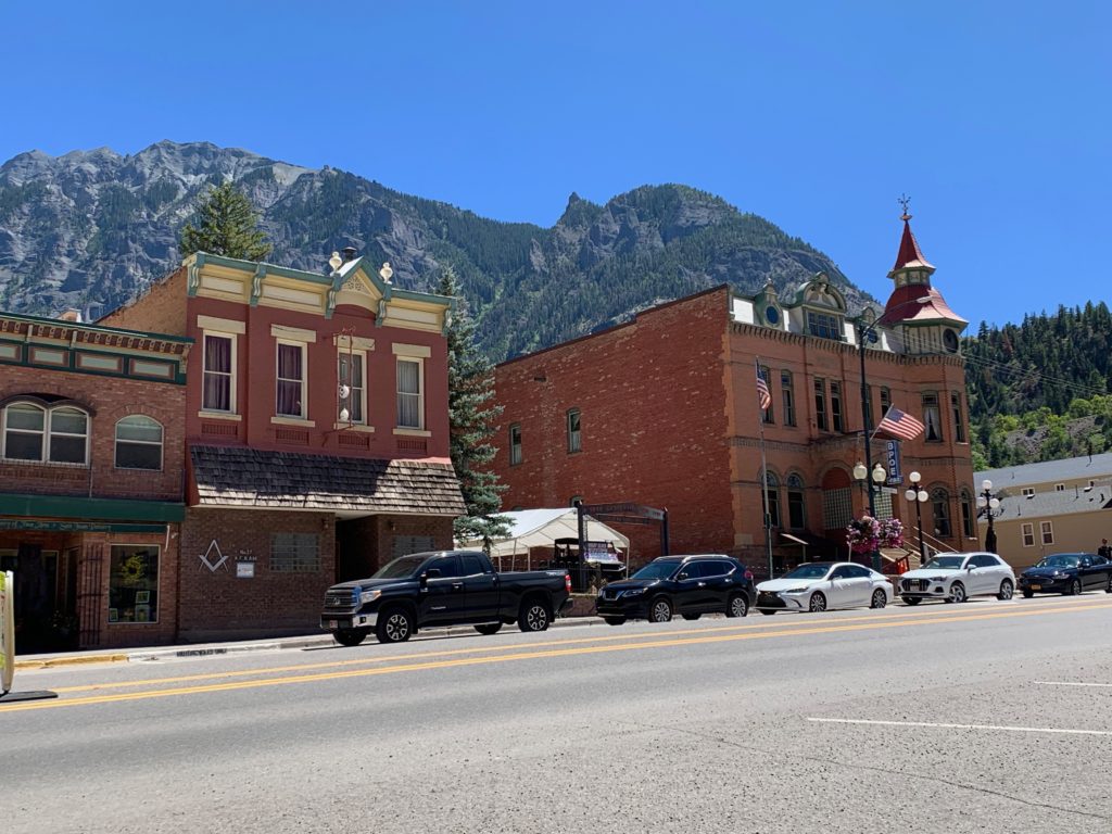
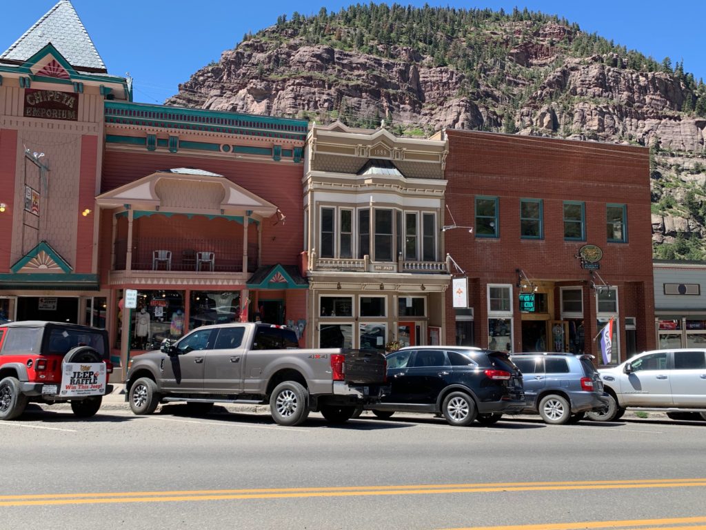
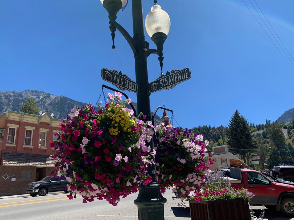
I got back to the car around 12:30 then headed down to Ouray for a little sight seeing. With its quaint, historical architecture, surrounded on three sides with cliffs and waterfalls, Ouray reminds me of some of the villages I’ve seen in Switzerland.
It was a great trip and a challenging climb. The V-notch was definitely a learning experience that stretched what I thought I was capable of. And it was amazing to be back in the San Juans and actually climbing one of those mountains that I used to see from a distance as a kid.