I don’t consider myself a particularly obsessive person but if I’m interested in something I do have a tendency to lock onto it like a dog on a bone. From the very first 14er we climbed years ago I’ve found a definite attraction to their challenges. And now that we’ve climbed several of them, I find my interest has only grown. I don’t know if I’ll ever climb them all. Due to their difficulty or remoteness, there are several that are probably out of my reach at this point in life. I’m not 20 years old anymore. But for the time being I’m really interested in pushing myself to climb as many as I can.
The problem is, 14ers are, uh, big. It takes time to climb them. And for me it takes time to recover from climbing them. For this reason, among those who climb there’s an attraction to places where multiple peaks that can be knocked off in a single trip. There are many 14ers that, due to their proximity with each other, tend to be climbed in pairs. There are a few that, if you have the fitness, can be climbed as a set of three. And yeah, there are some trail running freaks of nature out there, all leg and lung, that have linked up entire ranges in a go. But there is only one place that allows a normal human being to climb four 14ers in a single outing: the Lincoln group, above the town of Alma in the Mosquito range. For someone looking for the greatest high-altitude bang for the buck, this is the place.
- Mt. Democrat 14,148’
- Mt. Cameron 14,238’
- Mt. Lincoln 14,286’
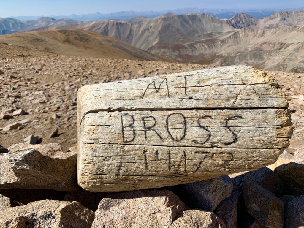
- Mt. Bross 14,172’
It’s so popular it even has a name, created by sticking the names of the four peaks together: the Decalibron. Like a decathlon, but there are only four things and they’re all mountains. I had to give it a try.
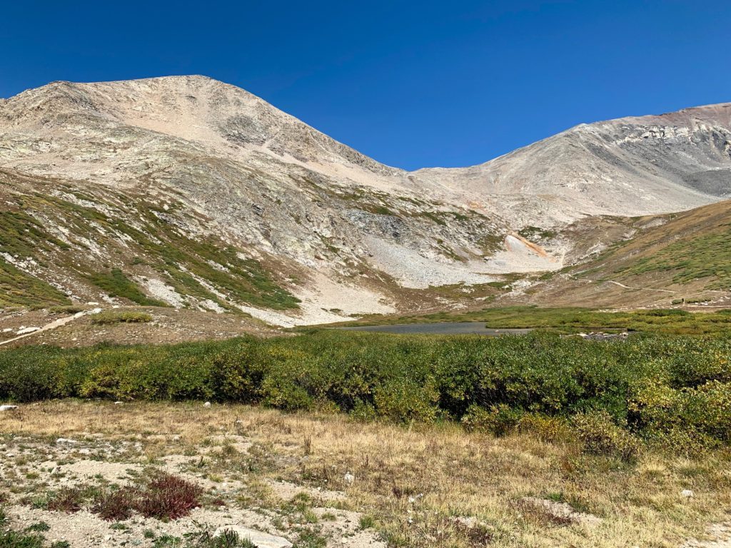
The Decalibron is possible because all four peaks are connected via ridges forming a rough semi-circle around a huge amphitheater surrounding Kite Lake. The trailhead is high, at 12,000 feet, so you start your hike at an altitude that normally takes an hour or more to reach on most climbs and you spend your whole day above timberline. Great for peak bagging but not a good place to be if the weather looks iffy.
Kite Lake trailhead.
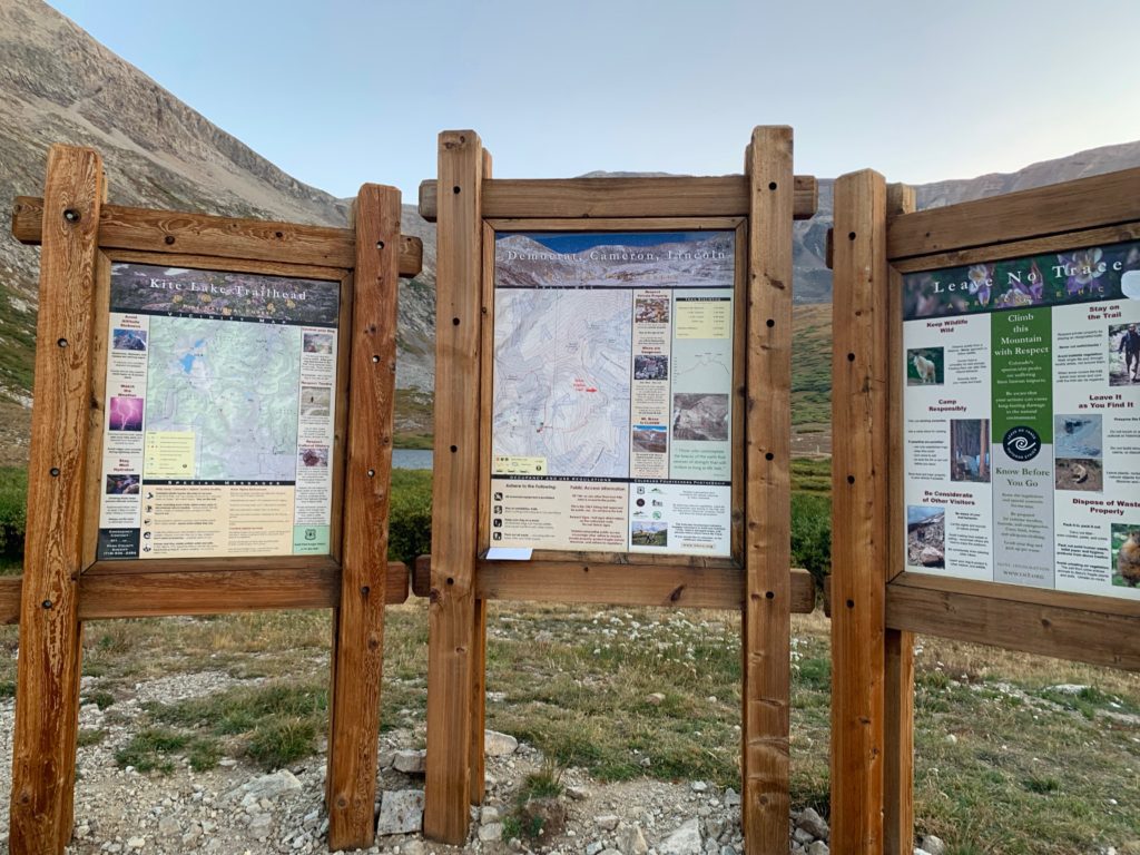
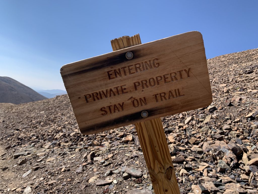
You’ll notice Mt. Bross is not listed on the sign and if you read the fine print, it says Mt. Bross is closed. There’s a long history of gold and silver mining in these mountains. In fact, the summits of all four are actually private land owned by mining companies with ownership going back to the 1800s. The whole area is riddled with partially collapsed mining prospect holes, shafts, and tunnels. As a result, there’s been an equally long history of access battles between the state, which would like to keep these mountains open to recreational use like the surrounding public lands and the landowners who, understandably, don’t want to be sued by someone who wanders off trail and falls into a collapsing mine shaft.
Back in 2006 the nearby town of Alma reached an agreement with the landowners releasing them from liability from recreational use. Trails were re-routed and warning signs were installed. All the landowners except the owners of Bross signed on. To this day, the summit of Bross is technically closed to the public. Hence, it’s absence from the sign.
Kite Lake from the trailhead with the east flank of Mt. Democrat to the left and Mt. Cameron to the right.
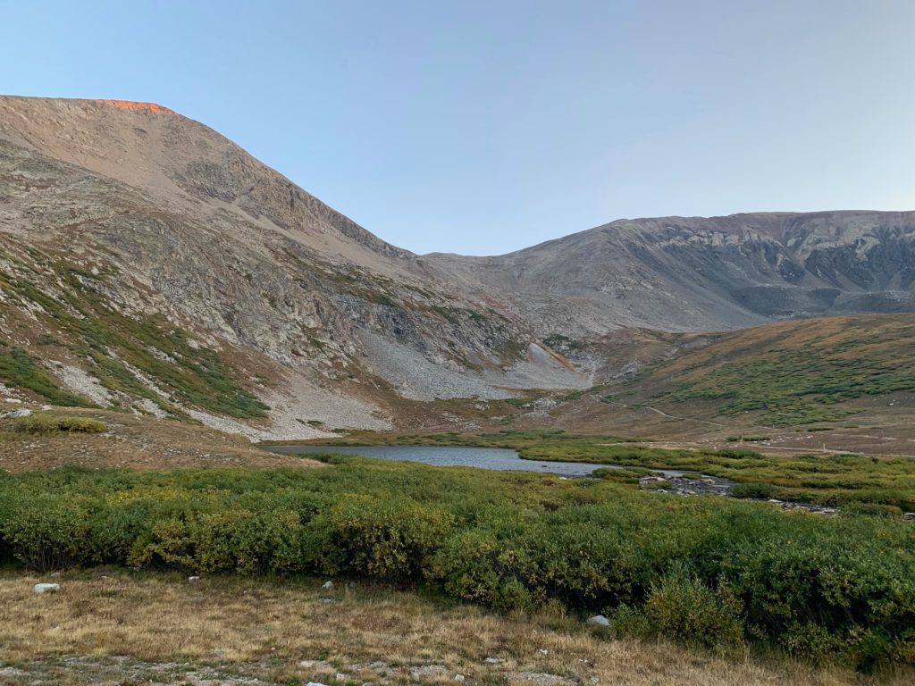
Looking back on Kite Lake from the start of the trail. There were several people camping near the lake.

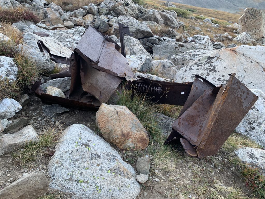
First sighting of an old mine, mining junk and the remains of a mining cabin.
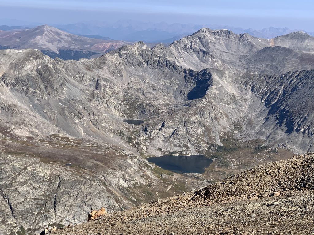
Kite Lake from higher up. From here you can see it’s actually shaped like an old-school kite. Coincidence?

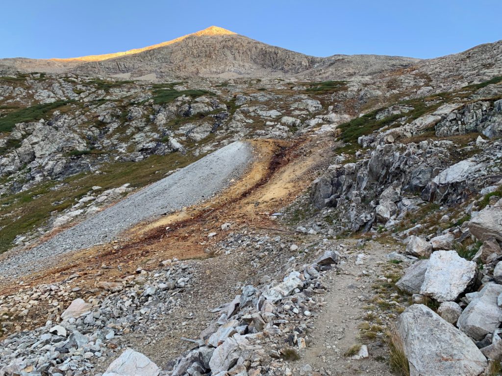
The Mt. Democrat trail higher up.
Approaching Democrat’s east ridge and the early morning sunshine.
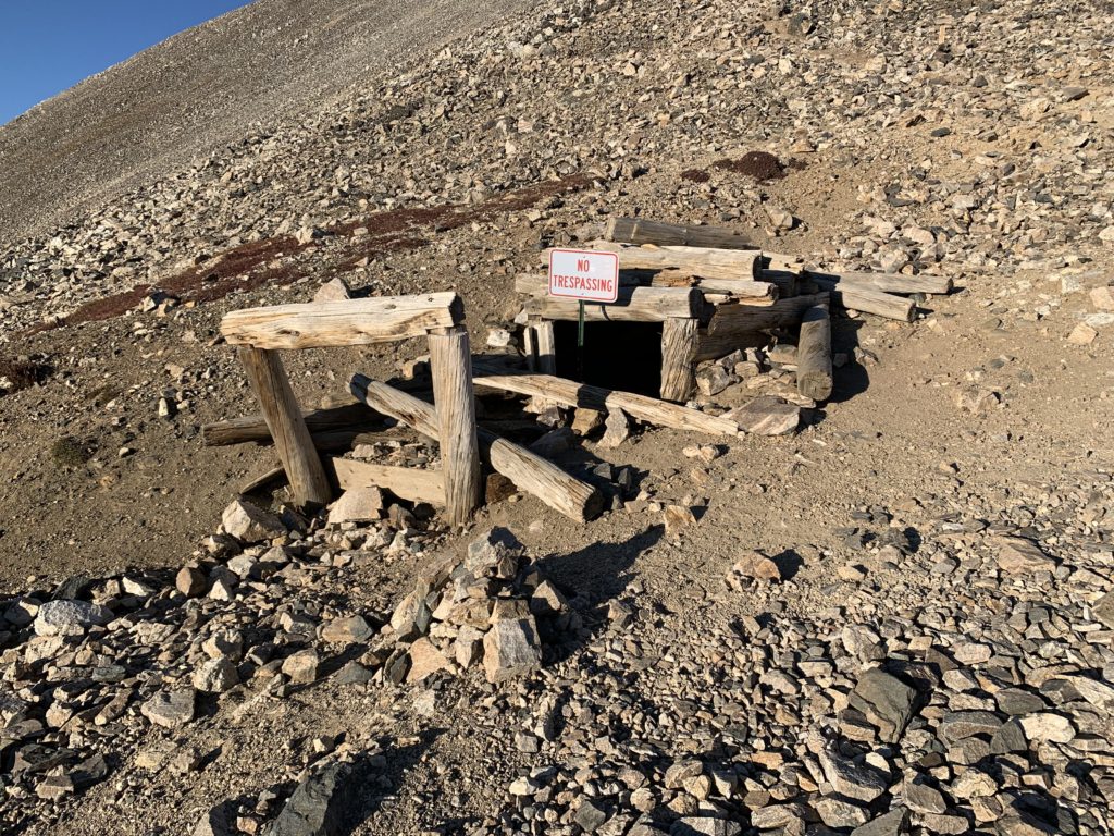
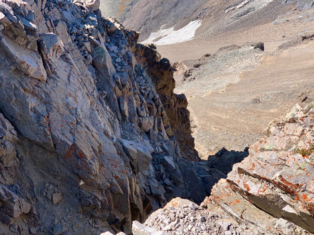
Abandoned mine shaft.
Democrat’s east ridge. False summit in the center, actual summit to the right.
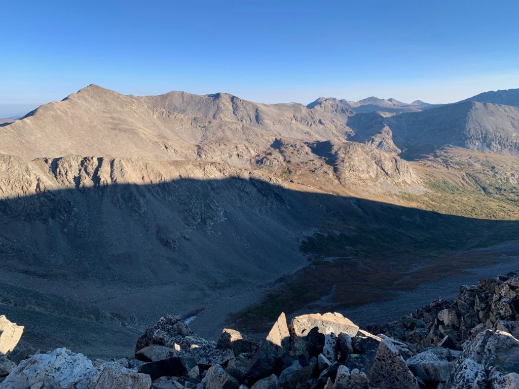
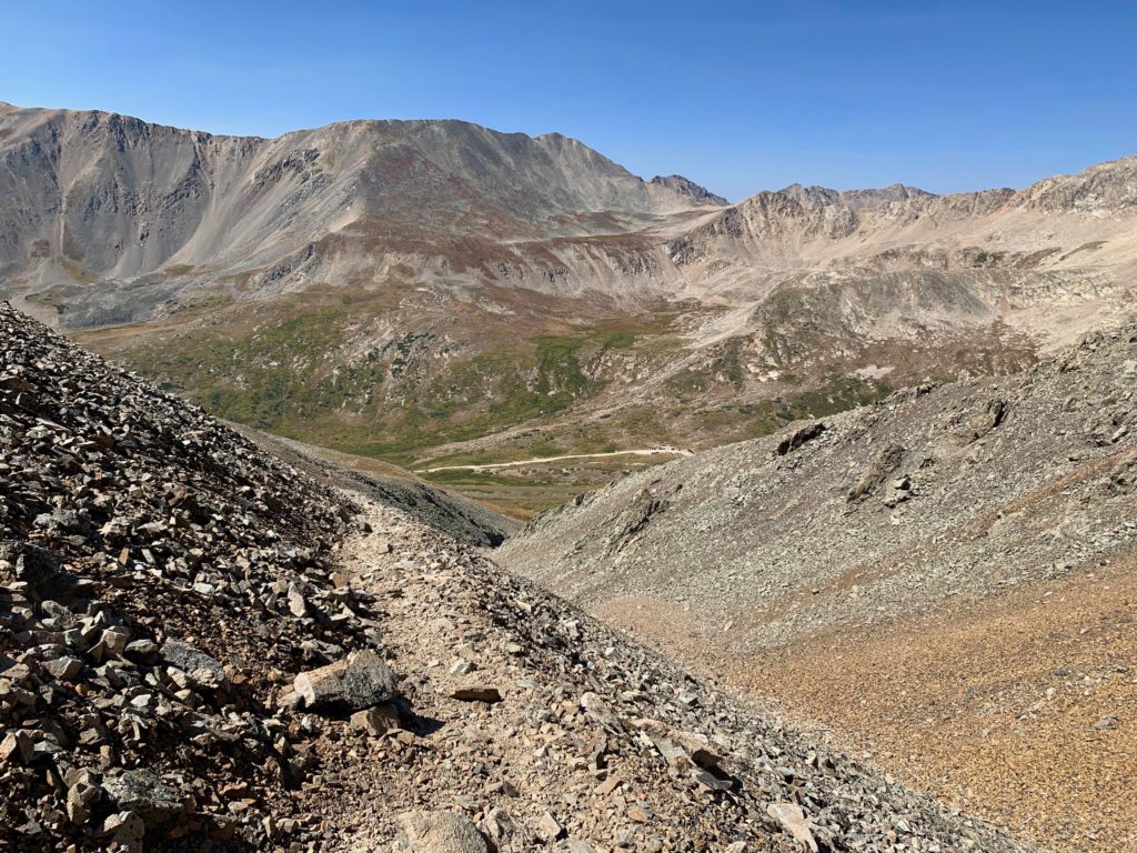
Looking north from Democrat’s east ridge into the next basin and the rest of the Mosquito Range.
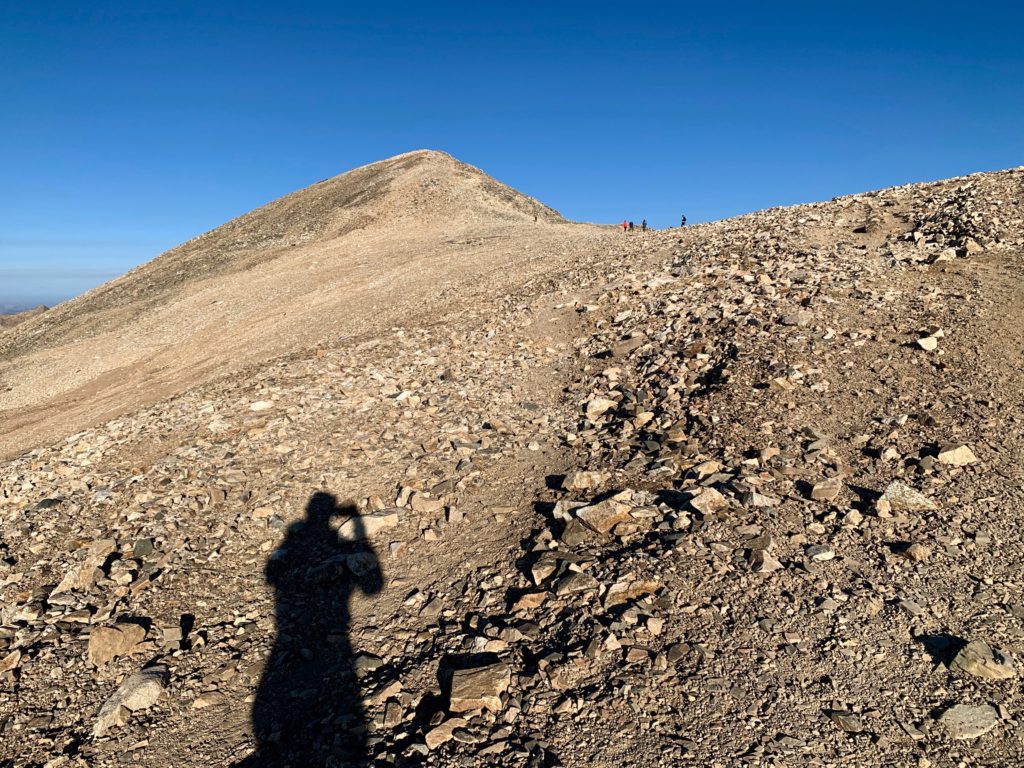
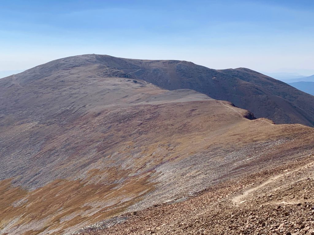
Past the false summit looking at the summit and some of my fellow climbers. Due to their proximity to Breckenridge and their mellow nature, these peaks are a very popular climbing destination.
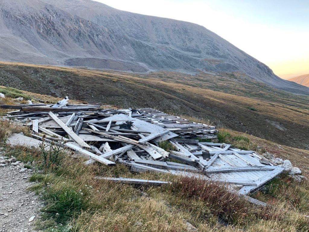
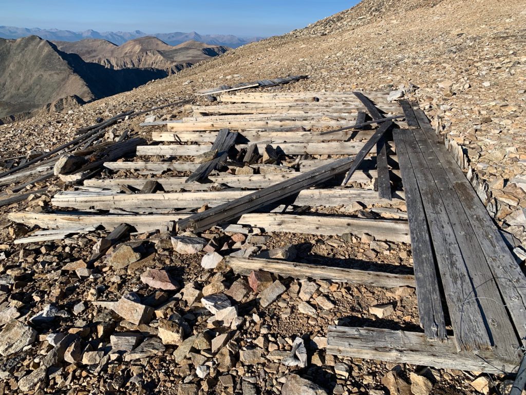
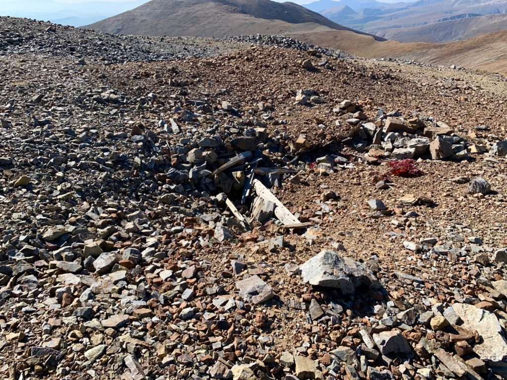
Remains of an old mining cabin at 14,000 ft. So many questions. How’d they get the lumber up here? Did they live here year-round? How did they decide who went to the store for food? How many got hit by lightning?
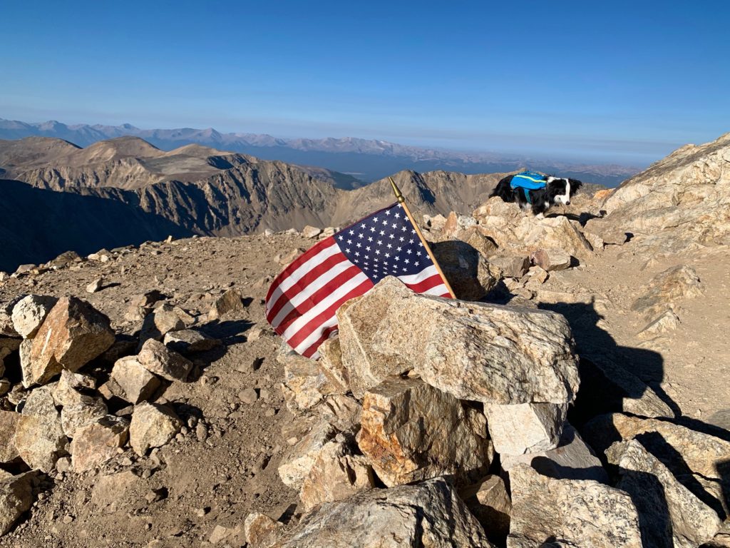
Democrat’s summit. The little border collie belonged to two guys from Fort Collins that were on the summit when I arrived. We spent most of the rest of the day leap-frogging each other around the Decalibron loop.
The view south to South Park.

Mt. Arkansas and the headwaters of the Arkansas river to the west.
An actual working mine, the Climax molybdenum mine, to the northwest.

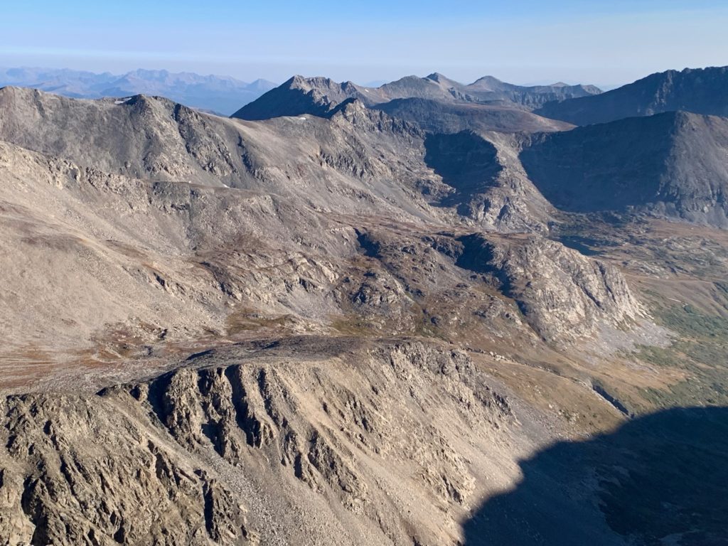
The rest of the Mosquito range to the north.
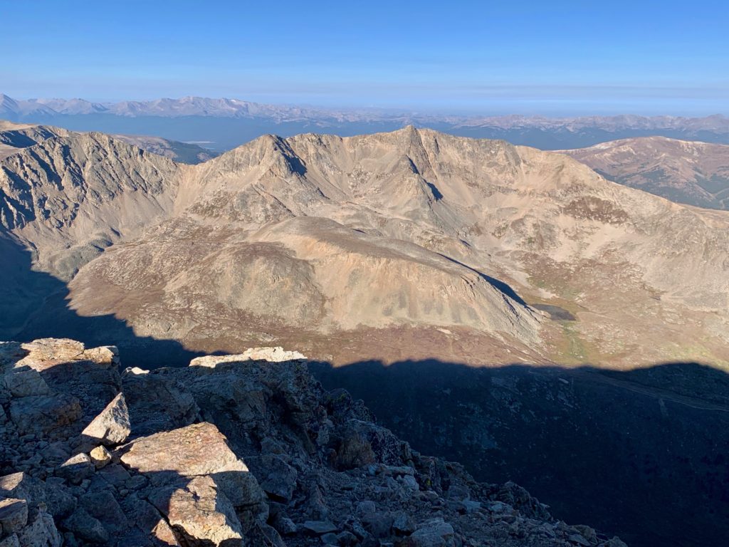
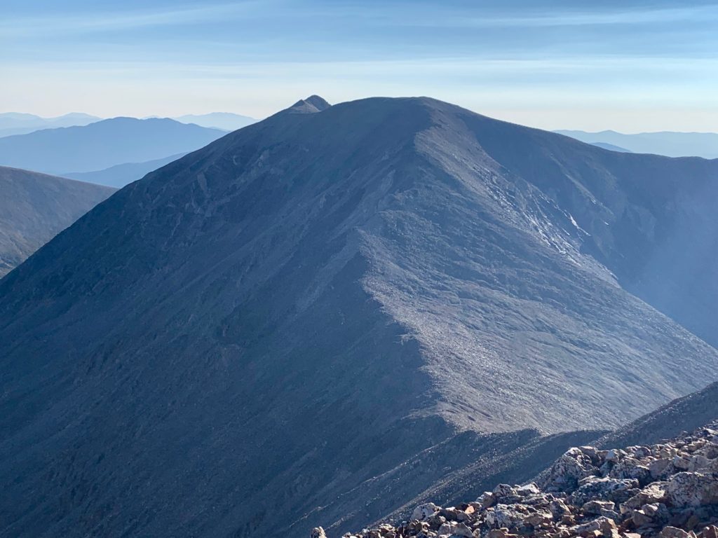
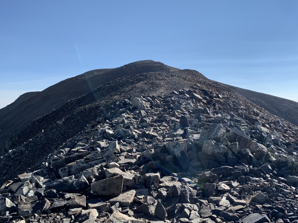
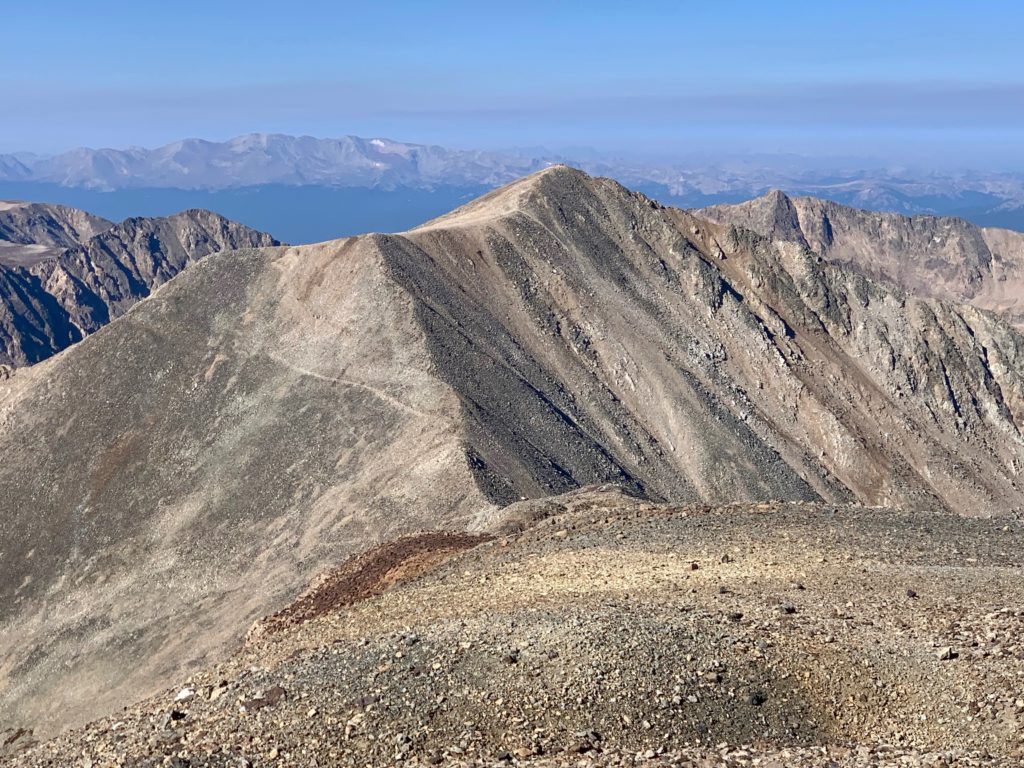
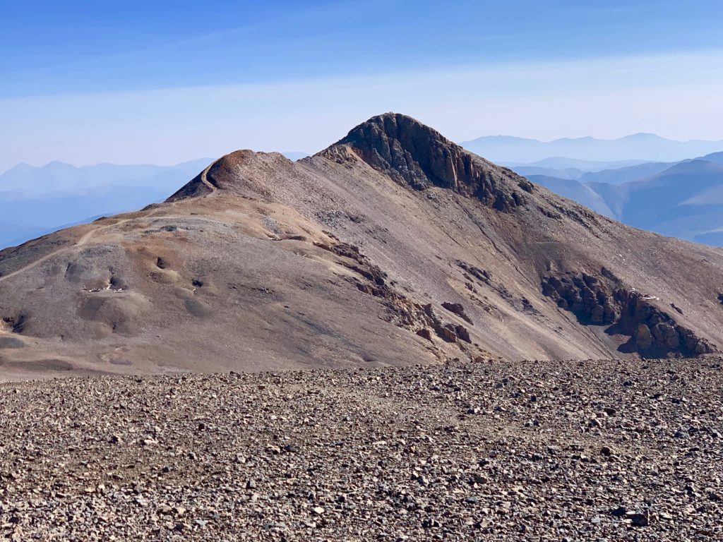
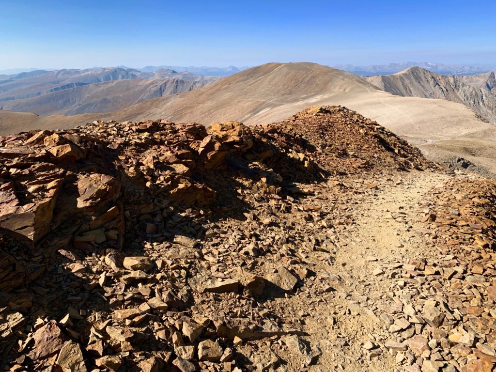
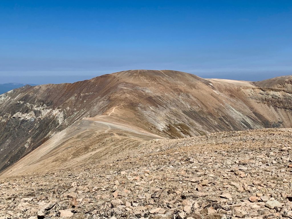
To the east, the next two objectives for the day, Mt. Cameron, center, with Mt. Lincoln peaking over its shoulder.
Descending back down to the Democrat / Cameron saddle.
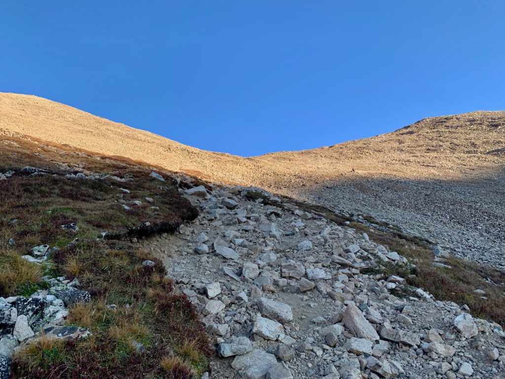
The rocky 2,000 ft. climb up Democrat was the physically hardest part of the day. Fortunately, it was at the beginning. But mentally, the most difficult part was the climb up Cameron.
Cameron is what’s known as a named, but not ranked 14er. That is, it’s over 14,000 feet and it has a unique name so it makes the commonly used list of Colorado’s 58 named 14ers but it doesn’t meet all the criteria for being on the stricter list of 53 ranked 14ers. In order to be on that list a peak has to rise at least 300 feet above its saddle from its neighboring peaks. Cameron only rises about 150 feet from its saddle with Lincoln so in my mind it was only going to be a bump in the trail. A non-event for the day’s hike. It didn’t even register as something to think about. Problem is, 150 feet is from the other side of Cameron. From this side, the Democrat side, you’re looking at a 900 ft rocky slog up a steep slope. That one hurt my psyche bone.

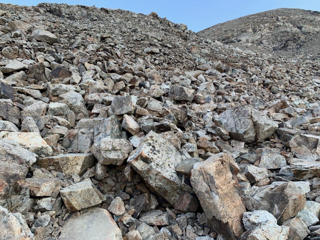
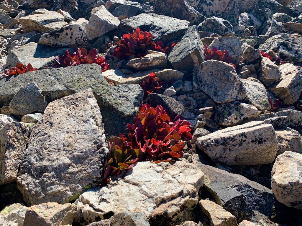
Everything from the Democrat / Cameron saddle on up was nothing but rock. There was literally nothing growing, no tundra, no flowers, no moss, with the exception of these weird little red succulents. They looked particularly striking against Cameron’s mostly black rocks.

Reaching Cameron’s west ridge with a nice view of Wheeler Peak and Wheeler Lake to the north.
The rest of Cameron’s ridge.
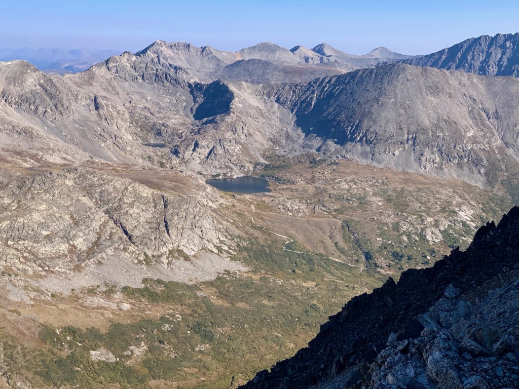
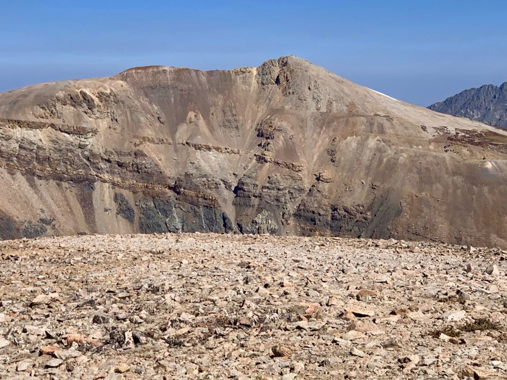
Unlike Democrat, which has a small, pointy summit, Cameron has a huge flat summit about the size of a gymnasium. And because it’s the most centrally located of the four peaks it provides the best views of all the surrounding mountains.
Wheeler and Drift peaks with Wheeler Lake to the northwest.
Looking west back to Democrat.
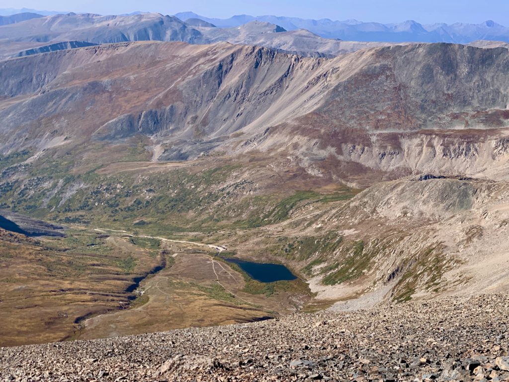
The view down to Kite Lake. Look, I can see my car! It was funny, this is the first 14er climb where I could actually see where I parked my car for most of the hike.
Mount Bross to the southeast.
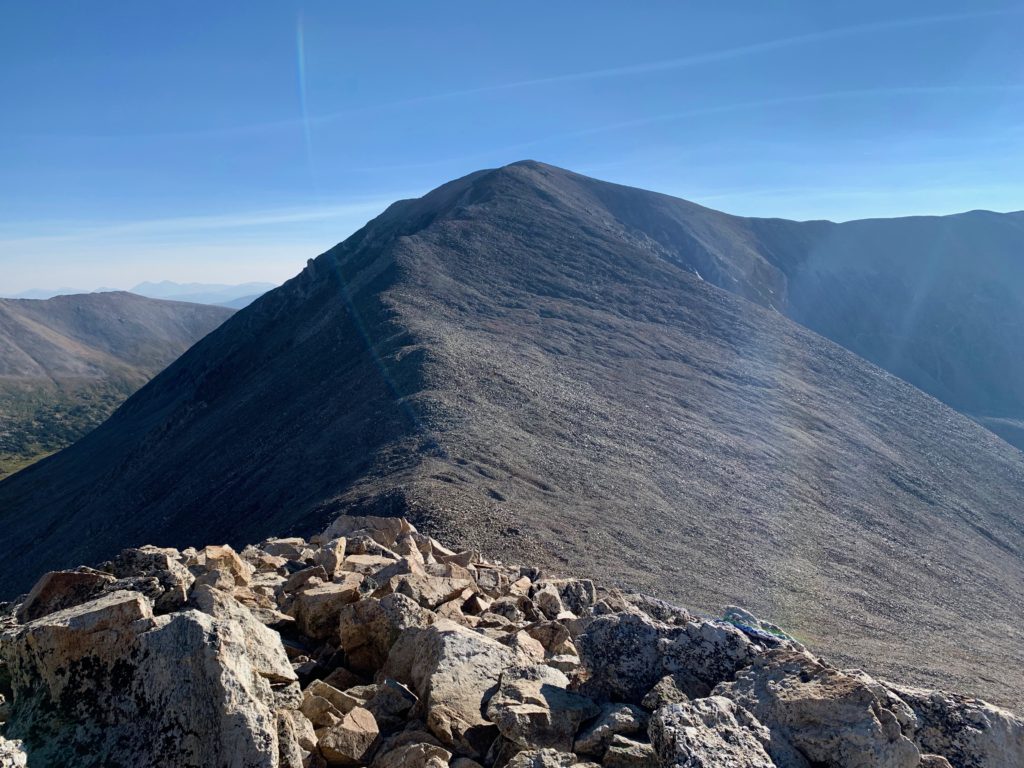
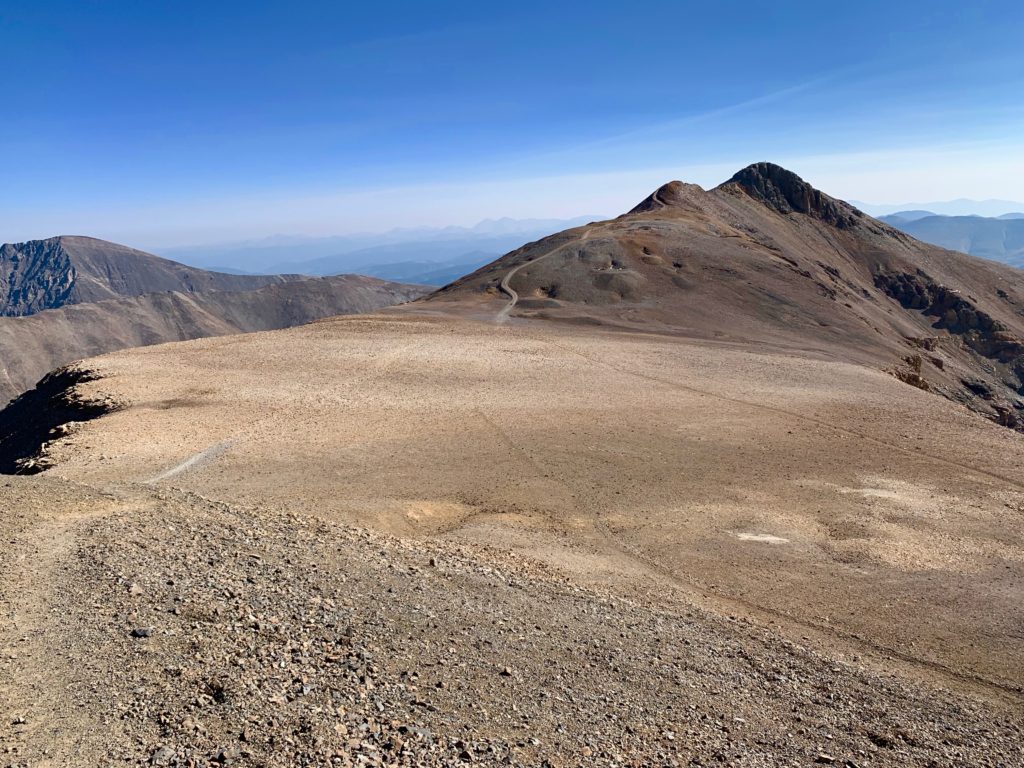
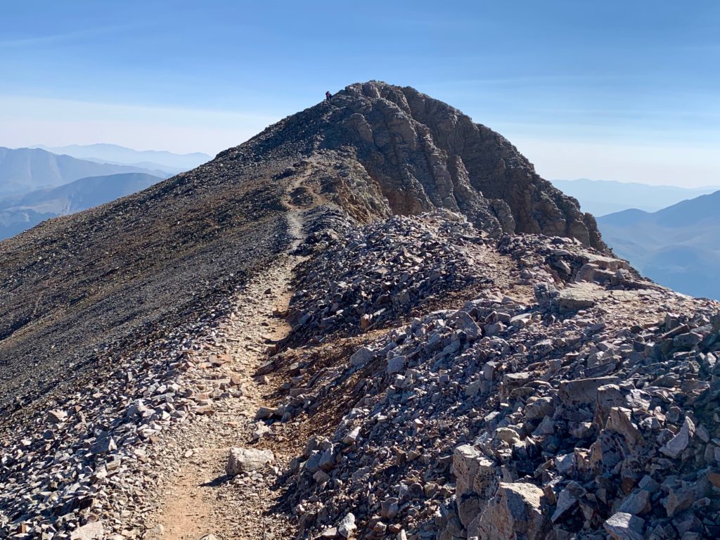
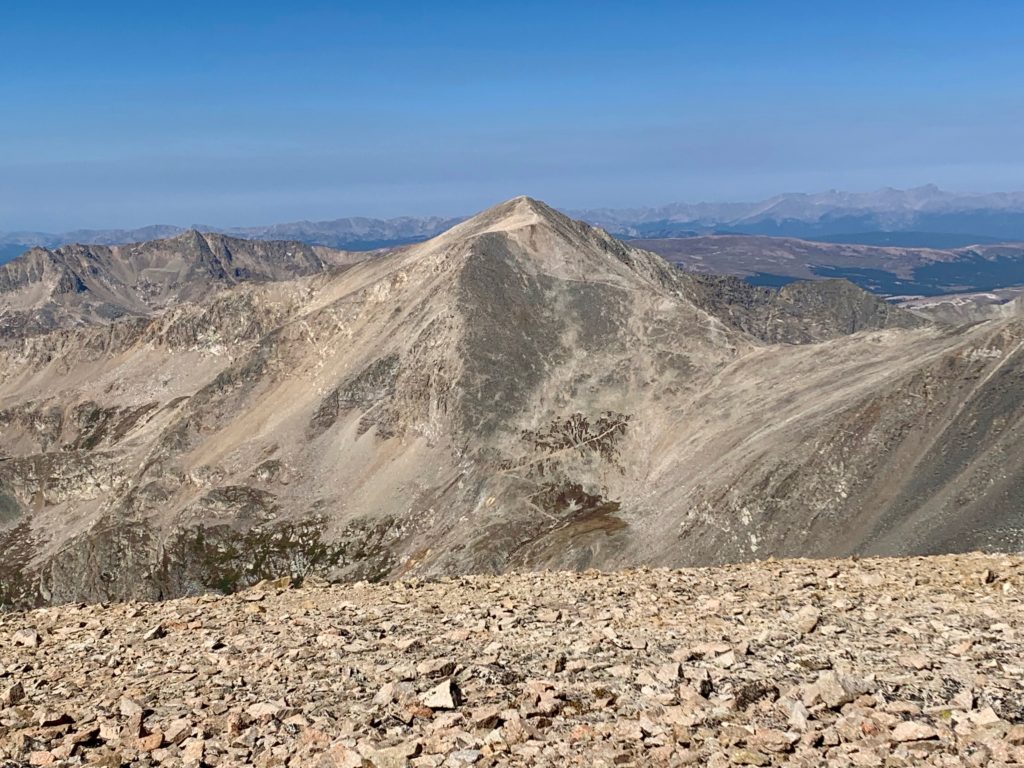
The next objective for the day and the highest of the four peaks, Mt. Lincoln.
Heading down Cameron’s east face to the flat Cameron / Lincoln saddle. There’s that inconsequential 150 ft drop.
Mt. Lincoln from the Cameron / Lincoln saddle. Notice all the mine pits on Lincoln’s lower slopes.
Closer view of one of the pits near the trail.
Rust colored rocks on Lincoln’s west ridge.
Approaching Lincoln’s summit block.
Looking down Lincoln’s steep south slope into what’s known as the Cameron amphitheater.

On Lincoln’s summit looking back to Cameron and Democrat.
There was a summit “log” and a cool old USGS marker up there.


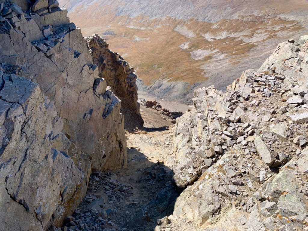
Looking down one of the chutes off Lincoln’s cliffy south face.
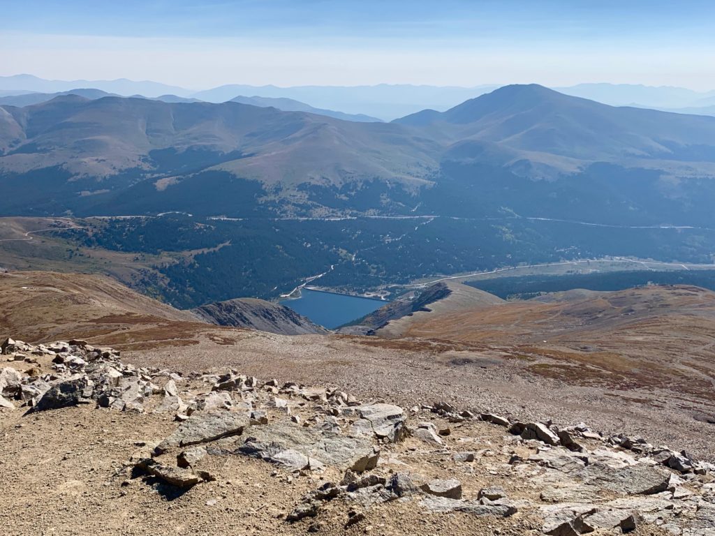
Montgomery reservoir and Hwy. 9 over Hoosier Pass to the east. Going left on Hwy. 9 takes you to Breckenridge.
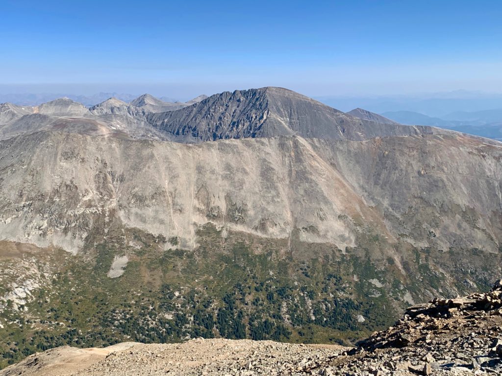
14er Quandry Peak and the Ten-Mile range to the north.
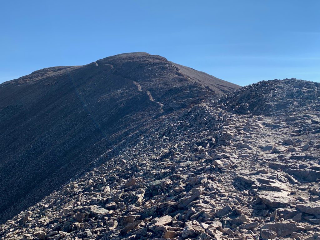
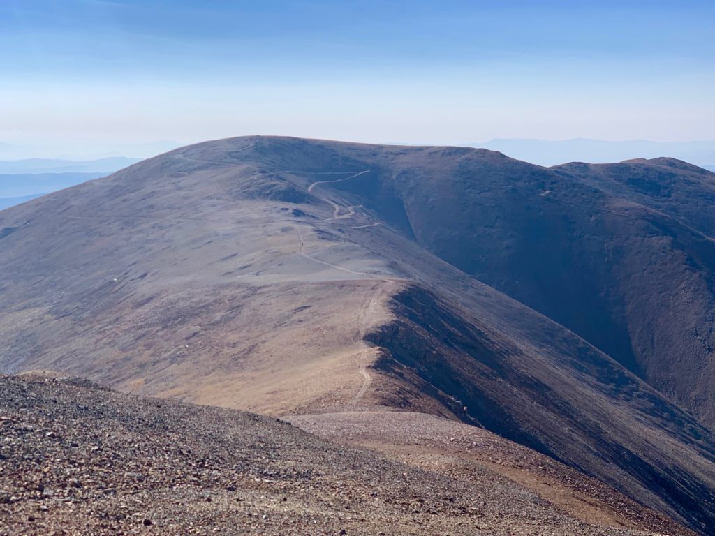
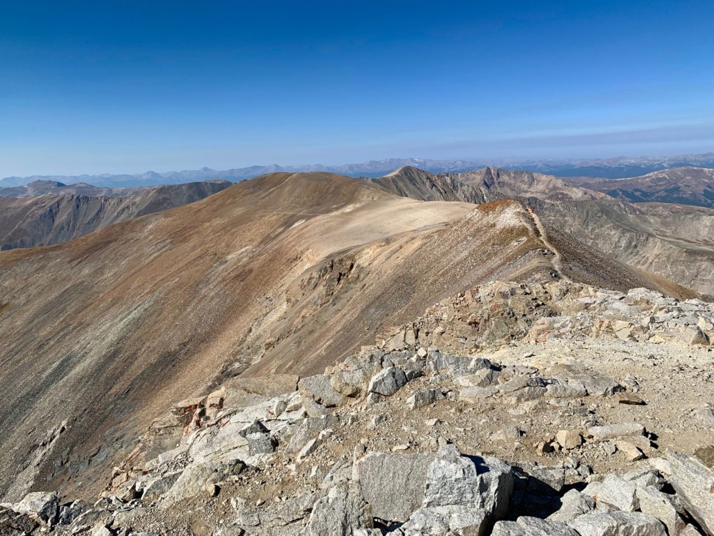
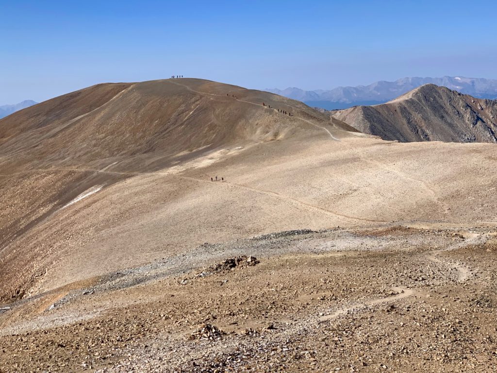
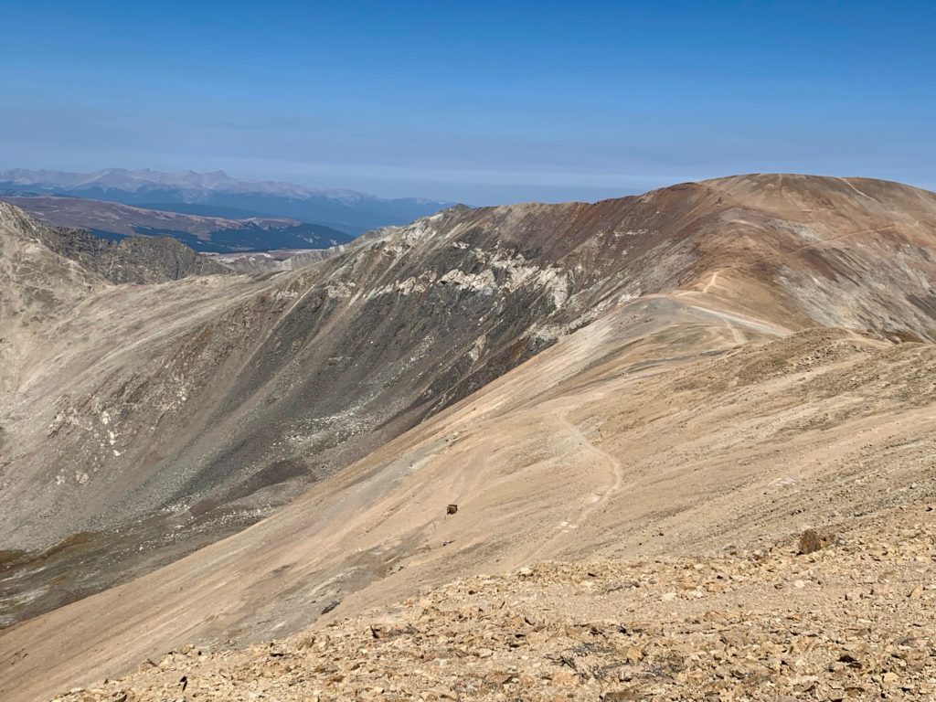
The final objective for the day, Mt. Bross.

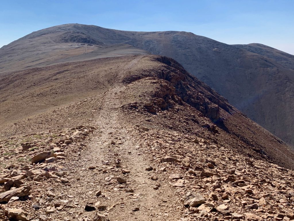
Heading back down Lincoln’s west ridge with the hoards coming over Cameron.
The trail to Bross from the Lincoln / Cameron saddle.

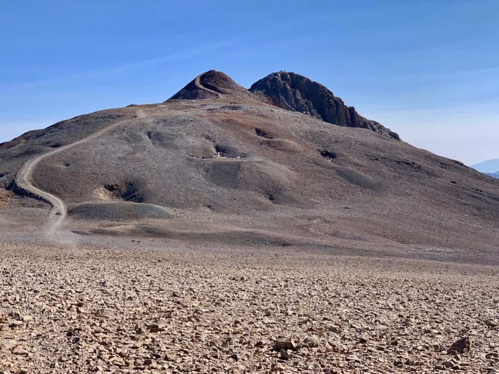
Bross from the Cameron / Bross saddle.
Looking back at Lincoln’s rugged south face.

The closer I got to Bross, the more of these signs I saw.
Approaching Bross with many more old mines on its slopes.

Coming into this hike, I debated how badly I wanted Bross, it being closed and all. I mean, it’s the top of a 14,000 ft. mountain, what are they going to do, post a guy in a lawn chair with a shotgun up there? There are no trees to mount a game camera on, so that’s out for security. I figured if there was literally no trail up there or if it looked sketchy in any way, I’d bail on that summit. On Lincoln I talked to the guys with the dog and they said they were planning to do it so that definitely nudged me in the direction of climbing it.
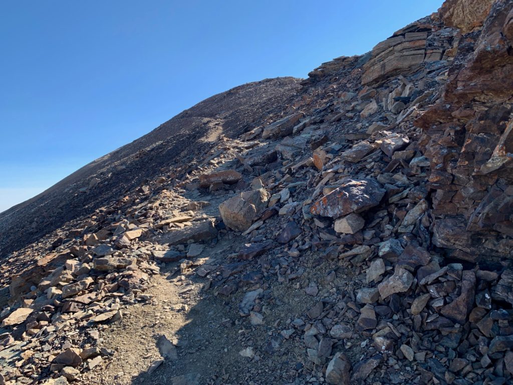
To accommodate the Bross closure, the old trail, which used to ascend the northwest face of the mountain has been closed and the Forest Service has built a bypass trail around the west side of the mountain below the private property on top, the idea being to route recreational users past the summit. But about halfway around the west face on the bypass trail, there’s another well-defined, well-traveled trail that switches back and up the west face directly to the summit. Clearly, no one is taking this closure thing seriously. So I took it.
On the summit access trail looking back at my route traveled from Cameron.
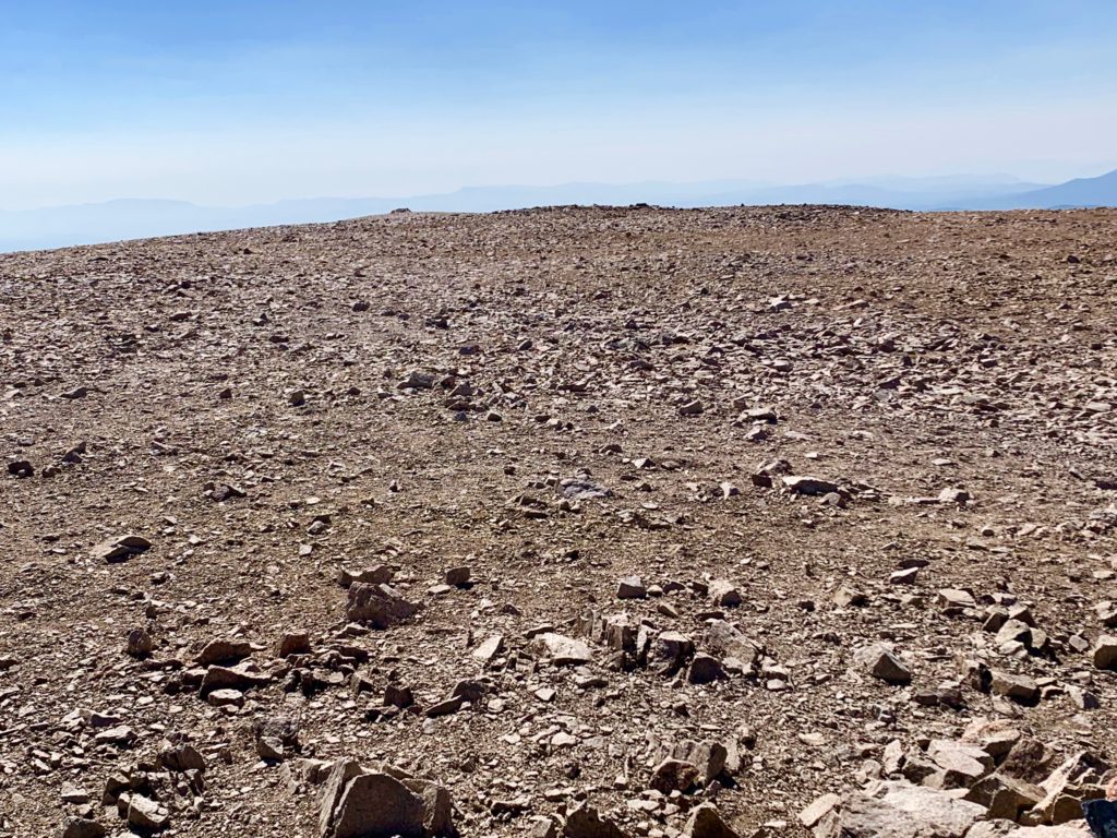
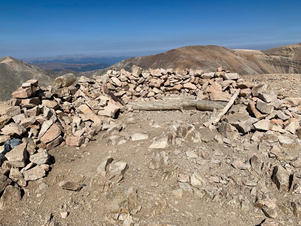
If Cameron’s summit is a gymnasium Bross’ is an aircraft carrier. And if it weren’t for the rocks, I do believe you could land a plane on it. The largest, flattest summit I’ve been on to date. At the north end someone has built a crude shelter with some logs for lounging which, due to the illegal nature of my situation, I did not partake in.
Views of the peaks already climbed from the Bross summit:
Democrat
Cameron
Lincoln
One of the cool things about doing a circuit climb is that your return route is all new, rather than just a reverse of your climb route. I found that really appealing. Starting down Bross’ west face.

Kite Lake from Bross. You can just see Lake Emma inset in the bowl above Kite Lake. It hadn’t been visible until this point and I honestly didn’t know it was there until I saw it from the slopes of Bross.

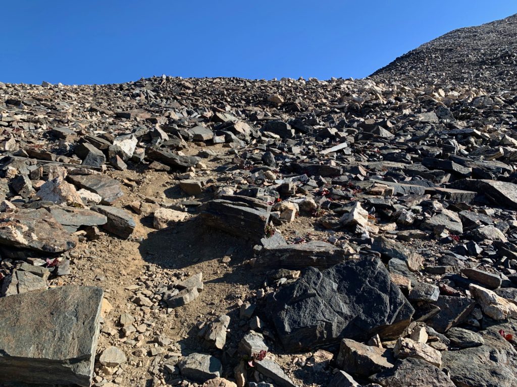
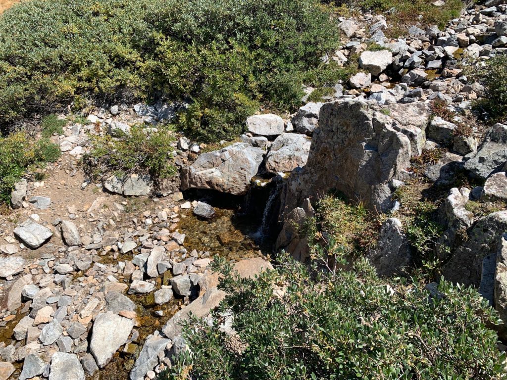
The trail was well-defined but very steep and loose in places.

Near the bottom the trail runs beside a small creek that drops off a series of waterfalls.

Back down in Kite Lake basin. In the midday sun you could see the willows were beginning to put on their fall colors.


All told, it was an 8.4 mile round trip with a total of 3,400 feet of climbing. It took me 5.5 hours which, based on the number of people I passed along the trail, felt like an above average speed. A great day in Colorado’s Mosquito range!