
Pandemic weirdness and the occasional cleaning day aside, since retiring and moving to Salida, our lives have pretty much felt like one ongoing vacation every single day. Riding, hiking, skiing, life is indeed good. But even living in God’s country, sometimes you need a change of scenery.
The great thing is, living in Colorado, we’re now that much closer to a bunch of other cool things to see and do in the western U.S. of A. Things that you can see and do without getting on a plane. We talked about where we’d like go this year and decided on Arches National Park, which neither of us had seen, and Grand Canyon National Park, which only I’d seen as a kid on trips to California with my family.
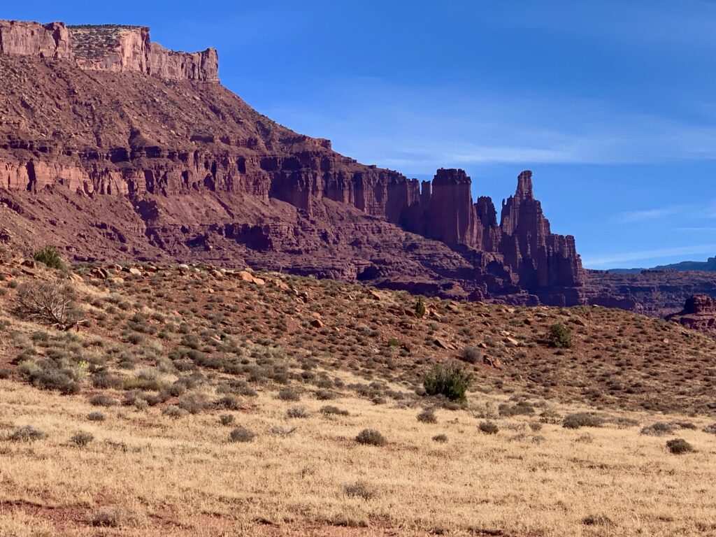
And my dad wasn’t one to spend a lot of time exploring. He was more about stop the car, take a few photos, check out the visitor center, load up the car and go. Gotta make good time. We were looking forward to spending some time at these places on our schedule. Our plan was to drive to Moab, about five hours away, spend a day at Arches and then continue on to the Grand Canyon, another five hours southwest, and spend a couple more days. Road trip!
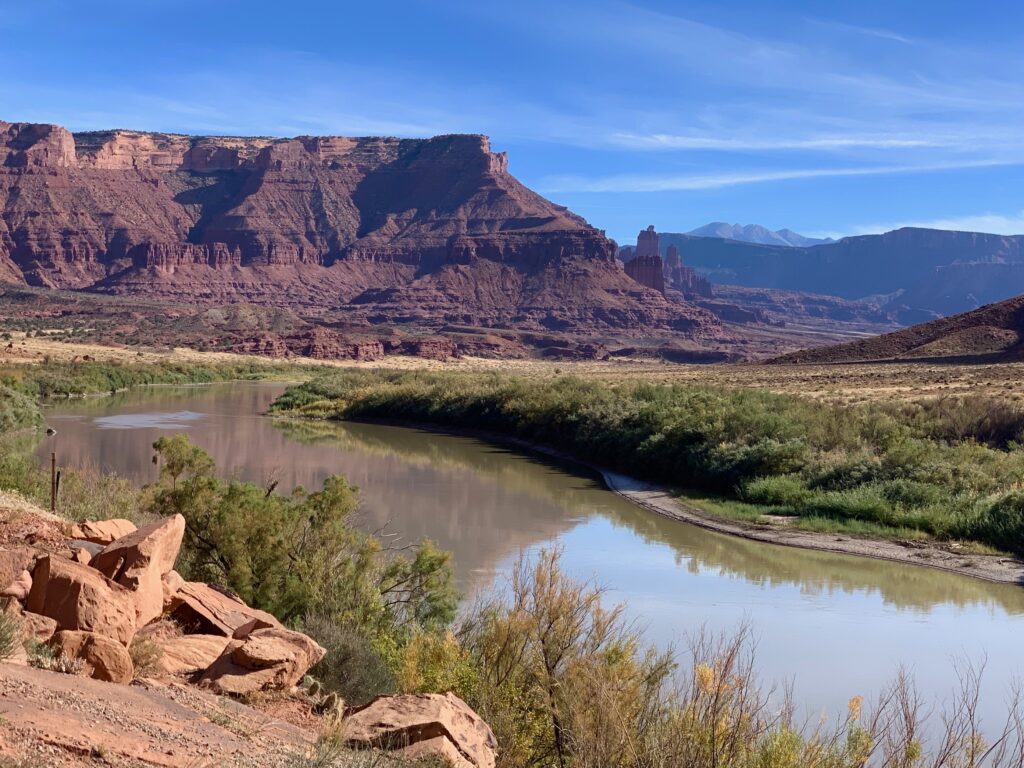
Approaching Moab on highway 128 along the Colorado river.
We arrived in Moab in the afternoon, checked in to our hotel and had a nice dinner in town. The next morning, we were up early to spend the day at Arches.
Arches
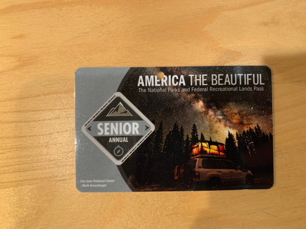
When we told the nice ranger man at the gate we were also planning to visit the Grand Canyon, he hooked us up with one of these. Twenty bucks, good for all national parks. For a year. There aren’t many advantages to being old but this is one of them.
As you enter the park, there isn’t a lot to see because the gate is at the base of a huge mesa. The only thing visible out of the car windshield is a giant cliff face. But after a short drive up several steep switchbacks on good road you reach the top and it feels like you have left Earth and are now on Mars.
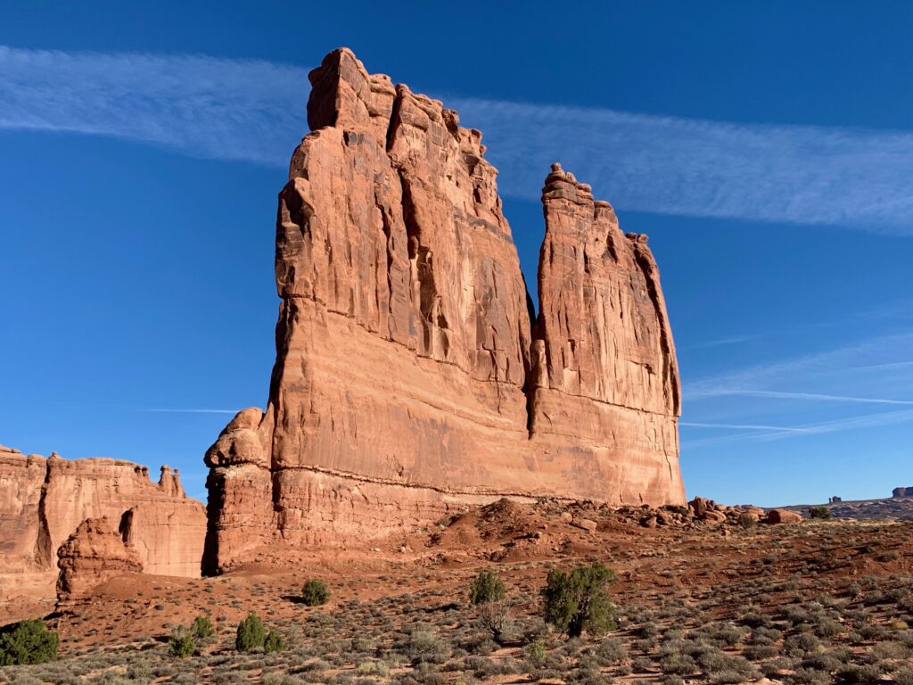
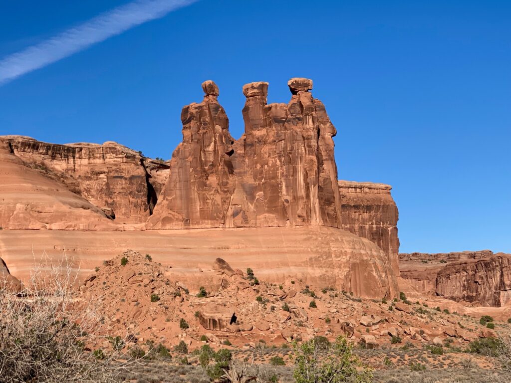
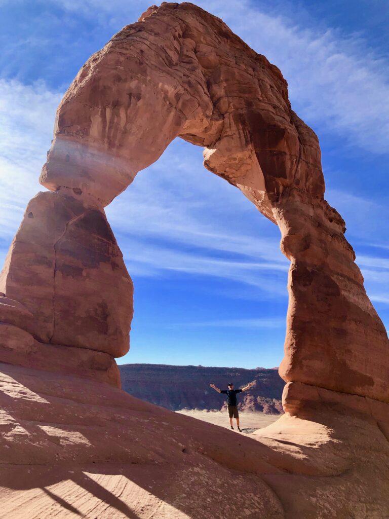
Parking at the first couple of viewing sites was already full when we arrived so we continued deeper into the park. Our first objective of the day was to see the iconic Delicate Arch. There is a viewing area to see it from a distance but if you want to get up close and personal, it’ll cost you an engaging and worthwhile 1.5-mile hike. We managed to find a parking spot at the Delicate Arch trailhead and headed out for our first hike in the desert.
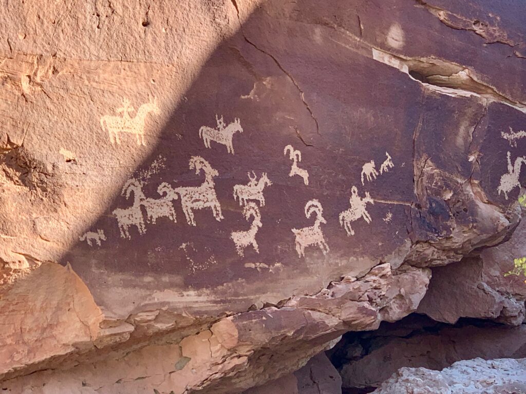
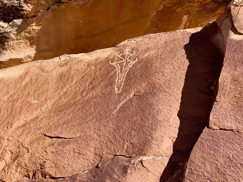
Along the way there are petroglyphs…
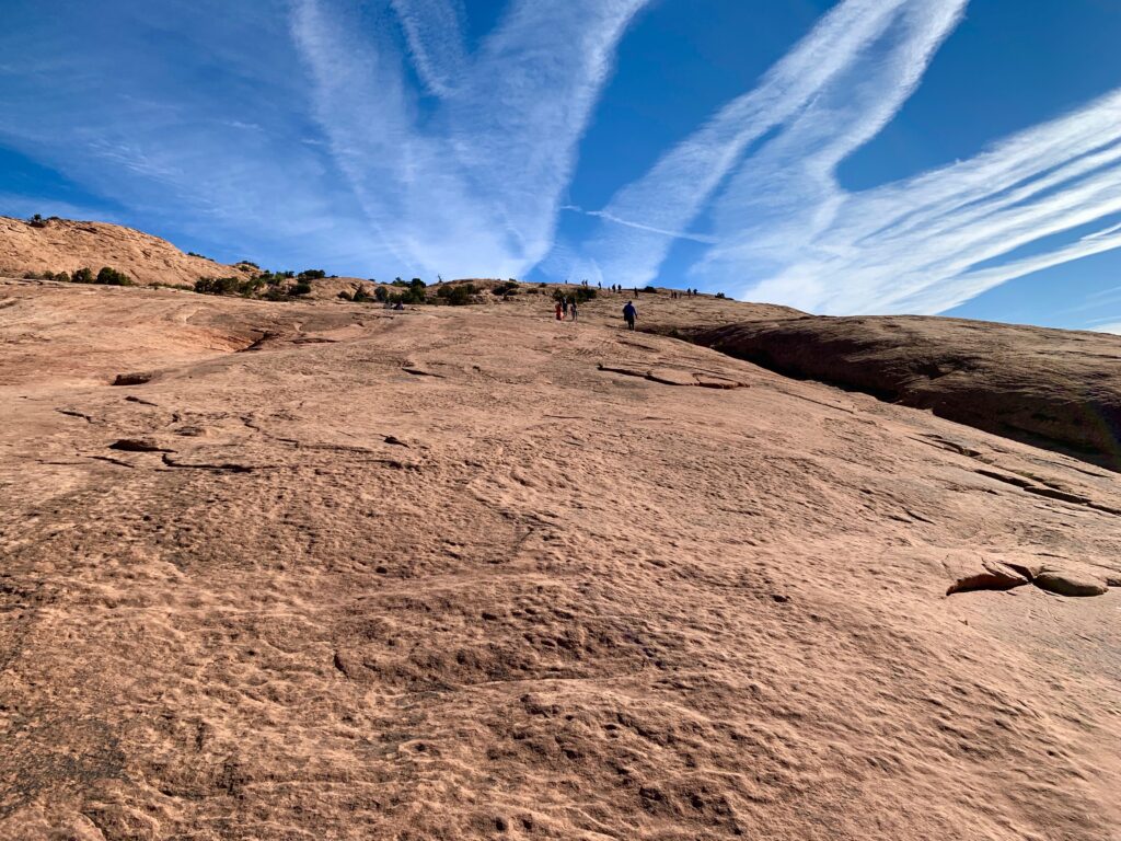
Lots of cool slick rock…
Domes…

And cliffs.


Until finally, you reach a huge natural red rock amphitheater with Delicate Arch perched on the far side.

Despite the crowd around the base of the arch, people were respectful of everyone’s desire to get photos. People were queuing up to take turns under the arch but it was next to impossible to get a clean picture without some stranger in it. I’m sure I’m in some of theirs. In the unlikely chance there’s any overlap between national park visitors and random Colorado blog readers and you see yourself in any of these photos, shoot me a comment.

After spending a fair amount of time marveling at Delicate Arch from every possible angle we hiked back to our car and headed up to the Devil’s Garden on the north end of the park for more arch viewing. Unfortunately, after making a couple of laps around the huge Devils Garden parking lot it was clear we were out of luck for the time being.
Plan B was to visit some of the other arches in the middle of the park. First was Skyline Arch, a short half-mile hike off the main road.
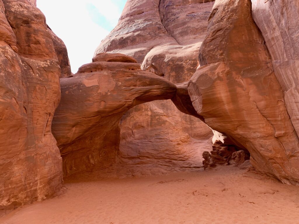
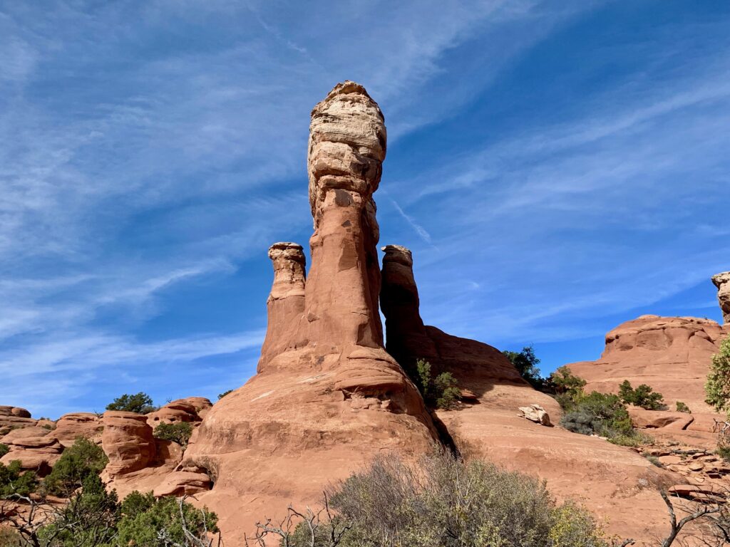
Next was a four-mile loop hike to see three arches: Sand Dune, Broken, and Tapestry. Sand Dune Arch was particularly interesting because it’s located in the middle of this weird rock formation.

And getting to it involved a couple of tight squeezes.
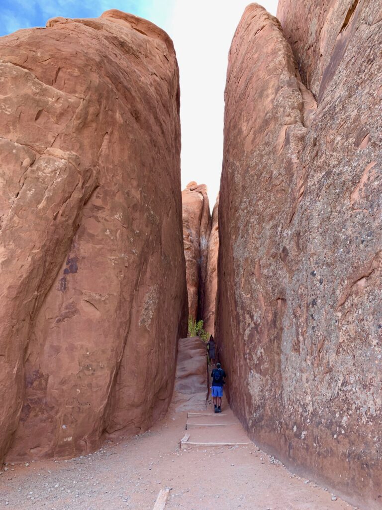
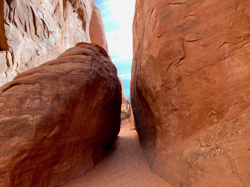
Tucked away among the huge sandstone fins is Sand Dune Arch.
A mile or so hike from Sand Dune Arch along a sandy trail is Broken Arch. Not sure why it’s called that. It looks fine to me.
I believe mother nature is working on two new arches on either side of Tapestry Arch. Check back in a few million years. They should be done.
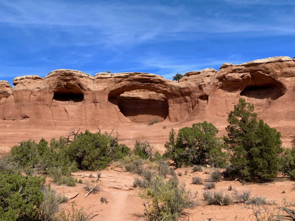
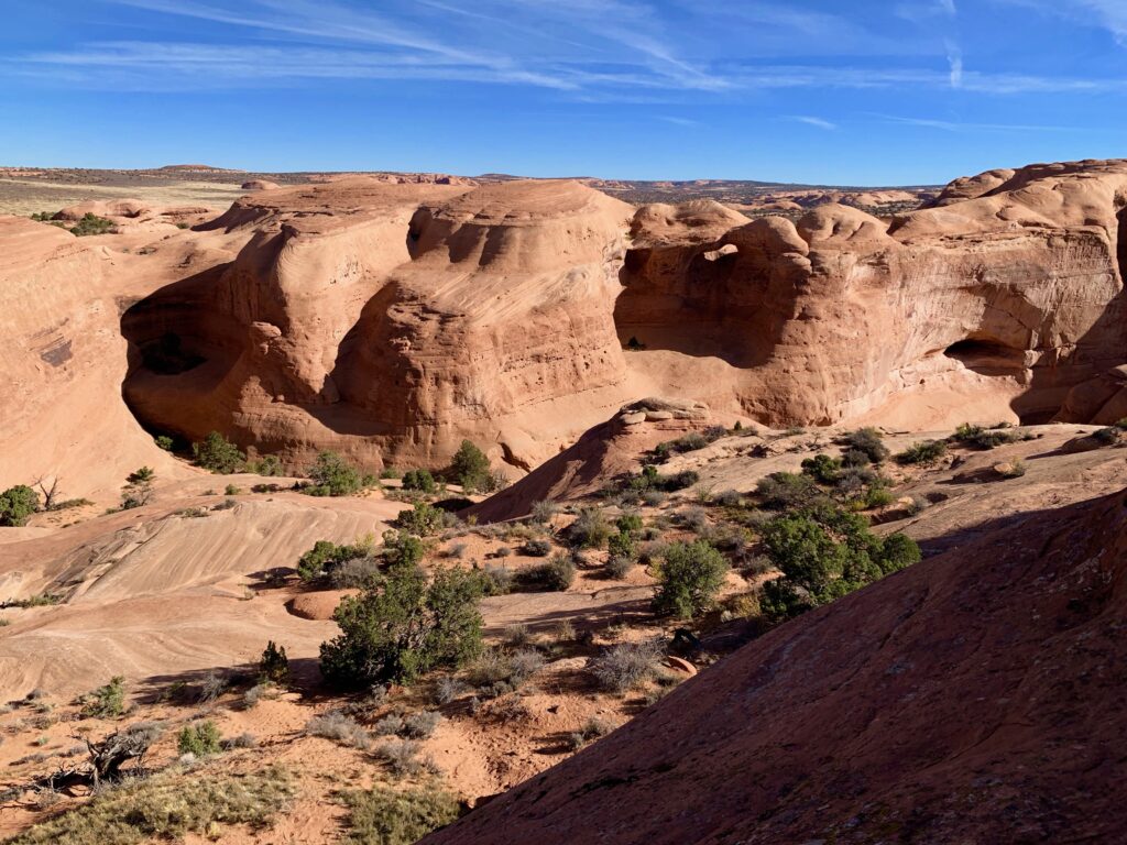
There are a lot of unexpected wonders to be found while hiking around Arches. One of our favorites was this unmarked slot canyon / fin garden the trail passed through on the way back to the car.
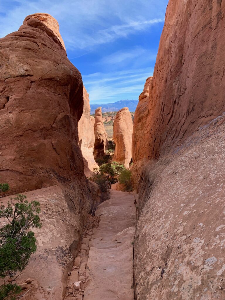

It was getting to be afternoon so we decided to head back up to the Devils Garden area to see if the crowds had thinned out any. Turns out they had. We found a place to park and headed to the Devils Garden trailhead. The Devils Garden trail is an eight-mile loop that includes what is described as technical, exposed terrain. With already eight or so miles of hiking in our legs we decided we weren’t going to attempt the whole loop. We’d go until the trail got too technical or we got tired, whichever came first.
The trail starts out in a canyon weaving its way between smooth sandstone cliffs and fins.

The first arch on this trail is basically a hole in one of these cliff faces called Tunnel Arch.
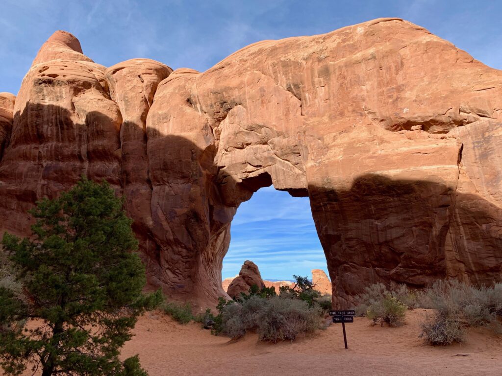
Nearby is Pine Tree arch.
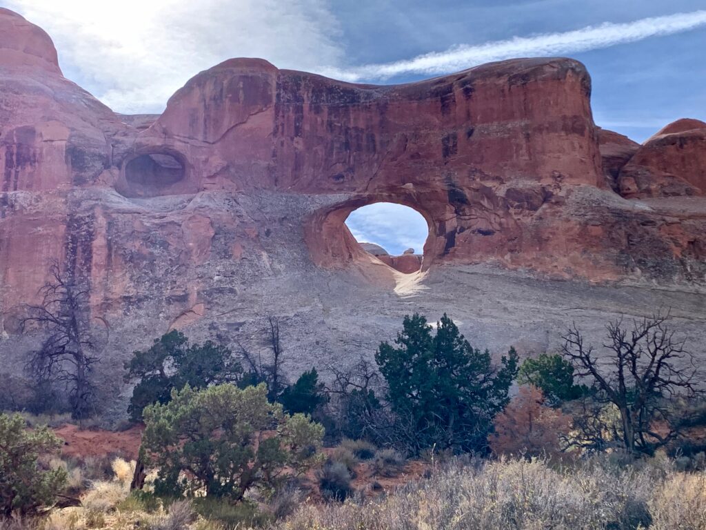
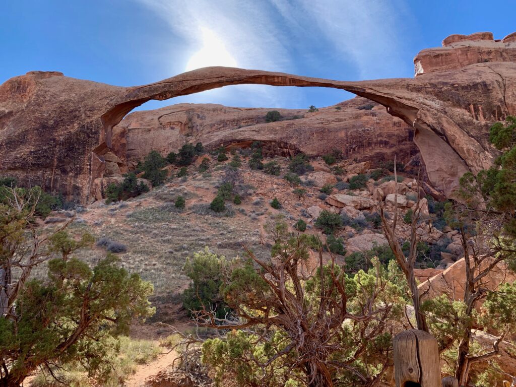
A little further up the trail is the arch with the longest span in the park. Measuring in at a gravity defying 300 feet across, Landscape Arch.
Shortly after Landscape Arch the trail becomes more technical, starting with a climb up a steeply sloped rock fin. We had decided we were going to turn around at this point but I couldn’t resist a quick scramble to the top of this grippy sandstone walkway in the sky.
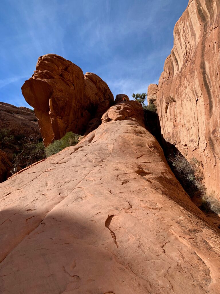
View from the top.


Partition Arch.

After seeing all we wanted to see in the Devils Garden it was getting late in the day. We headed back toward the park entrance to catch some of the arches in what’s called the Windows section. We had skipped this area at the beginning of the day due to parking issues. By now the sun was low in the sky. The late afternoon light against the red sandstone made for some great camera shots, even for an amateur like myself.
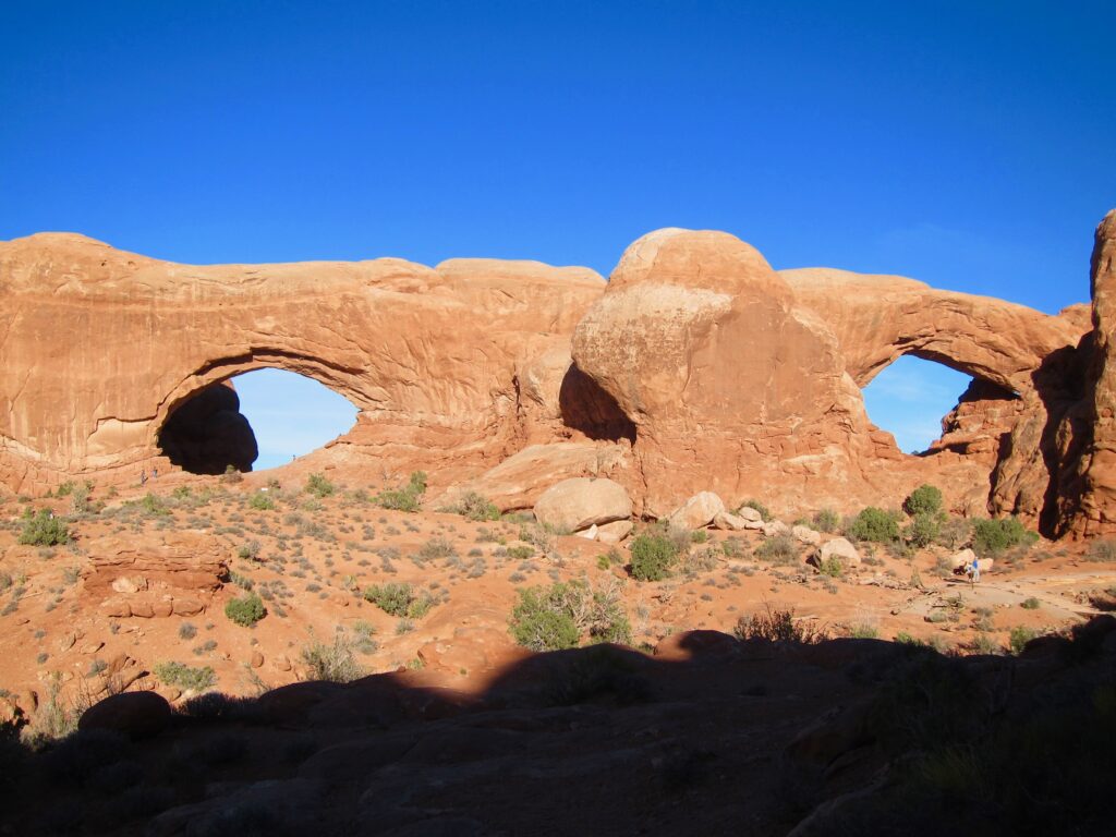
North and South Windows
Art shot from under North Window.
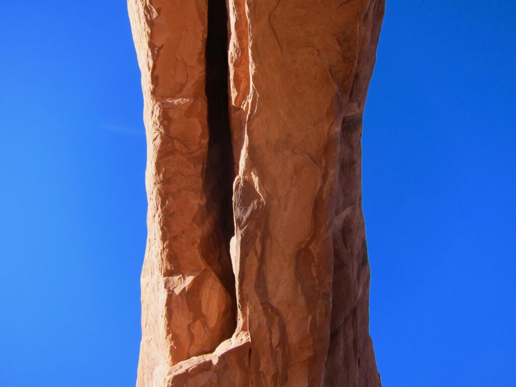
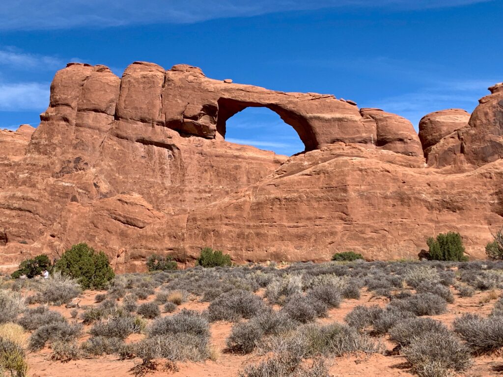
The weird Turret Arch

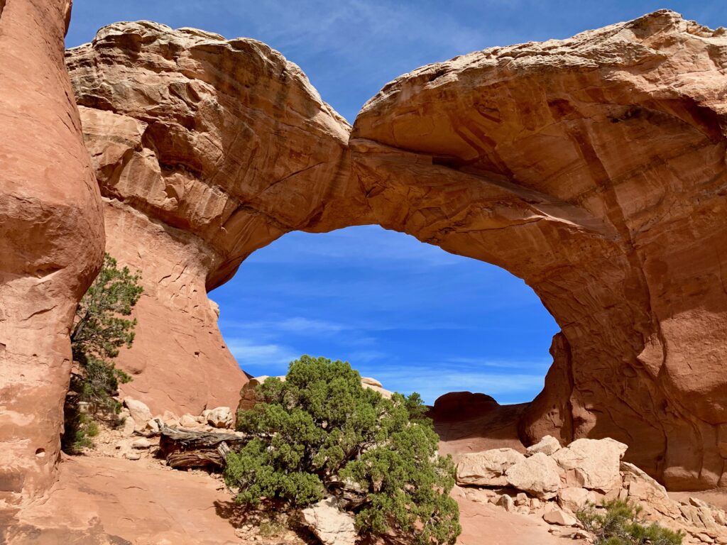
One of my favorites, Double Arch.

Not an arch but very cool, Balanced Rock.

My impressions of Arches:
It’s otherworldly. It’s hard to believe that rocks can be carved into such strange and interesting shapes by nothing more than natural forces. Natural forces over millions of years, but still. And the colors are unreal. Mostly shades of red, orange and sienna that are constantly changing depending on the angle of the sun and the direction you’re looking.
The hiking was a pleasant surprise. I didn’t do a lot of research on the park but I was thinking it was going to be mostly a driving adventure. You know, drive to a parking lot, get out, look at an arch, get back in your car and drive to the next arch. Certainly some of the arches are like that. But many, in fact I’d say most, involve at least a short hike and some a fairly significant hike. Which was great. It’s fun to get out and do something physical in such a beautifully unusual place. I’m not sure I’d want to do it in July or August but in October, it was perfect.
The crowds, unfortunately. To allow for adequate parking, this past summer for the first time, Arches instituted a reservation system to get into the park. We were there after the reservation system ended on October 3, but they still warn you that you might get held at the gate if they determine there are too many cars in the park. We didn’t get held but we did spend some time driving in circles looking for parking at several of the arches and ended up visiting some of the areas in the park in a different order than we had planned.
Grand Canyon
There was plenty more to see and do around Moab but facing a five-hour drive across the desert we opted for a leisurely wake up, a nice breakfast and a late morning departure.
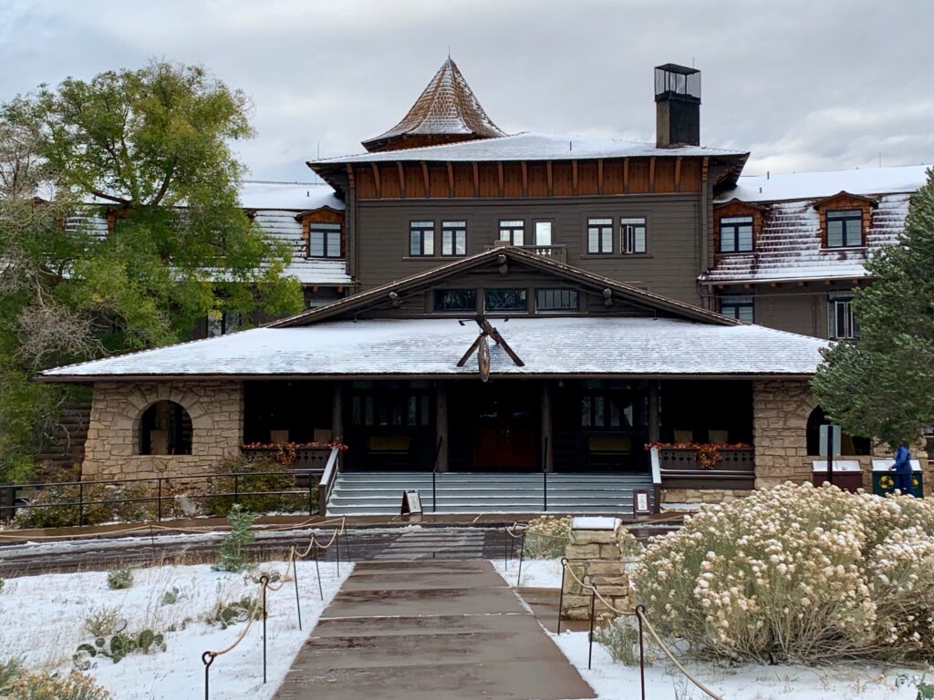
We arrived at the Grand Canyon in the afternoon just in time to check into our room at the historic El Tovar. Built in 1905, the El Tovar sits just feet from the south rim and has hosted presidents and luminaries all the way back to Theodore Roosevelt. Hey, if it’s good enough for Teddy…

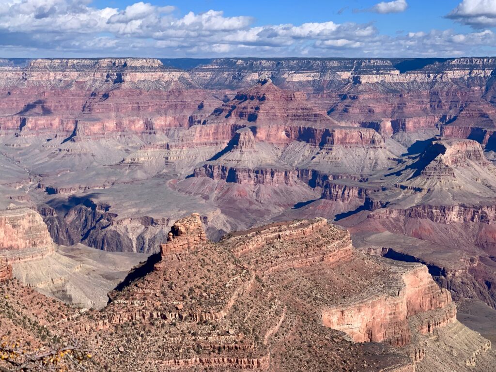
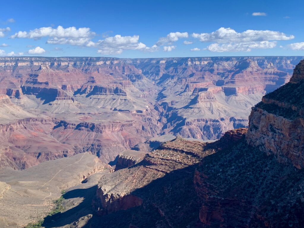
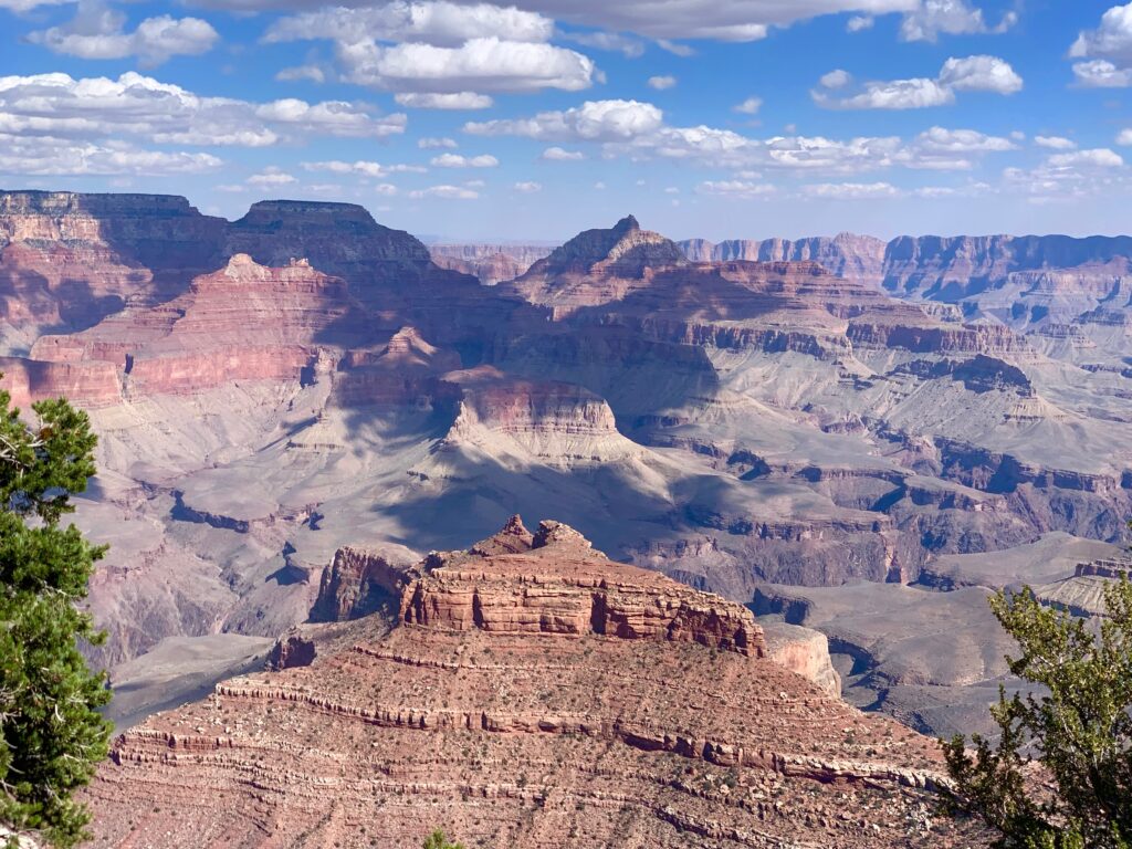
The views off the back patio were jaw dropping, as only the Grand Canyon can do jaw dropping.


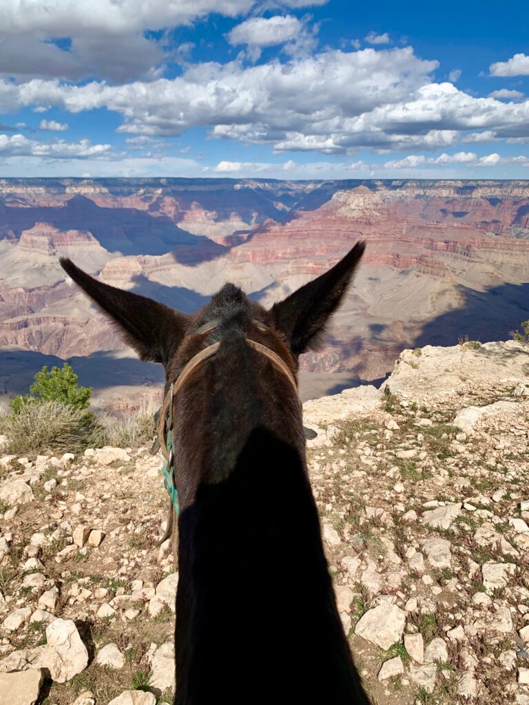
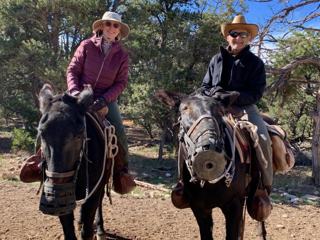
The next morning was our first organized activity of the trip: mule ride!
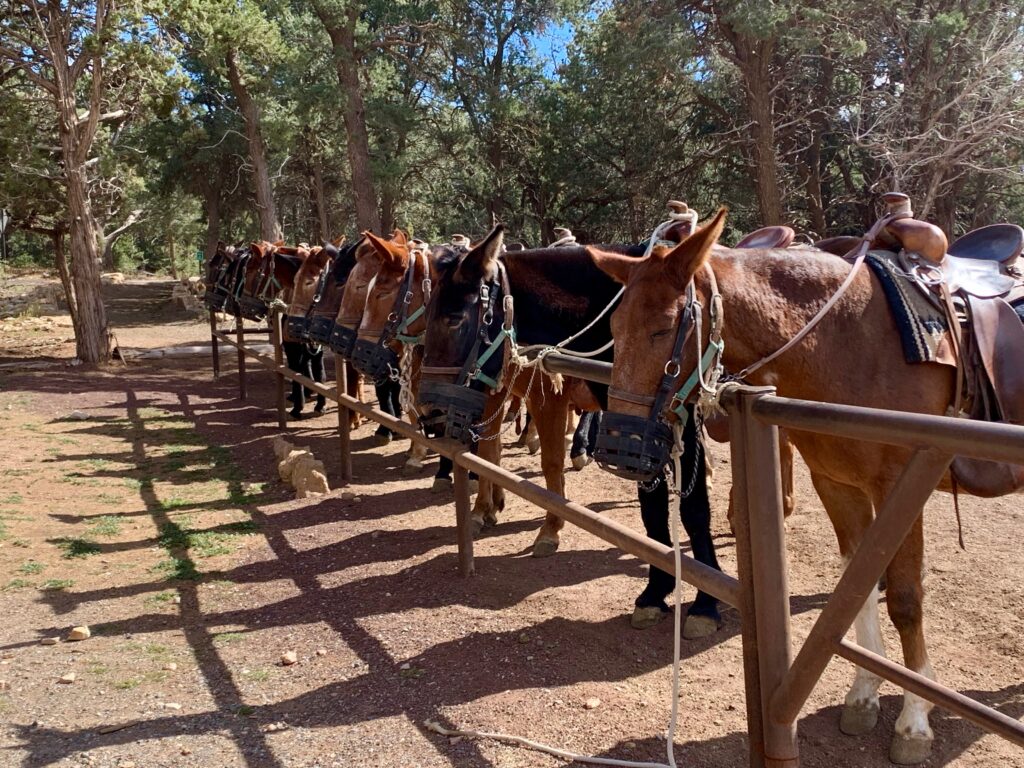
Now I know nothing about riding mules, horses, or any other animal for that matter. And the thought of sitting up high on the back of a large animal over which I have only illusory control, near the edge of a very large cliff, had me more than a little nervous. Fortunately, when I expressed my anxiety and lack of experience to the group leader, they paired me with a mule named Maude. And Maude had exactly the temperament you’d expect from a mule named Maude. Just what I was looking for.
We opted for the Canyon Vista ride which takes two hours and takes you through the woods along a relatively flat section of the south rim, versus the Phantom Ranch ride which takes two days and takes you to the bottom of the canyon. Thank God. The ride was fun but I don’t think my nerves or my backside could have handled much more than two hours.
Mule with a view.

Cowpokes R us
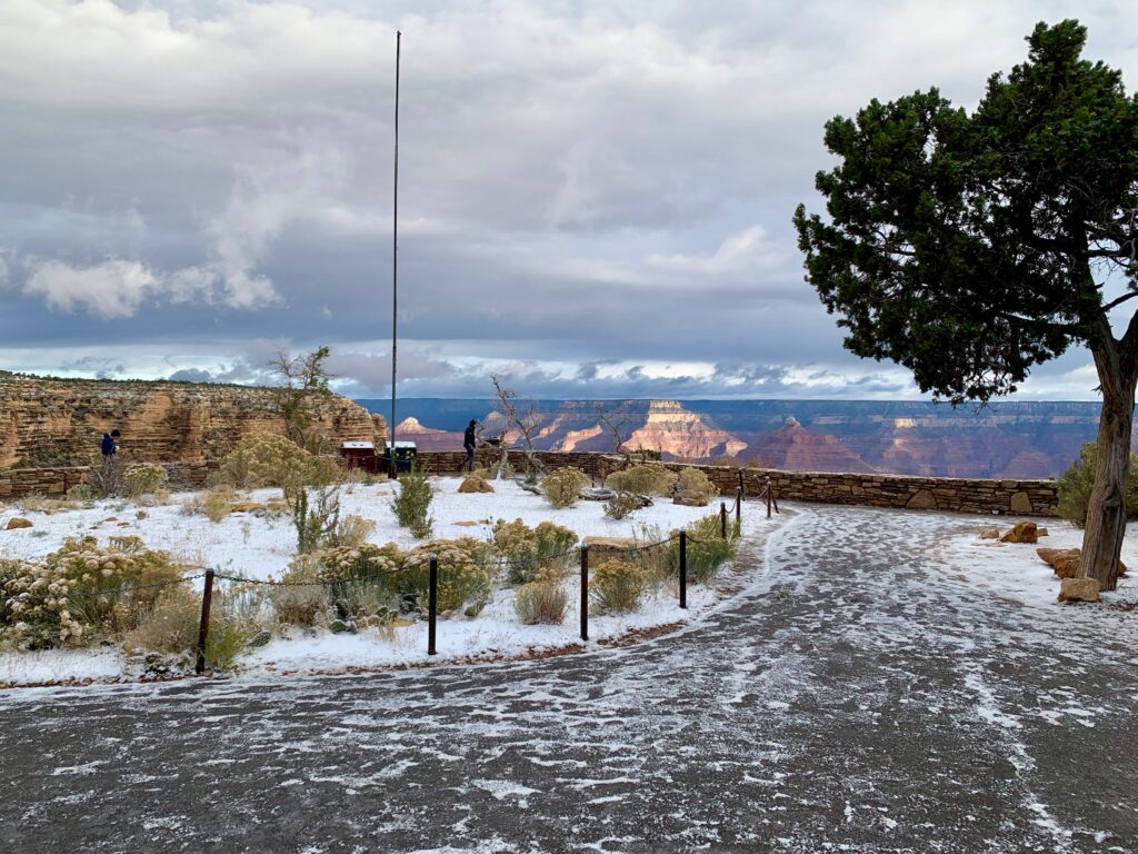
The next morning we were greeted with a light dusting of snow along the top of the canyon. Fun fact: It gets warmer the deeper into the canyon you go, so snow on top was rain down below.

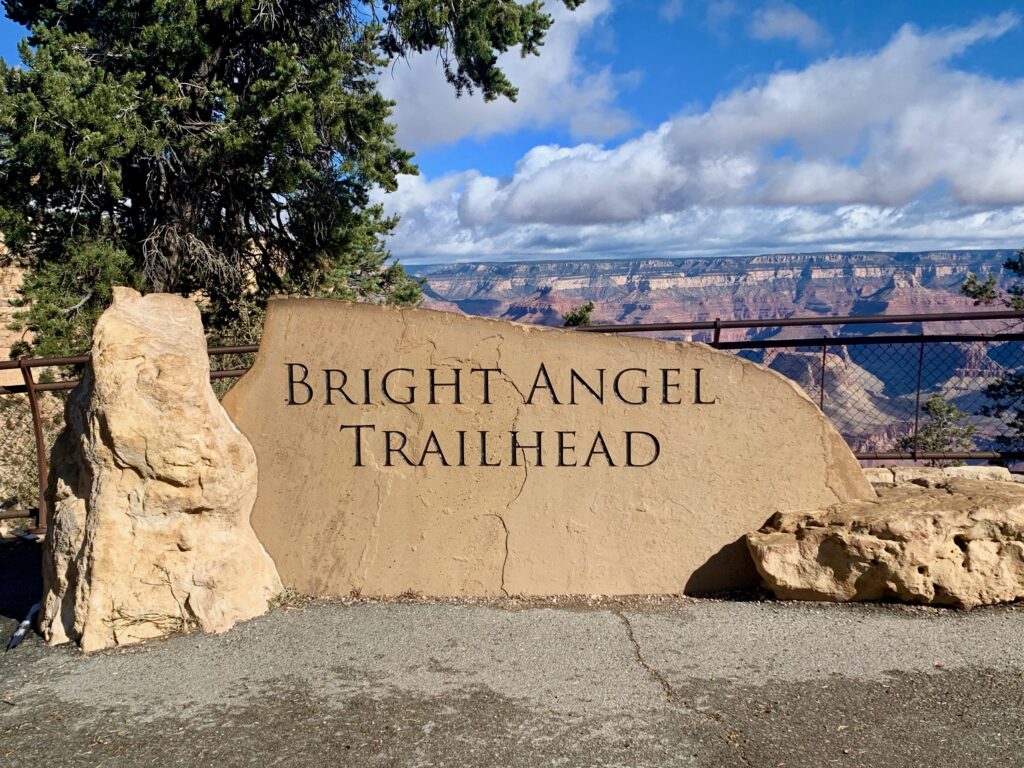
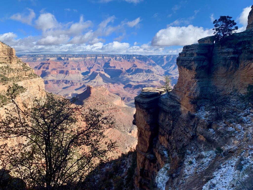
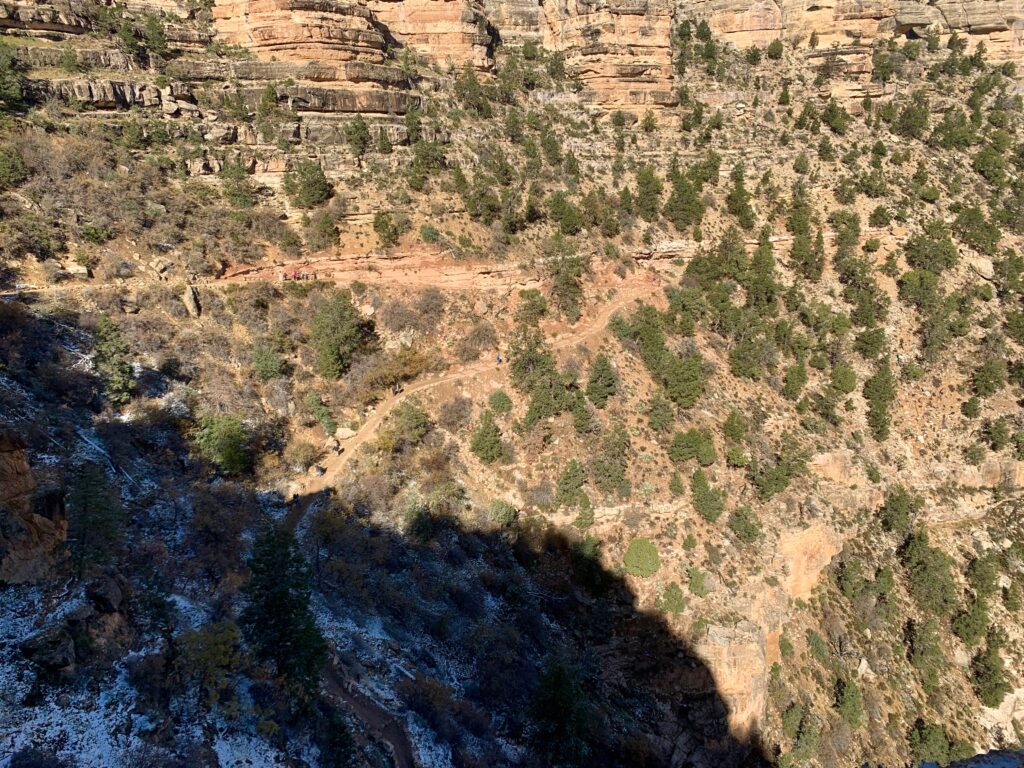
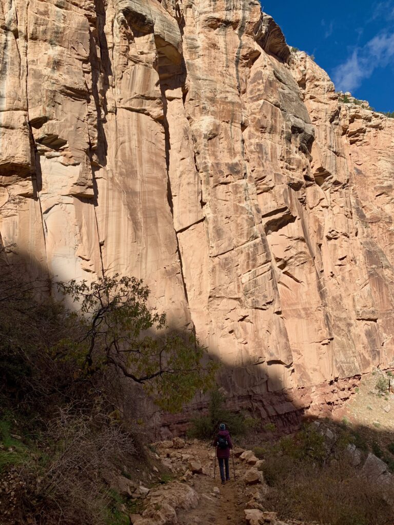
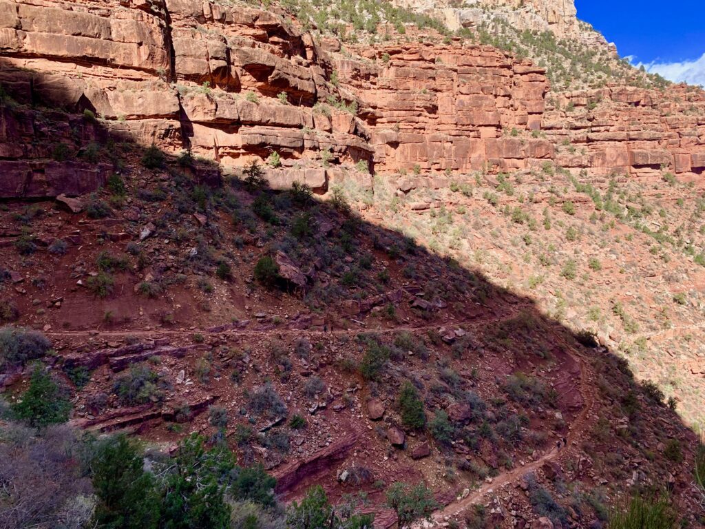
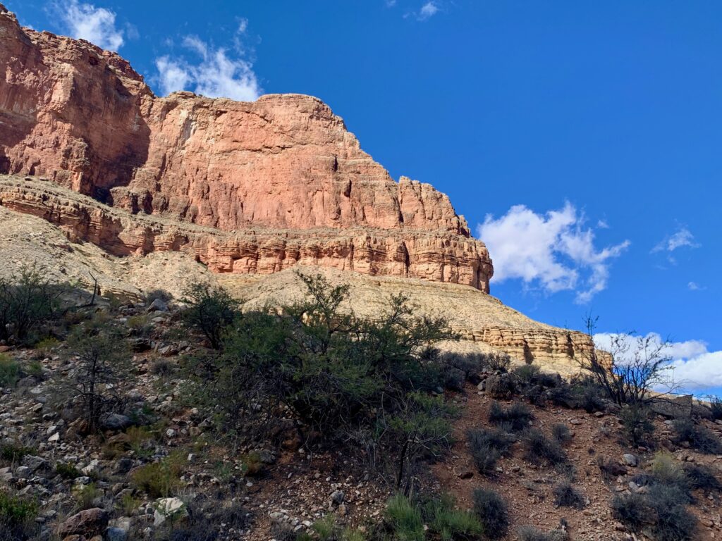
Our plan for the day was a hike into the canyon via the Bright Angel trail. When you’re standing on the south rim looking into the canyon, the bottom doesn’t look all that far away. But it’s farther than you think. For one, you can’t actually see the bottom due to the terrain below you. And due to the steepness, the trail requires innumerable switchbacks making it a full eight miles and nearly 5,000 feet of vertical to the river.
In case you’re still feeling confident, there are lots of signs like these around Grand Canyon village to help you change your mind. Kudos to whoever added the googly eye.
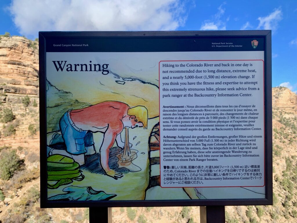
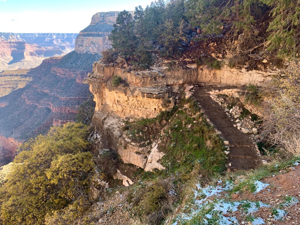
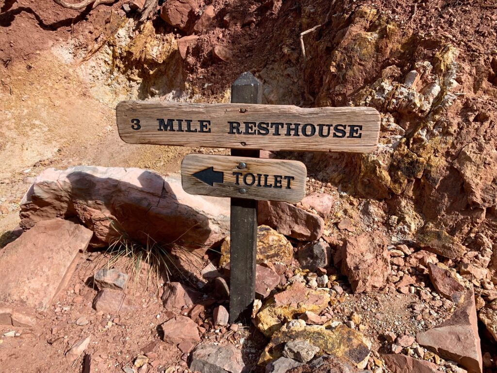
Ok, so maybe we won’t hike down to the river. It’s still a one-of-a-kind hike. We figured we’d target the three-mile rest house (a six-mile round trip) and see how we feel from there.
Starting down.
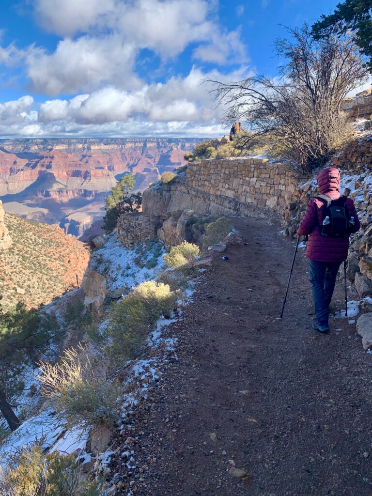

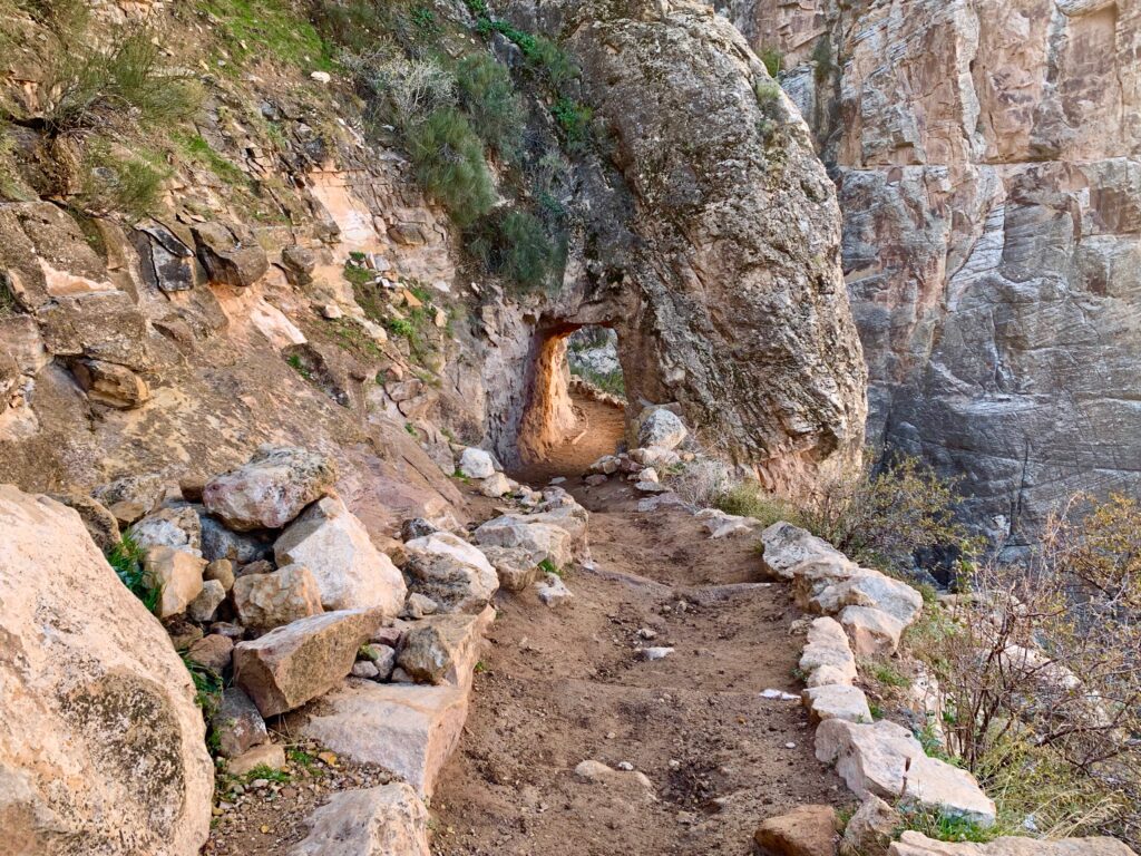
Lots of switchbacks.


The three mile rest house is 2,000 vertical feet below the south rim. Ms. Seeking decided that was enough for her. I, on the other hand, was interested in going farther, down to the Indian Garden campground. My lovely wife is good at allowing me just enough rope to potentially hang myself and said have fun, see you later. She headed back up and I continued down.

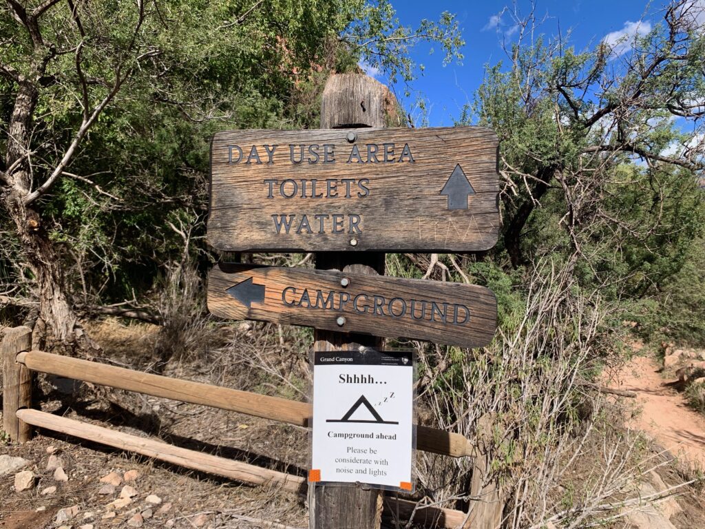
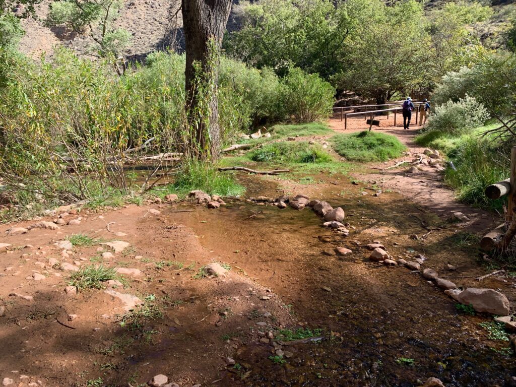
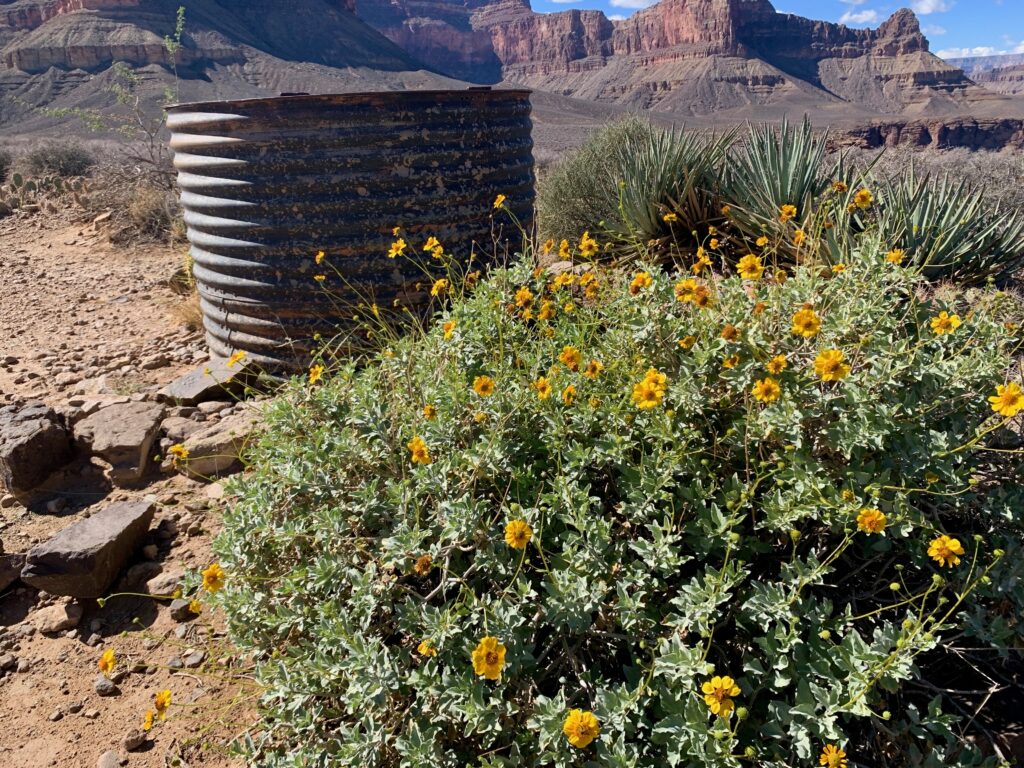
The Indian Garden campground.
A creek! That’s why it’s so green.
I reached the Indian Garden campground quicker than I expected and still didn’t feel much like turning around. I had no intention of going to the river but there was another option, Plateau Point. The sign at the campground said it was only another 1.5 miles away.
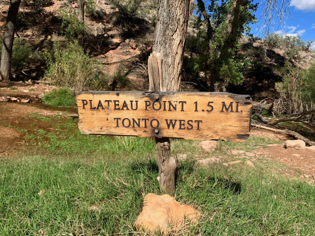
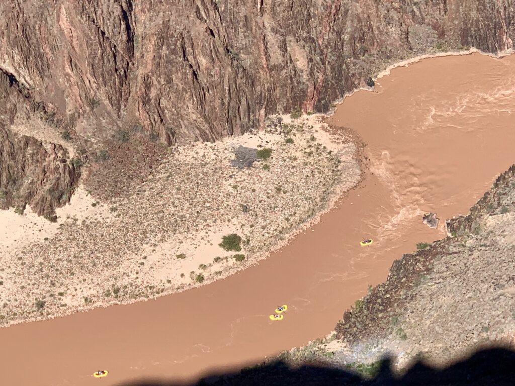
While I was standing there trying to decide what to do, a couple who I had just passed on the way down caught up with me and said they were heading to Plateau Point. When they told me you can see the river from there, I was sold. I really wanted to see the river. I sent a text that I was continuing on.
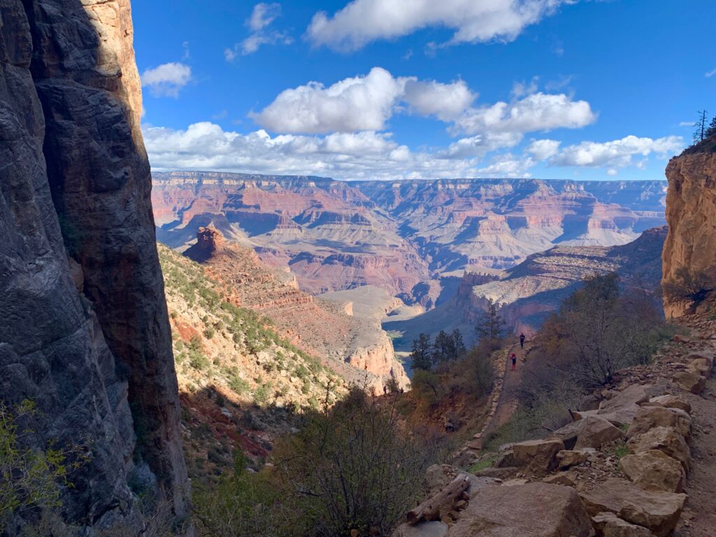
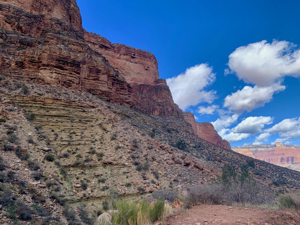
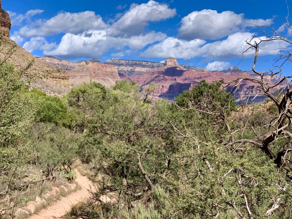
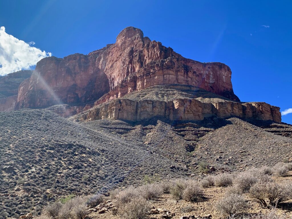
The plateau is a flatish, desert-like area about two-thirds of the way down into the canyon. Once the trail leaves the campground, it follows the contours of the plateau all the way out to the cliff overlooking the Colorado river.

On Plateau Point looking back to were I started.

And there’s the river!


When I got to Plateau Point, there were three other groups of people packing up to leave, leaving me all to myself. Deep in the canyon with only the sound of the river and the wind, surrounded by ancient cliffs, I could appreciate what originally attracted people to this place. It was magical.
I took a few pictures then sat down and ate the rest of my snacks. That settles it. No more food, I’m definitely heading back. But I was really happy I made it this far. Of course, the problem with a canyon hike is the uphill is on the way home.
Heading back up.


For someone used to climbing mountains where the top is rocky and desolate, it’s a weird experience to top out on the south rim of the Grand Canyon with its crowds of tourists, gift shops and hotels. All told, my hike to Plateau Point and back ended up being 12 miles and 3,200 feet of vertical and took me six hours. Not nearly as difficult as a typical 14er. And at lower altitude. Despite what the puking-man sign says, if I had actually planned it, I’m sure I could have made it to the river and back in a day. But what I did was great fun. It was cool to see the Grand Canyon from a completely different vantage point away from the crowds.
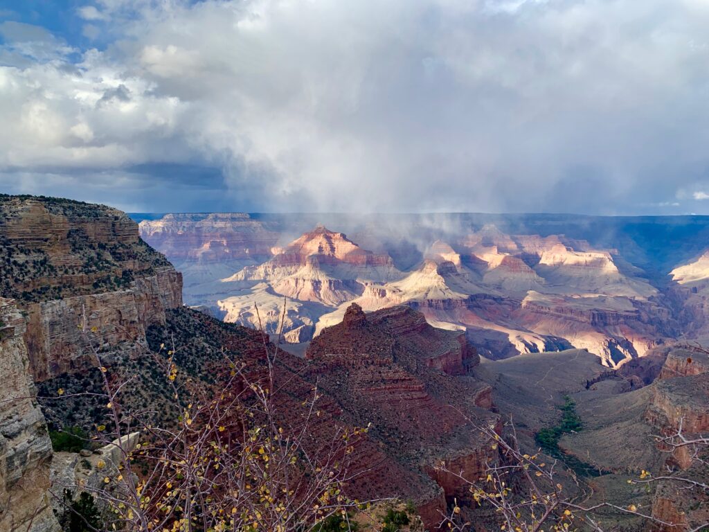
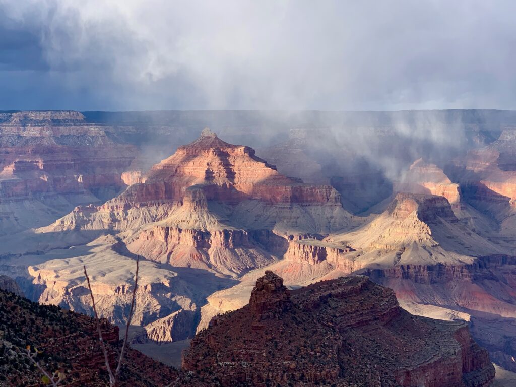
I met up with my ever-patient wife on the south rim. After a late lunch we came out of the restaurant to what was probably the most striking view of the canyon we had seen in three days. The clouds were hanging low into the canyon looking almost like rain, but the sun was shining below them illuminating the canyon features with a surreal light.
Like Arches, the Grand Canyon is amazing. It was great to see it as an adult and to spend a few days to explore it. I know now that I really didn’t appreciate it as a kid.
But also like Arches, the Grand Canyon is crowded. In fact, it’s worse. I’d read stories about how congested our national parks have become in recent years but it was kind of shocking to see it in person. Every meal required reservations or a wait in line. Parking was in a satellite lot, requiring us to schlep our bags a fairly ridiculous distance to the hotel. And just the constant crush of people. In the off-season.
While we were there we heard people speaking languages from all over the world, so clearly the Grand Canyon’s popularity extends beyond the U.S. But if you can get outside, down into the canyon, away from the crowds, all that recedes into the distance until it doesn’t matter. It’s still a remarkable place, well worth all the other annoyances.