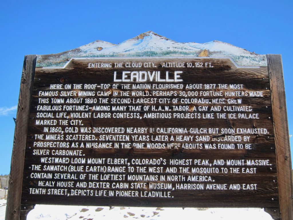
So I was thinking of going to Leadville. Back in November when I bought my fat bike, the guys at Cycles of Life made a point of telling me about Leadville’s groomed winter trails, “One of the best places to ride snow in the area!” A couple of our neighbors cross-country ski and they also mentioned the Leadville trails to me. I figured it would be a good idea to make a trip up to the Cloud City before the snow gets melted out for the season.
But first, since I was going solo I was going to need to do some Internetting to get an idea where the trails are and what they’re all about. A quick search shows there are three groomed winter trail systems in Leadville proper:
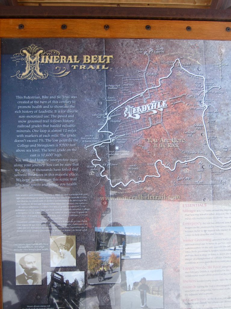
- The Mineral Belt Trail (MBT) – An 11.6 mile paved loop around town. Sounds kind of touristy but with snow it could be cool, albeit a little on the short side.
- East Side Mining District – In the hills above Leadville is a system of old mining roads dating back the 1800’s. Now days the mines are abandoned and the roads have become hiking/biking/skiing trails. A whole network of them. It was hard to tell exactly from the map, but it appeared that with some creative routing it would be possible to work out a six or seven mile loop.
- Timberline Trails at Colorado Mountain College – The Cloud City Wheelers have built a 10-mile network of fat-bike-specific trails in the woods on the Colorado Mountain College campus. Fat-bike specific? You gotta love Leadville.
Hmmm…. All three sounded intriguing but somewhat limited. What if I were to string them together into one big loop? That would give me a chance to see them all and would give me the mileage to justify the hour drive up to Leadville. After some triangulating on local maps, I decided it looked doable. So with my route selected, I took some map screenshots (just in case) and headed up the road for my very own Tour de Leadville.
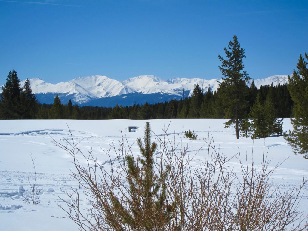
Sunny day in Leadville.


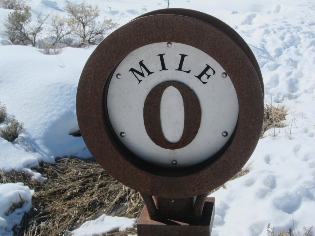
The plan was to ride the MBT clockwise starting on the west side of town, loop around to the East Side Mining District trails, head South to hit the Timberline Trails then finish up on the MBT back to the car. By pure accident I parked at mile marker zero on the MBT, which is the parking lot at the Dutch Henry tubing hill. From riding plenty of unfamiliar trails I know it’s always a good idea to end with a downhill and the west side of Leadville is the lowest part of town, so that’s where I parked. The builders of the Mineral Belt Trail must’ve had the same idea. Great minds?

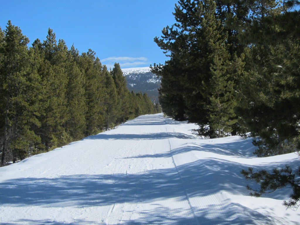
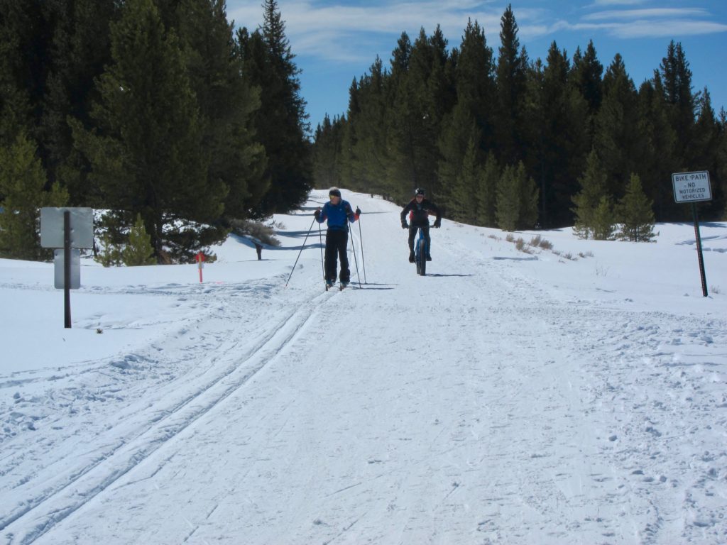
The MBT is proof of how serious Leadvillians (?) are about their winter sports. As wide as a one-lane road, the trail makes a gentle rolling loop completely around town. It’s groomed with equipment that makes the same corduroy you see at ski resorts and it has designated tracks for classic cross-country skiing, skate skiing, dog joring (basically skiing behind a dog), fat biking, snowshoeing, etc.
Stay in your lane!

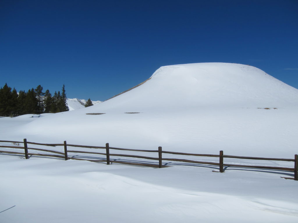
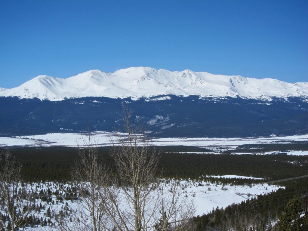
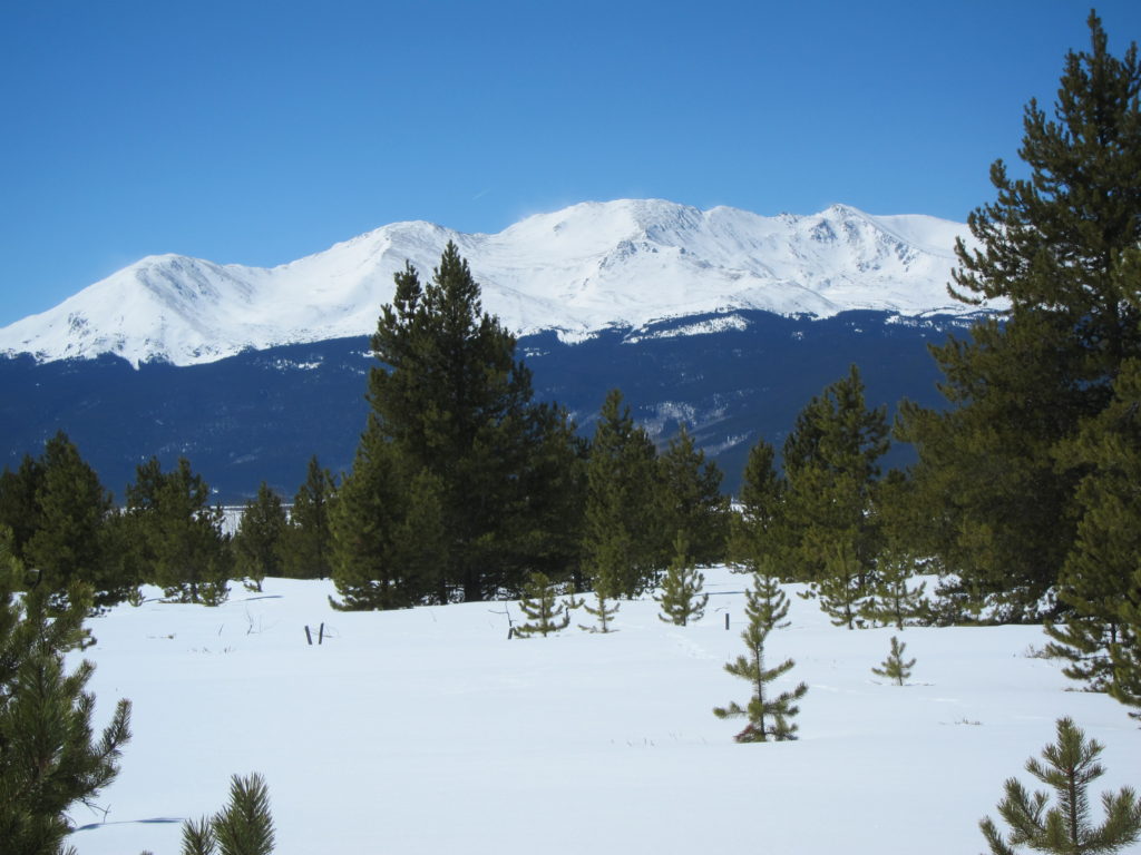
Mt. Massive takes up the entire western skyline from town.

Old and new. The trail cuts by a housing development on the north side of town. Like most Colorado towns Leadville is booming.


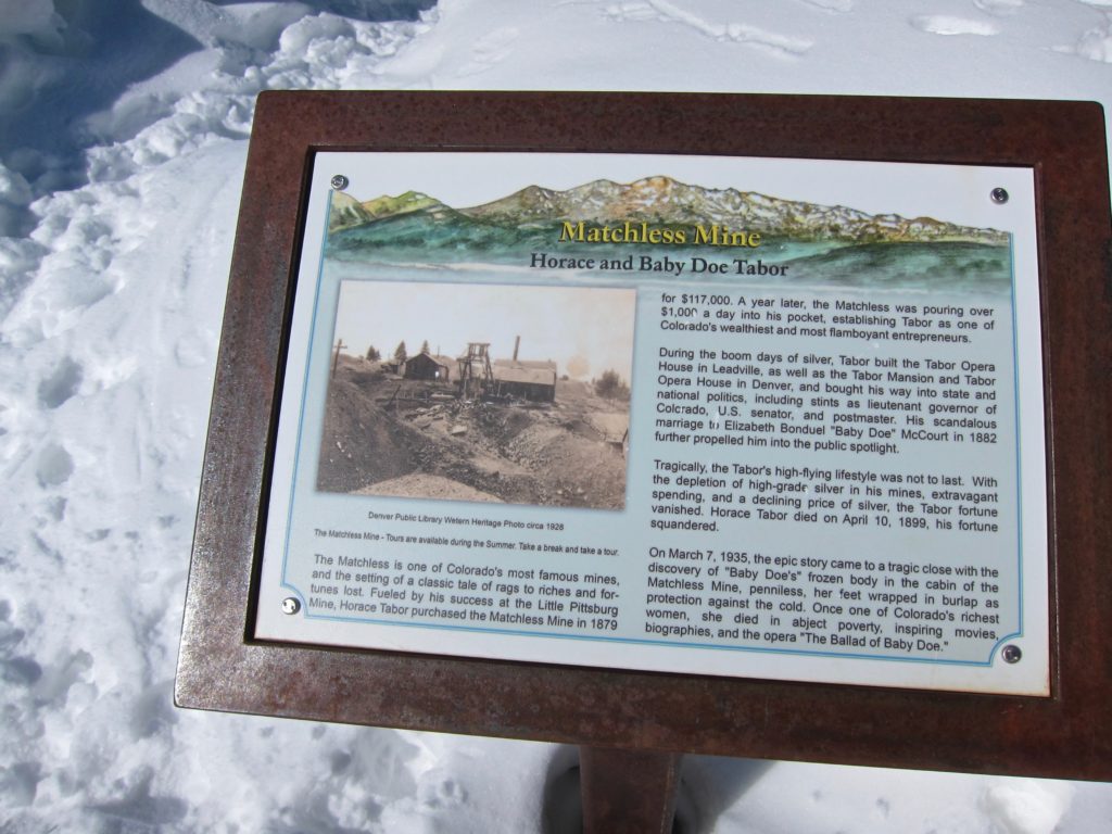
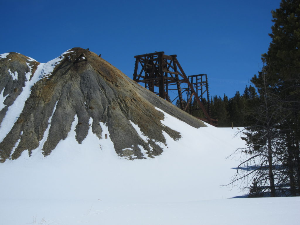
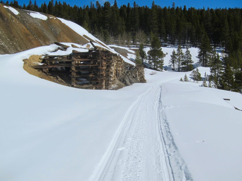
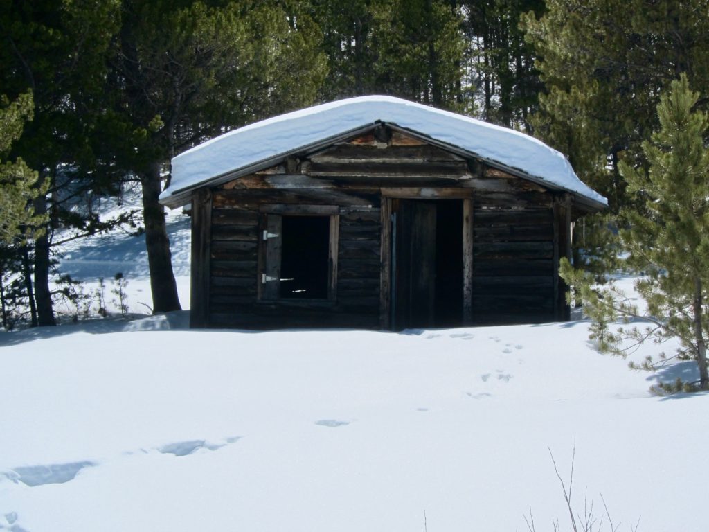
The famous Tabor Matchless Mine.
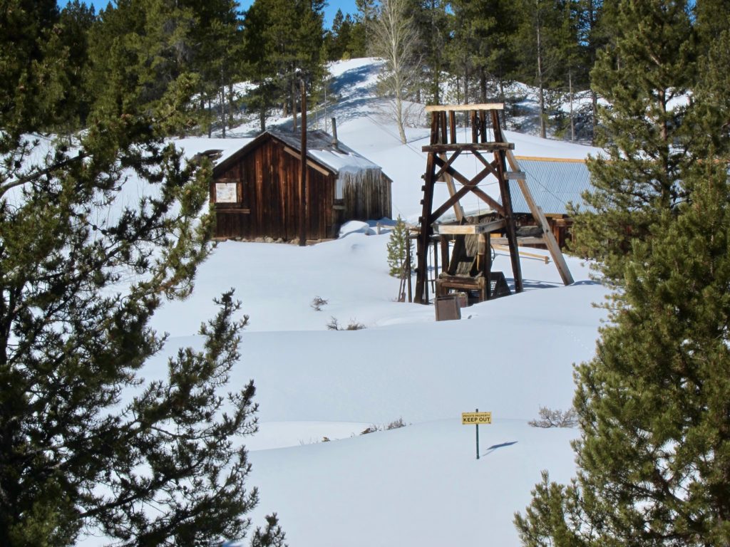

The Robert Emmet mine.
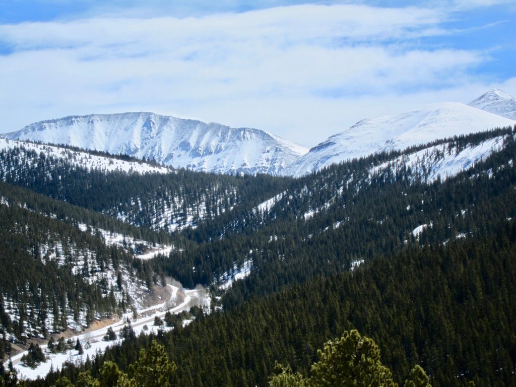
From the east side of the MBT the rest of the northern Sawatch comes into view.
Fellow MBT users.
When riding in an area that I’ve never been, it always surprises me how different the real world looks from what I envisioned from looking at a map. Even a topo map, which shows hills and slopes hardly prepares you for what the terrain actually looks like.
As I turned east and then south on the MBT I had the suspicion that I had missed my turn. I knew I needed to turn left somewhere around the Robert Emmet Mine but everything looked different from what I had in my head. Although all the roads were numbered on the map none of them actually had signs in real life. And keep in mind these are Leadville roads, not Denver roads or even Salida roads. They’re, shall we say, rustic. With the deep snow it was hard to tell what was an actual road and what was just some random snowmobile track into the woods.
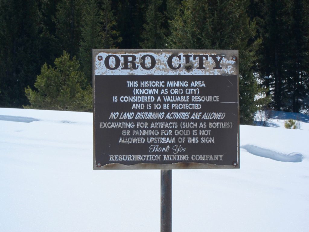
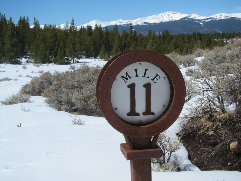
While I was standing there trying to decipher my place in the universe, a couple of people on fat bikes came by and turned up an intersecting trail. It was then that I noticed this small marker.
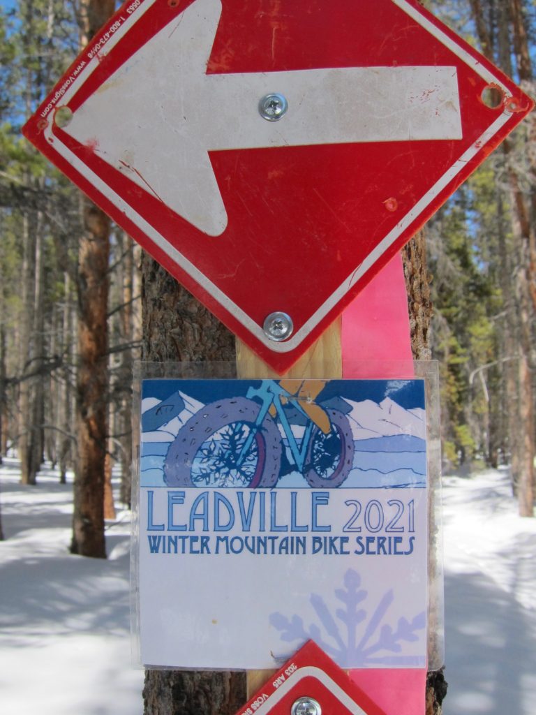
I was on Leadville’s winter bike race course! I didn’t know if it was the exact road I had originally planned to take but it was definitely headed in the direction I wanted and since it was a race course it almost certainly would loop back to town at some point, all I had to do is follow the markers. Activate Plan B.
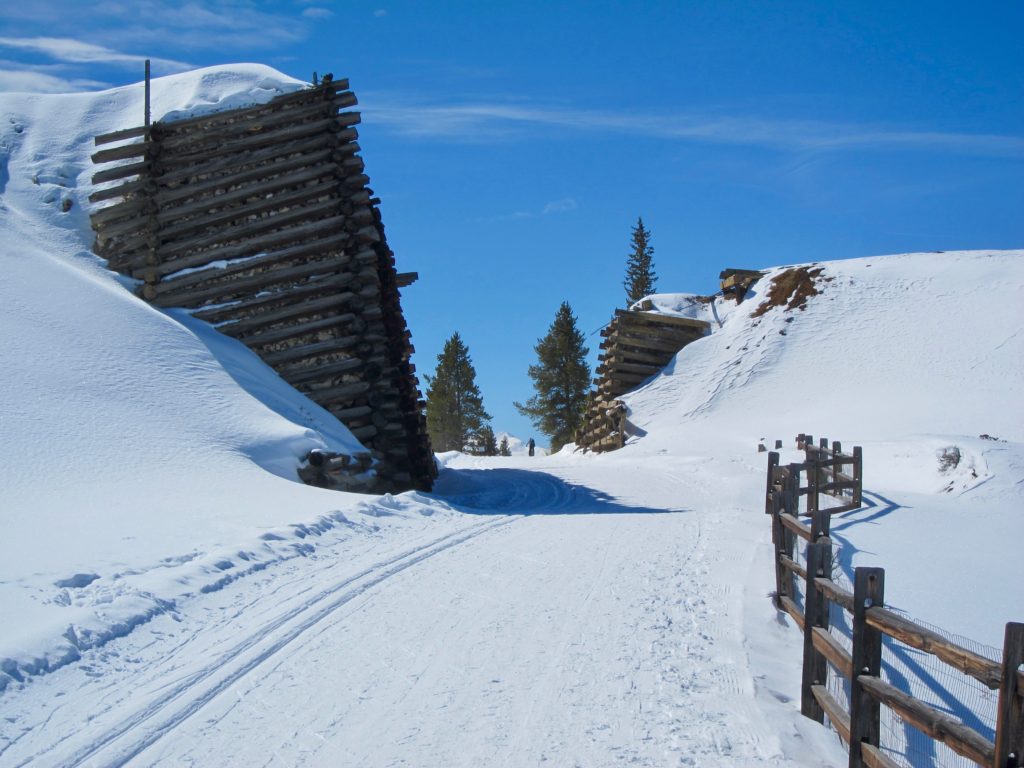
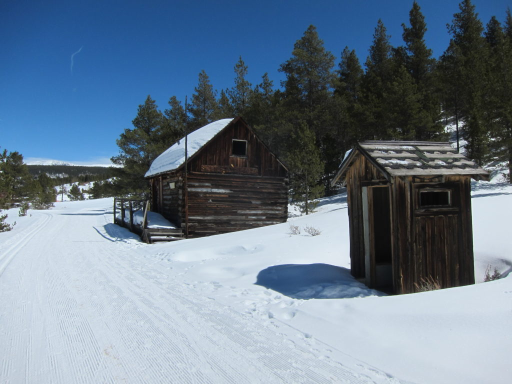
Old tailing pile and head frame.
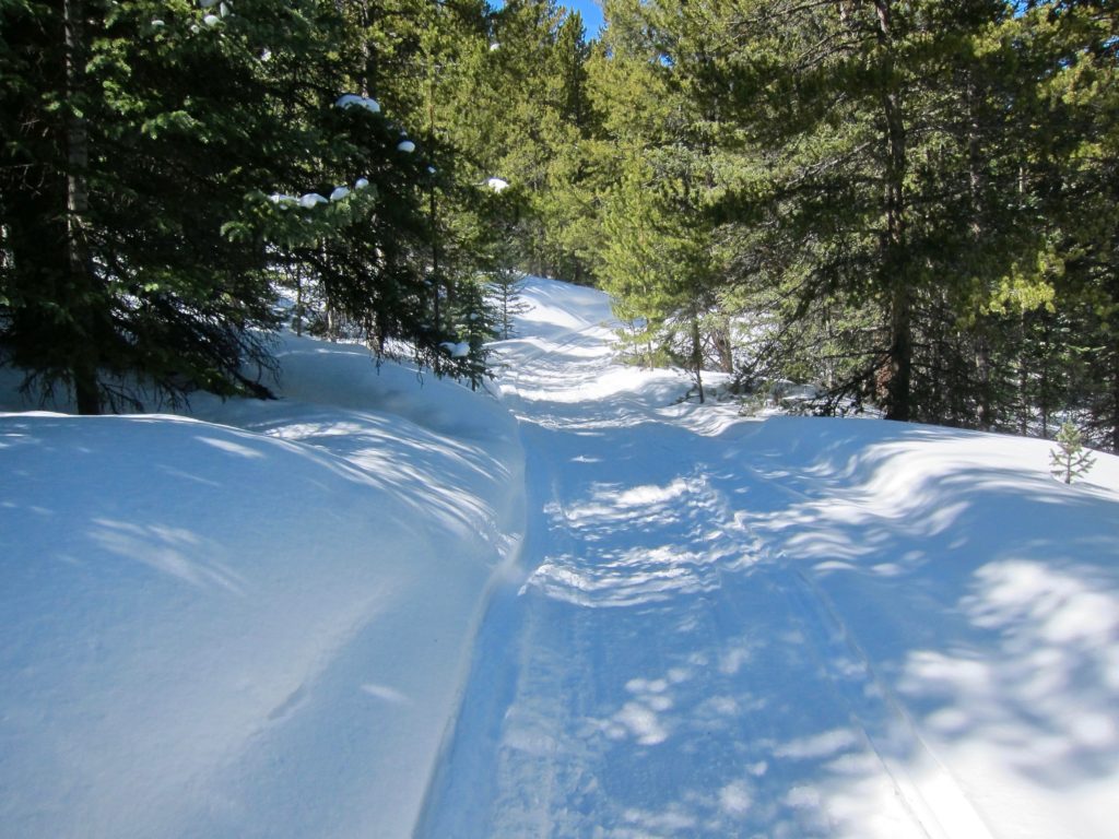
The trail had clearly been groomed by snowmobile and there were plenty of fat bike tracks providing assurance I was at least going somewhere well traveled.
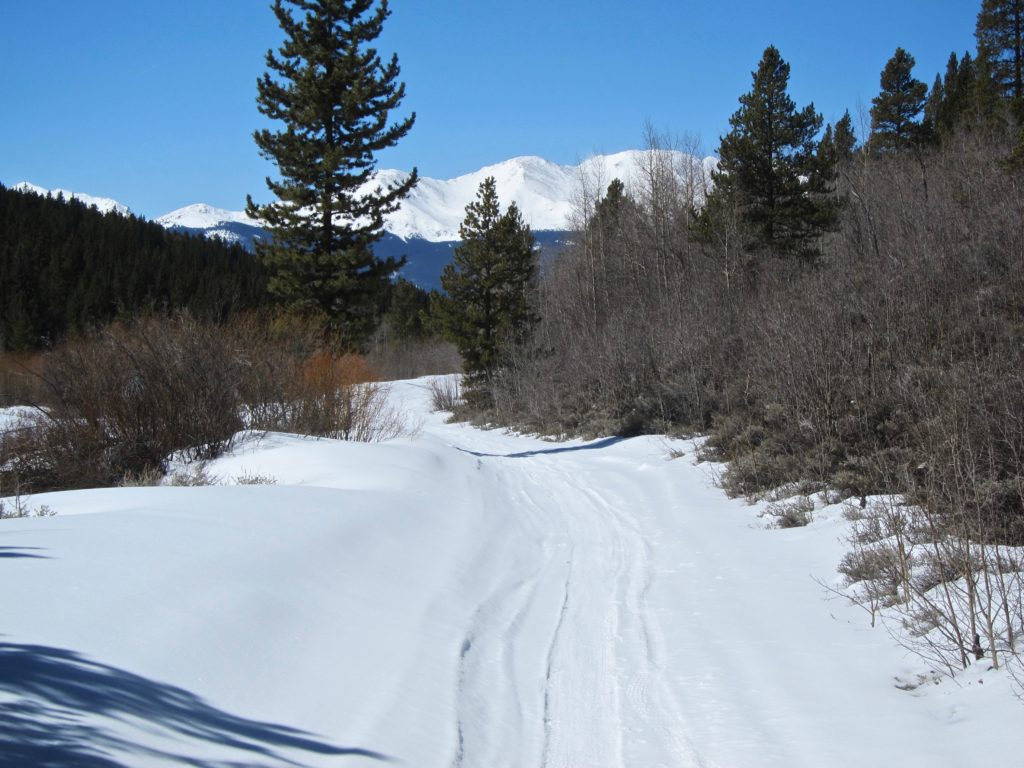
The views did not suck.

Further east the Mosquito range came into view.
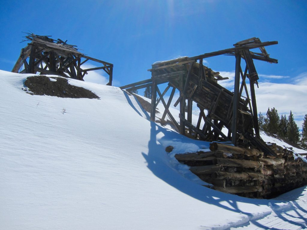
More old mines.
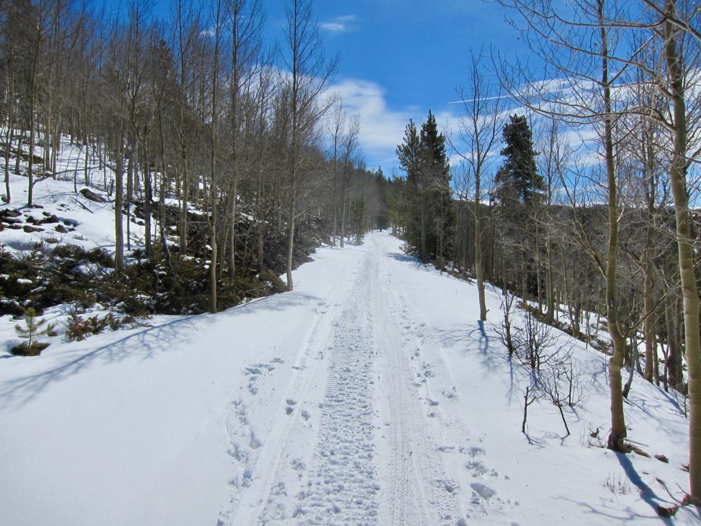
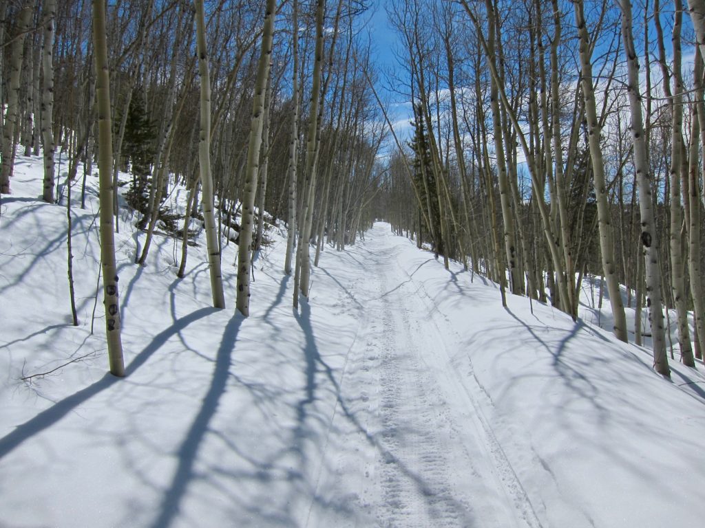
Climbing higher into the woods.
The start of the descent back to town.

Which brought me to this intersection. The race course marker indicated a left turn, which felt right but I had no idea where I was. Fortunately, two skiers came by as I was rolling up to the intersection and when I asked them what road they were on they said, “This is the Mineral Belt Trail”. Perfect, I had just completed my East Side Mining District loop!
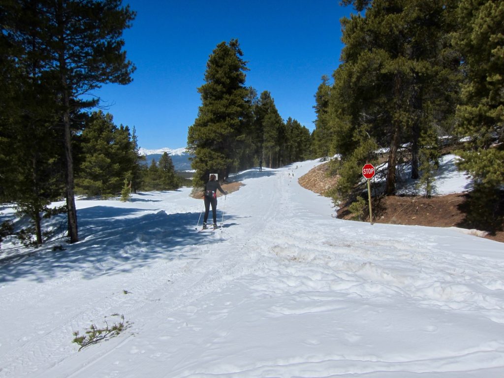
After about another mile I saw the Timberline Trail system marker.
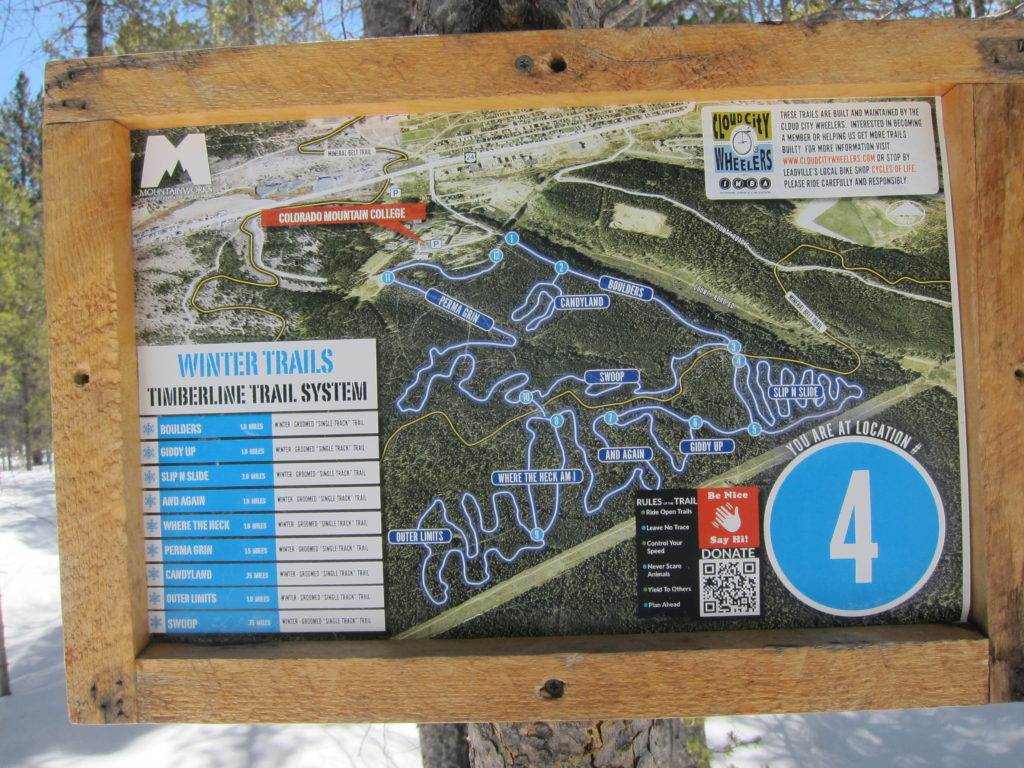
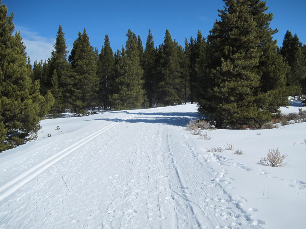
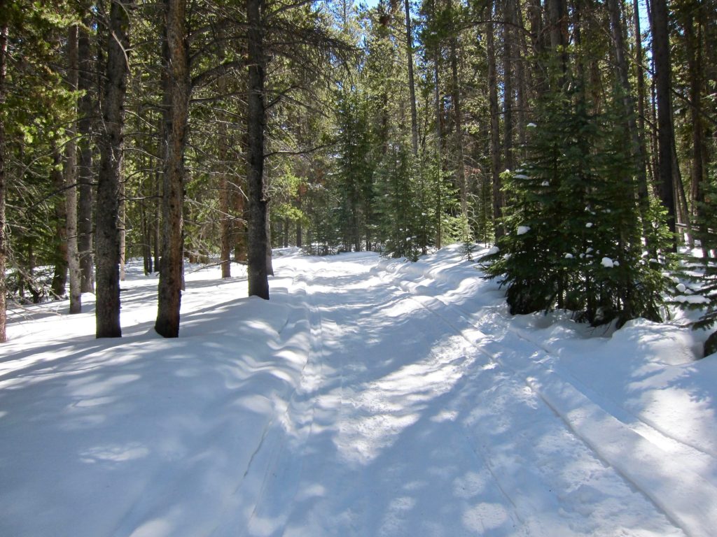
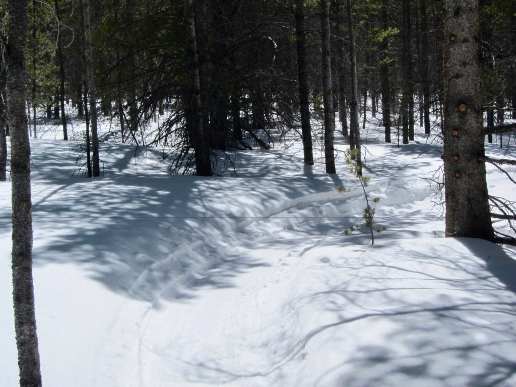
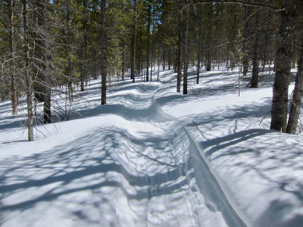
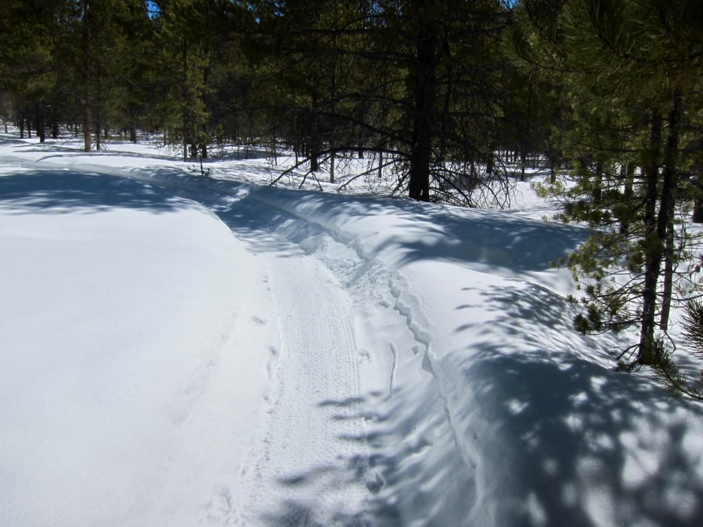
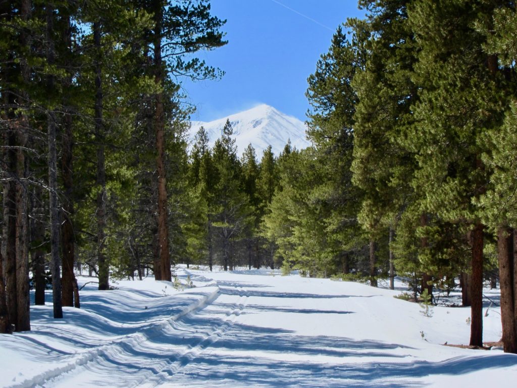
I’m not sure what they use to make these trails, they seem narrower than a typical snowmobile track. But they were fast and flowy, clearly laid out by trail builders who know what they’re doing. Perfect for fat biking!

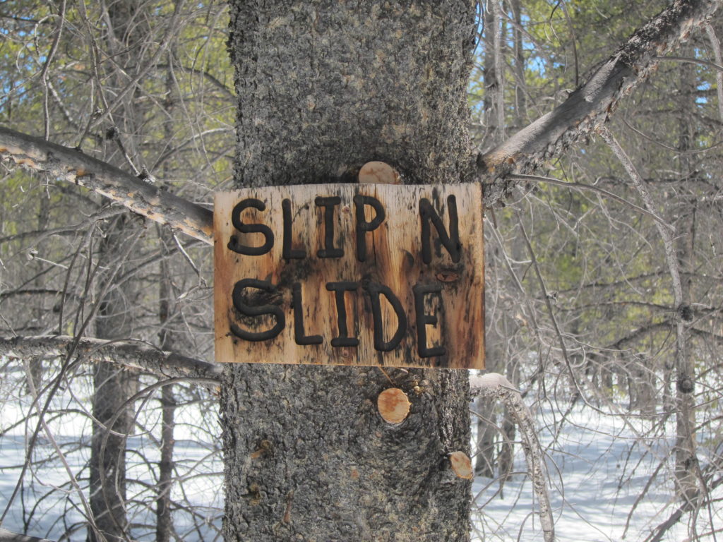
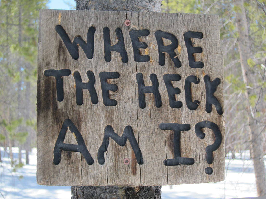
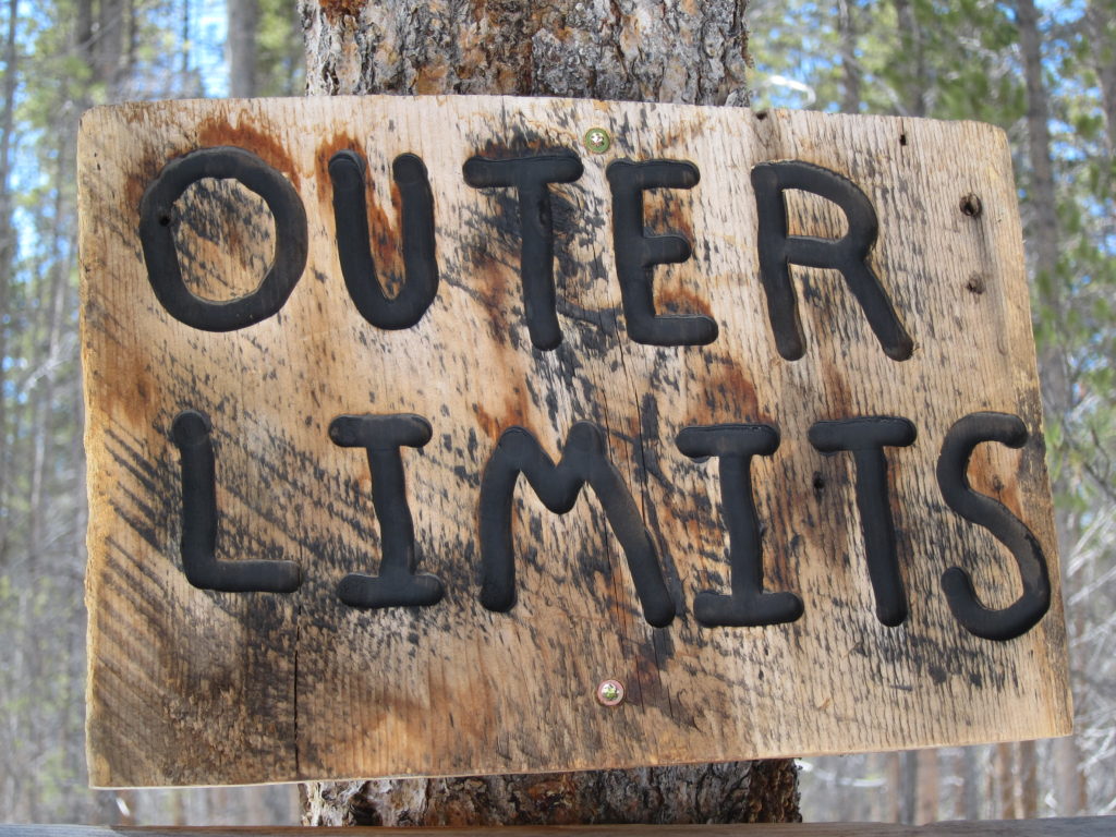
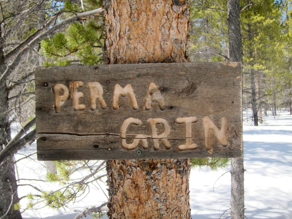
And they were well-marked with memorable names.
I eventually popped back out on the MBT with a nice view of Mt. Elbert through the trees.
No disc golf today.

Almost home.
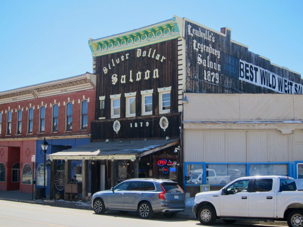
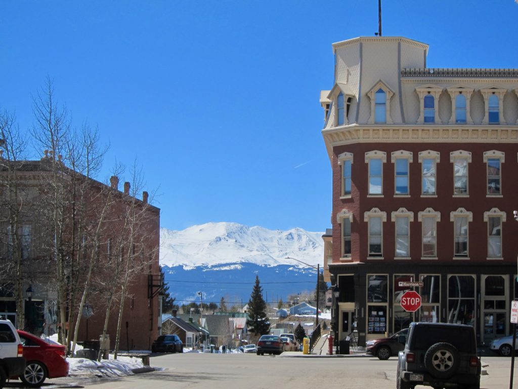
Some historic Leadville buildings along the trail.
Back around to Mt. Massive
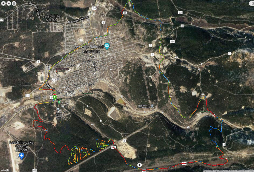
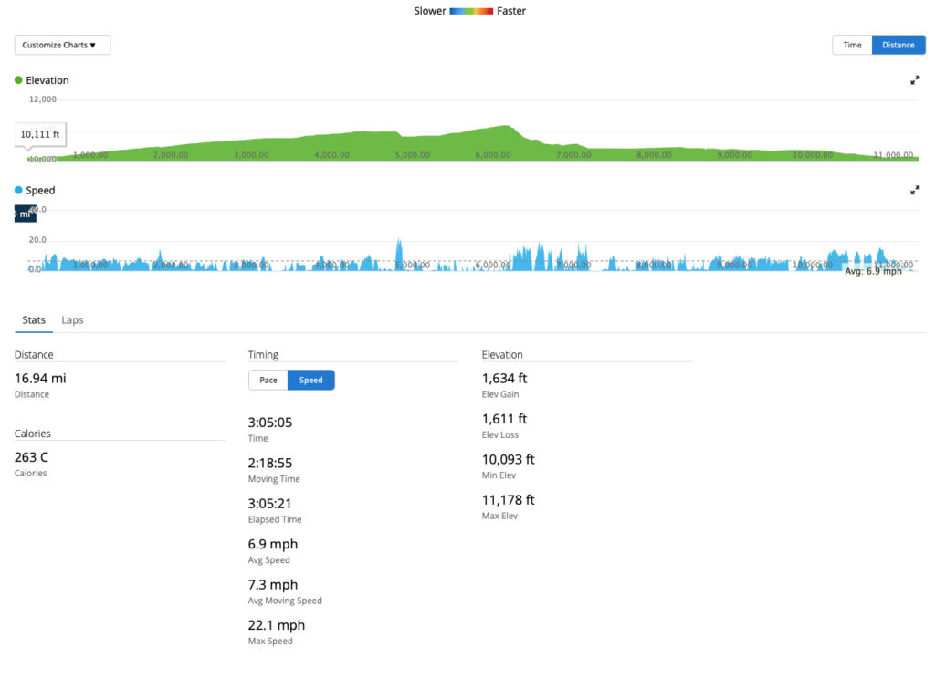
All told, it ended up being being a 17-mile loop. I’m sure I could have made it longer by going deeper into the East Side Mining District but finding that race course trail was a nice bonus that I was glad I stumbled on. I’ll definitely be back to Leadville for some winter riding. Here’s the map and stats.
Looks like a great day! Ready to get to Leadville and try out the bikes! Great job! Enjoyed riding along.