I swear, the older I get, the faster time goes. Blink and three months go by. Here it is the middle of Summer and it’s been over a month since I’ve posted a single thing on this admittedly intermittent web site. Apologies for that. Time to rectify the situation.
Something I’ve been thinking about for some time is whether it would be possible to ride the Monarch Crest without taking a shuttle to the top. Get on the bike in Salida, ride up to the Continental Divide, ride the Crest and ride back down, all without the aid of fossil fuels.
In theory, you could do this by simply riding up highway 50, like you do in a car. But it’s not advisable. As I think I mentioned somewhere before, highway 50 is the second busiest east-west highway in Colorado after I-70. In the summer it’s full of semi-trucks, campers and tourists white-knuckling it around blind corners and down steep grades. There’s little to no shoulder. I mean, you COULD do it but it would be dangerous, bordering on a death wish.
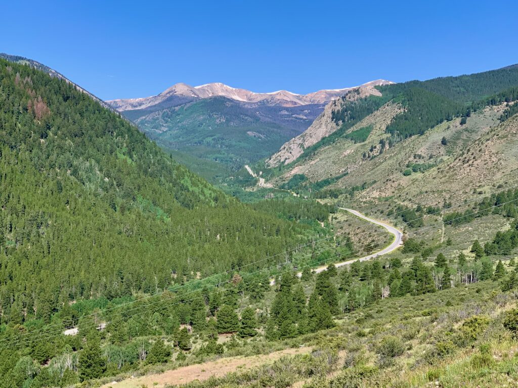
Besides, I’m looking for a mountain bike ride. I don’t want to ride on asphalt any more than I have to. I want to ride on dirt, preferably the long, skinny single-track variety. So, after four years of studying maps and riding trails around here, I worked out a route combining dirt roads and trails that would take me up to the Crest. It would be long, approximately 70 miles, and climby, with over 7,000 feet of ascension. A full day’s outing. To be honest, I wasn’t even sure I could do it. But most of the climbing is on the front end and I knew once I got on the Crest there were multiple bail-out options if my legs gave out.
I was familiar with the trails on the route from having ridden them in previous outings. The only exception was the segment called North Fooses from the Colorado Trail up to the Crest. The topo map shows a 4WD road climbing all the way to the top. From multiple rides of the Crest, I know where it tops out. About a mile from the normal start at the top of Monarch Pass, at the end of the first section of single track, the trail pops out onto a saddle and there’s a sign that says, ‘North Fooses’. So by climbing North Fooses from the Colorado Trail, I knew I would be able to do the entire Monarch Crest excluding that first mile, without riding on Highway 50. That was the plan.
Estimating I could be looking at as much as eight hours in the saddle, I stocked up on food and water and was rolling a little before six a.m.
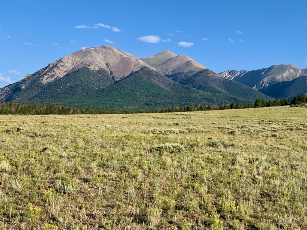
Approaching Mt. Shavano on County Road 252.
The Blanks Cabin trailhead.
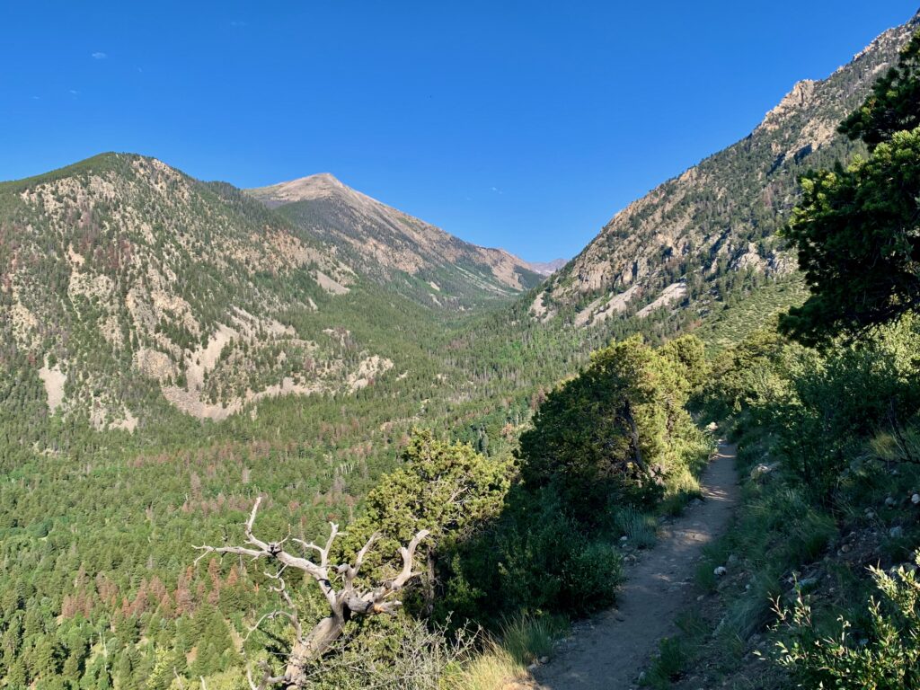
Dropping into North Fork on the Colorado Trail.
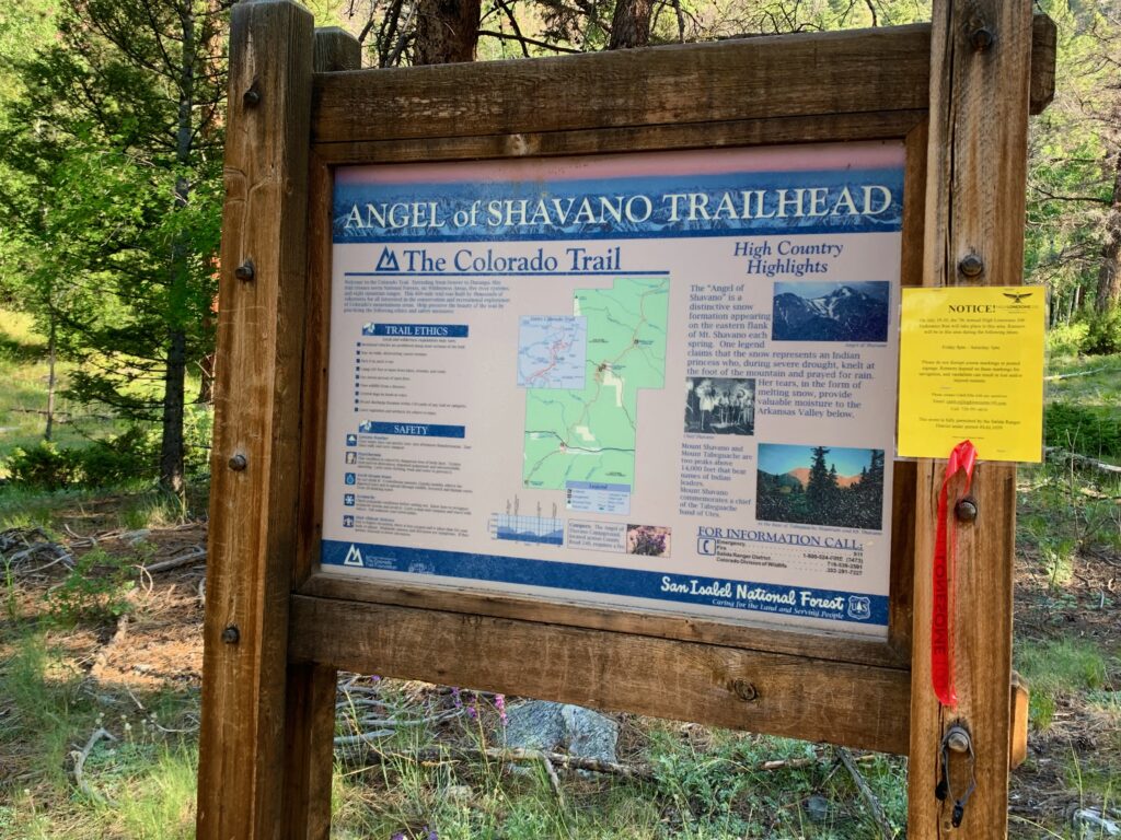
The Angel of Shavano campground.
Descending down to Highway 50 on the Colorado Trail.
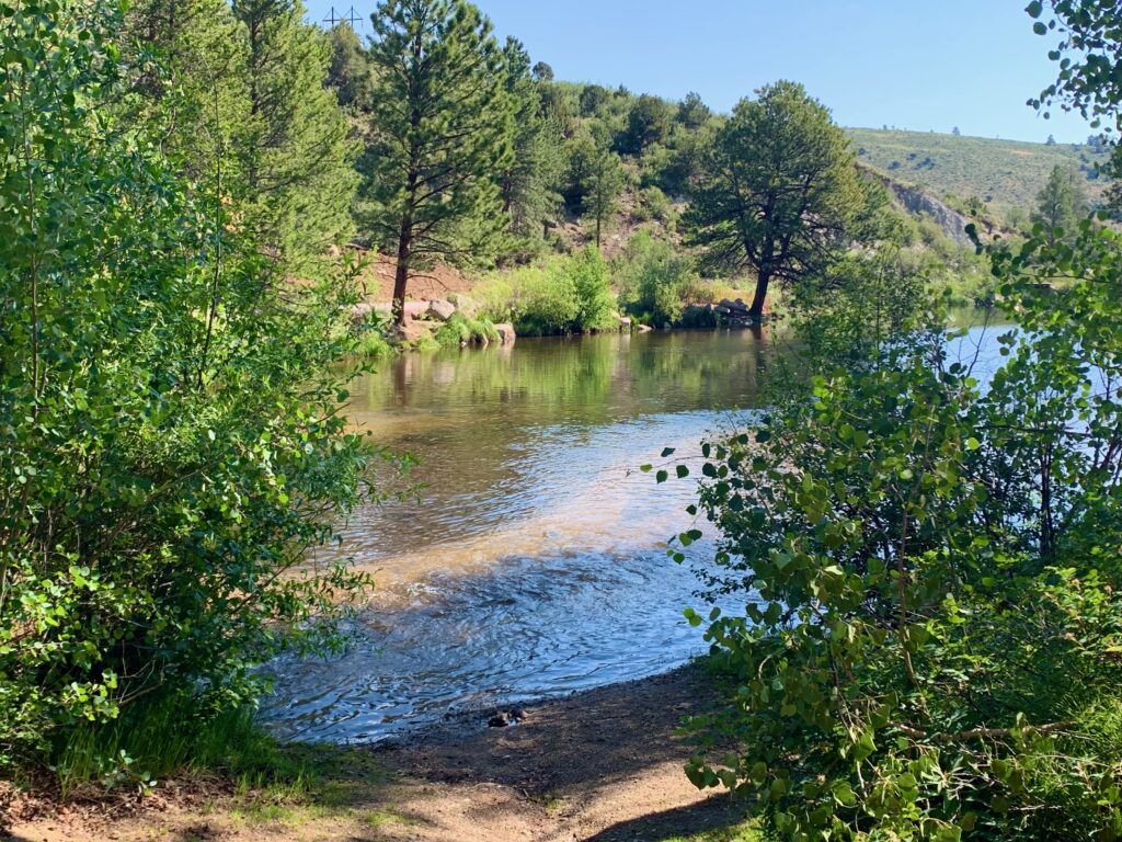
Fooses Creek reservoir.
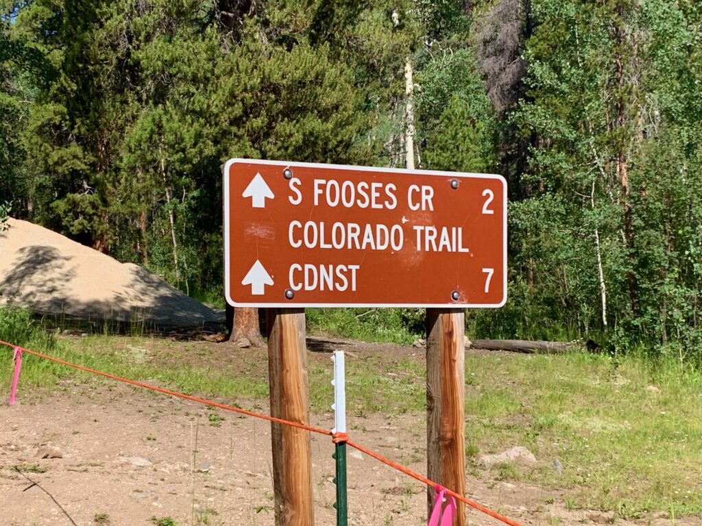
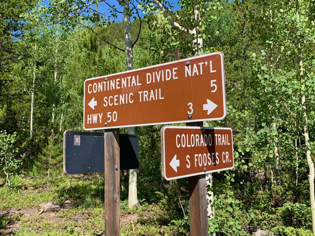
The Continental Divide National Scenic Trail (CDNST) is the first part of the Crest. The sign says it goes.
Sign part way up North Fooses Creek.
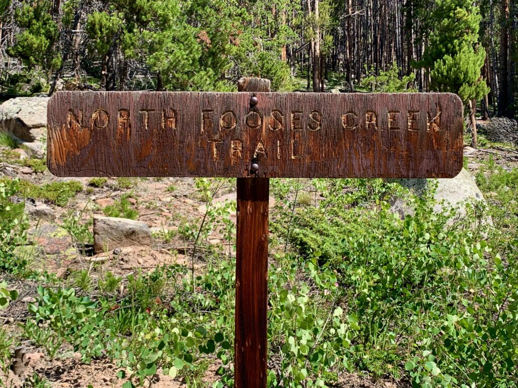
But as I discovered, in the mountains you can’t always believe the map or the signs. Approximately four miles up North Fooses, at the bottom of the first switch back where the road gets seriously steep, there was a closed gate. Signs on either side said “Authorized vehicles only. Violators will be prosecuted.”
Now normally I wouldn’t let a minor inconvenience like a gate derail a ride. I was on public land, deep in the backcountry. There wasn’t much anyone could do if I just lifted my bike over the gate and continued on my way. The bigger problem was what was beyond the gate. Despite what the map indicated, despite the sign at the bottom, beyond the gate there really wasn’t a road anymore. There wasn’t even a trail. It was just a ridiculously steep slope covered in Kleenex box-sized scree. More like a ski slope without snow than a road. It would be miserable to hike, let alone push a bike.
All I could figure was it used to be a road but it became too difficult and/or expensive to maintain so they just gave up and gated it off. Over time, the surrounding hillside caved in, leaving the rock slide I was seeing. Unfortunately for me, no one had bothered to take it off the map or change the sign.
So there I was at 10,500 feet, less than a mile from the top, a stone’s throw from the Crest, with no way to get there.
Because I was mentally and physically ready for an all-day outing, I didn’t really feel like abandoning so early in the effort. But I didn’t have a lot of options. I was standing at the top of what is essentially a box canyon with the only exit being down. After some consideration of my situation, I decided to head back down to try a climb of South Fooses. I knew for sure it went to the top because it’s the Colorado Trail. But that would mean essentially two climbs of Fooses in one day.
That’s what I started to do, but by the time I was halfway up the second climb it was getting late, the afternoon thunderstorms were starting to roll in and my legs were starting to give out. I never made it to the top of South Fooses. I turned around after approximately three miles and headed home.
It was a rather disappointing day in terms of my goal, but it was still many hours of being outside on my bike in the mountains so it’s kind of hard to complain. It was good enough that I went ahead and made a video. Some nice shots of the Colorado Trail and surrounding areas. As the video shows, even though I didn’t make it to the Crest it was still a pretty sweet day out.
Postscript: A couple days after this ride I was sharing my story with a local who’s ridden all over these mountains and he replied casually, “Yep that’s the route, just lift your bike over the gate.”
“But what about that gawdawful rock slide just beyond the gate?”
“That’s the start of the hike-a-bike section.”
“You’re kidding me.”
“Nope. I do it all the time.”
Clearly his definition of “hike-a-bike” and mine are two completely different things. I never cease to be amazed at how hardcore people around here are. I guess now I’m just going to have to go back and try it again. Time to HTFU, as they say!